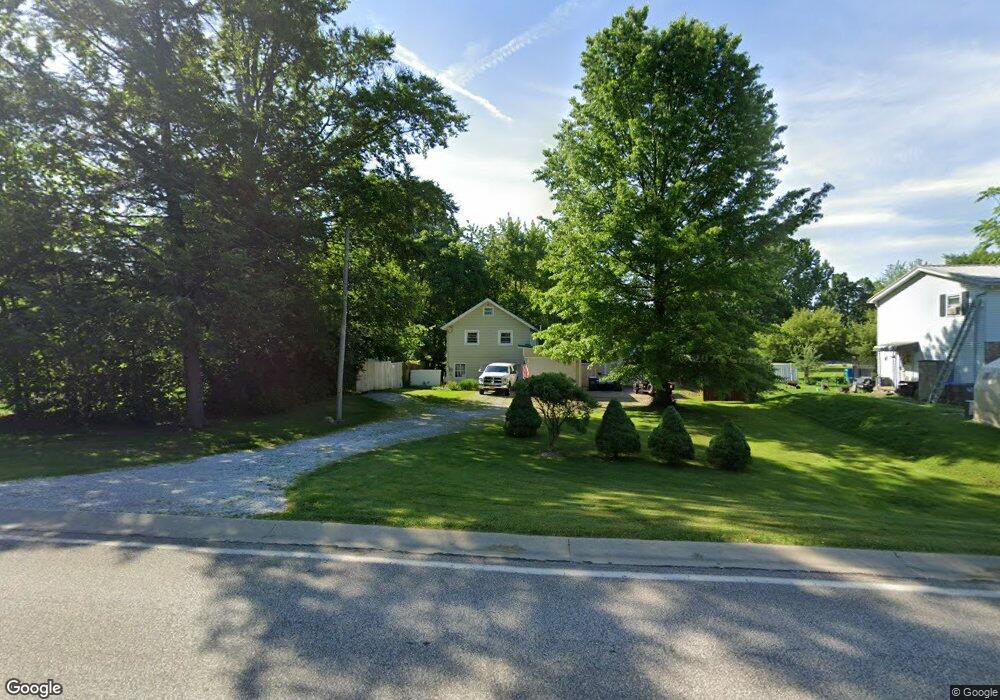
1811 W Gore Rd Erie, PA 16509
Millcreek NeighborhoodEstimated Value: $67,000 - $138,436
1
Bed
1
Bath
525
Sq Ft
$204/Sq Ft
Est. Value
About This Home
This home is located at 1811 W Gore Rd, Erie, PA 16509 and is currently estimated at $107,359, approximately $204 per square foot. 1811 W Gore Rd is a home located in Erie County with nearby schools including McDowell High School, Chestnut Hill Elementary School, and James S. Wilson Middle School.
Ownership History
Date
Name
Owned For
Owner Type
Purchase Details
Closed on
May 23, 2005
Sold by
Herman Joseph M and Hermann Joseph M
Bought by
Hermann Joseph M
Current Estimated Value
Home Financials for this Owner
Home Financials are based on the most recent Mortgage that was taken out on this home.
Original Mortgage
$44,100
Interest Rate
5.95%
Mortgage Type
New Conventional
Purchase Details
Closed on
Dec 15, 2004
Sold by
Stahon Ronald H and Stahon Connie J
Bought by
Herman Joseph M
Purchase Details
Closed on
May 21, 1999
Sold by
Stahon Ronald H and Stahon Connie J
Bought by
Stahon Ronald H and Stahon Connie J
Home Financials for this Owner
Home Financials are based on the most recent Mortgage that was taken out on this home.
Original Mortgage
$35,634
Interest Rate
6.82%
Mortgage Type
FHA
Purchase Details
Closed on
May 30, 1997
Sold by
Renze James A and Renze Ann M
Bought by
Stahon Ronald H
Create a Home Valuation Report for This Property
The Home Valuation Report is an in-depth analysis detailing your home's value as well as a comparison with similar homes in the area
Home Values in the Area
Average Home Value in this Area
Purchase History
| Date | Buyer | Sale Price | Title Company |
|---|---|---|---|
| Hermann Joseph M | -- | -- | |
| Herman Joseph M | $39,000 | -- | |
| Stahon Ronald H | -- | -- | |
| Stahon Connie J | -- | -- | |
| Stahon Ronald H | $41,000 | -- |
Source: Public Records
Mortgage History
| Date | Status | Borrower | Loan Amount |
|---|---|---|---|
| Closed | Hermann Joseph M | $44,100 | |
| Previous Owner | Stahon Connie J | $35,634 |
Source: Public Records
Tax History Compared to Growth
Tax History
| Year | Tax Paid | Tax Assessment Tax Assessment Total Assessment is a certain percentage of the fair market value that is determined by local assessors to be the total taxable value of land and additions on the property. | Land | Improvement |
|---|---|---|---|---|
| 2025 | $2,229 | $81,110 | $22,200 | $58,910 |
| 2024 | $2,171 | $81,110 | $22,200 | $58,910 |
| 2023 | $2,049 | $81,110 | $22,200 | $58,910 |
| 2022 | $1,969 | $81,110 | $22,200 | $58,910 |
| 2021 | $1,948 | $81,110 | $22,200 | $58,910 |
| 2020 | $1,928 | $81,110 | $22,200 | $58,910 |
| 2019 | $1,895 | $81,110 | $22,200 | $58,910 |
| 2018 | $1,849 | $81,110 | $22,200 | $58,910 |
| 2017 | $1,845 | $81,110 | $22,200 | $58,910 |
| 2016 | $2,136 | $81,110 | $22,200 | $58,910 |
| 2015 | $2,115 | $81,110 | $22,200 | $58,910 |
| 2014 | $688 | $81,110 | $22,200 | $58,910 |
Source: Public Records
Map
Nearby Homes
- 1810 W Gore Rd
- 4905 Conway St
- 1828 Zimmerly Rd
- 4830 Greenwood St
- 1842 Zimmerly Rd
- 1729 W 45th St Unit J2
- 4333 Caroline Dr
- 1718 W 56th St
- 4636 Wynburne Ave
- 1425 Nicholson St
- 1530 W 43rd St
- 1416 W Grandview Blvd
- 1443 W 43rd St
- 4002 Harvard Rd
- 1335 Nicholson St
- 1459 W 42nd St
- 1557 W 40th St
- 0 Peach St
- 1351 W 41st St
- 1821 W 37th St
- 1817 W Gore Rd
- 1809 W Gore Rd
- 1820 W 50th St
- 1808 W 50th St
- 1825 W Gore Rd
- 4914 Perkins St
- 1833 W Gore Rd
- 4912 Perkins St
- 4907 Perkins St
- 1838 W 50th St
- 4939 Perkins St
- 1755 W Gore Rd
- 1817 W 50th St
- 4905 Summer St
- 1821 W 50th St
- 4949 Perkins St
- 1809 W 50th St
- 1846 W 50th St
- 1829 W 50th St
- 1841 W Gore Rd