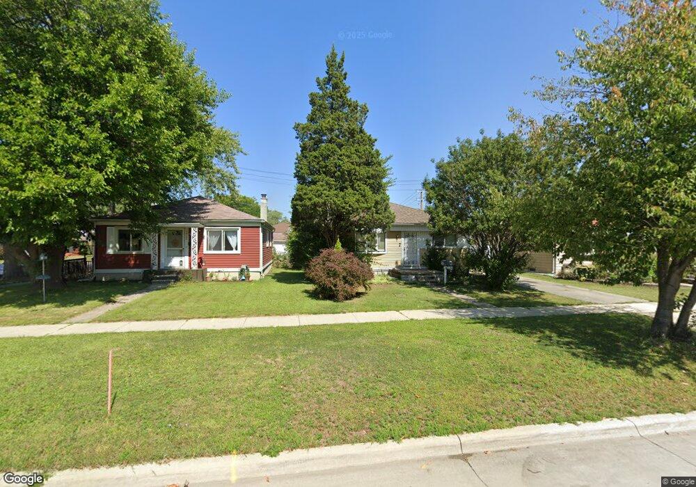
18115 Stephens Dr Eastpointe, MI 48021
Estimated Value: $132,000 - $172,000
3
Beds
1
Bath
1,000
Sq Ft
$145/Sq Ft
Est. Value
About This Home
This home is located at 18115 Stephens Dr, Eastpointe, MI 48021 and is currently estimated at $144,748, approximately $144 per square foot. 18115 Stephens Dr is a home located in Macomb County with nearby schools including Forest Park Elementary School, Eastpointe Middle School, and Reach Charter Academy.
Ownership History
Date
Name
Owned For
Owner Type
Purchase Details
Closed on
Mar 23, 2007
Sold by
Fannie Mae
Bought by
D & Z Investments Llc
Current Estimated Value
Purchase Details
Closed on
Sep 24, 2004
Sold by
Mortgage Electronic Registration Systems
Bought by
Federal National Mortgage Association
Purchase Details
Closed on
Sep 3, 2004
Sold by
Bielski Cindy and Bielski Barry
Bought by
Mortgage Electronic Registration Systems and First Equity Funding
Create a Home Valuation Report for This Property
The Home Valuation Report is an in-depth analysis detailing your home's value as well as a comparison with similar homes in the area
Home Values in the Area
Average Home Value in this Area
Purchase History
| Date | Buyer | Sale Price | Title Company |
|---|---|---|---|
| D & Z Investments Llc | $57,000 | None Available | |
| Federal National Mortgage Association | -- | Parks Title | |
| Mortgage Electronic Registration Systems | $94,094 | -- |
Source: Public Records
Tax History Compared to Growth
Tax History
| Year | Tax Paid | Tax Assessment Tax Assessment Total Assessment is a certain percentage of the fair market value that is determined by local assessors to be the total taxable value of land and additions on the property. | Land | Improvement |
|---|---|---|---|---|
| 2025 | $2,137 | $64,100 | $0 | $0 |
| 2024 | $2,029 | $59,800 | $0 | $0 |
| 2023 | $1,970 | $57,500 | $0 | $0 |
| 2022 | $2,013 | $47,800 | $0 | $0 |
| 2021 | $1,981 | $42,600 | $0 | $0 |
| 2020 | $1,910 | $37,800 | $0 | $0 |
| 2019 | $1,902 | $35,100 | $0 | $0 |
| 2018 | $1,931 | $27,450 | $0 | $0 |
| 2017 | $2,381 | $25,160 | $3,230 | $21,930 |
| 2016 | $1,981 | $25,160 | $0 | $0 |
| 2015 | $1,493 | $22,170 | $0 | $0 |
| 2013 | -- | $21,440 | $0 | $0 |
Source: Public Records
Map
Nearby Homes
- 18240 Stephens Dr
- 23785 Schroeder Ave
- 24336 Warrington Ct
- 24296 Roxana Ave
- 23772 Brittany Ave
- 24648 Wilmot Ave
- 23784 Brittany Ave
- 23799 Brittany Ave
- 23329 Roxana Ave
- 24245 Tuscany Ave
- 23038 Rosalind Ave
- 24301 Kelly Rd
- 24646 Tuscany Ave
- 22861 Rosalind Ave
- 23311 Courtland Ave
- 23162 Lambrecht Ave
- 24883 Wilmot Ave
- 23082 Tuscany Ave
- 24676 Lambrecht Ave
- 17225 Bell Ave
- 18105 Stephens Dr
- 18125 Stephens Dr
- 24226 Lexington Ave
- 18135 Stephens Dr
- 18049 Stephens Dr
- 24227 Rosalind Ave
- 24234 Lexington Ave
- 18145 Stephens Dr
- 24242 Lexington Ave
- 24235 Rosalind Ave
- 18039 Stephens Dr
- 24227 Lexington Ave
- 24243 Rosalind Ave
- 18118 Stephens Dr
- 18126 Stephens Dr Unit Bldg-Unit
- 18126 Stephens Dr
- 24235 Lexington Ave
- 18134 Stephens Dr
- 18054 Stephens Dr
- 18142 Stephens Dr