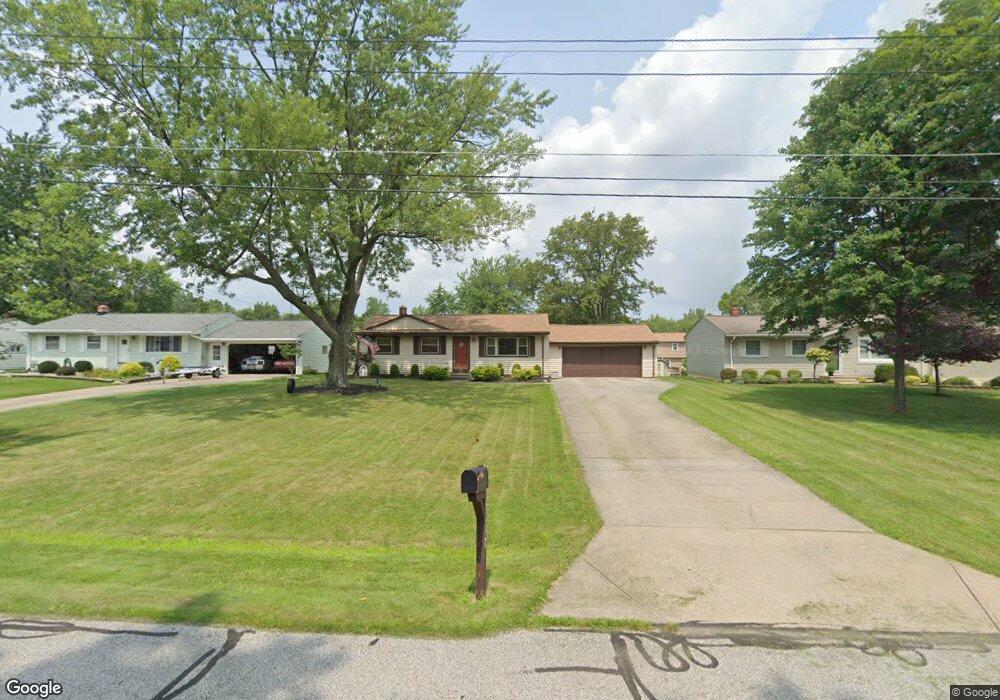
18118 Carol Dr Strongsville, OH 44136
Estimated Value: $219,808 - $266,000
3
Beds
1
Bath
980
Sq Ft
$249/Sq Ft
Est. Value
About This Home
This home is located at 18118 Carol Dr, Strongsville, OH 44136 and is currently estimated at $244,202, approximately $249 per square foot. 18118 Carol Dr is a home located in Cuyahoga County with nearby schools including Strongsville High School, Strongsville Academy, and Sts Joseph & John Interparochial School.
Ownership History
Date
Name
Owned For
Owner Type
Purchase Details
Closed on
Feb 16, 2005
Sold by
Allen Daniel B and Allen Deborah A
Bought by
Weeks Scott A and Weeks Suzanne
Current Estimated Value
Home Financials for this Owner
Home Financials are based on the most recent Mortgage that was taken out on this home.
Original Mortgage
$142,900
Outstanding Balance
$72,777
Interest Rate
5.78%
Mortgage Type
Purchase Money Mortgage
Estimated Equity
$171,425
Purchase Details
Closed on
Jan 20, 1998
Sold by
Wojnowski Barbara J
Bought by
Allen Daniel B and Allen Deborah A
Home Financials for this Owner
Home Financials are based on the most recent Mortgage that was taken out on this home.
Original Mortgage
$105,000
Interest Rate
7.24%
Purchase Details
Closed on
Jun 13, 1985
Sold by
Cunningham Charles E and Cunningham Carol
Bought by
Wojnowski Barbara J
Purchase Details
Closed on
Jan 1, 1975
Bought by
Cunningham Charles E and Cunningham Carol
Create a Home Valuation Report for This Property
The Home Valuation Report is an in-depth analysis detailing your home's value as well as a comparison with similar homes in the area
Home Values in the Area
Average Home Value in this Area
Purchase History
| Date | Buyer | Sale Price | Title Company |
|---|---|---|---|
| Weeks Scott A | $152,900 | Guardian Title & Guaranty | |
| Allen Daniel B | $135,000 | Commonwealth Land Title Agen | |
| Wojnowski Barbara J | $55,000 | -- | |
| Cunningham Charles E | -- | -- |
Source: Public Records
Mortgage History
| Date | Status | Borrower | Loan Amount |
|---|---|---|---|
| Open | Weeks Scott A | $142,900 | |
| Closed | Allen Daniel B | $105,000 |
Source: Public Records
Tax History Compared to Growth
Tax History
| Year | Tax Paid | Tax Assessment Tax Assessment Total Assessment is a certain percentage of the fair market value that is determined by local assessors to be the total taxable value of land and additions on the property. | Land | Improvement |
|---|---|---|---|---|
| 2024 | $3,272 | $69,685 | $11,305 | $58,380 |
| 2023 | $3,414 | $54,530 | $13,930 | $40,600 |
| 2022 | $3,390 | $54,530 | $13,930 | $40,600 |
| 2021 | $3,363 | $54,530 | $13,930 | $40,600 |
| 2020 | $3,116 | $44,700 | $11,410 | $33,290 |
| 2019 | $3,025 | $127,700 | $32,600 | $95,100 |
| 2018 | $2,696 | $44,700 | $11,410 | $33,290 |
| 2017 | $2,696 | $40,640 | $10,290 | $30,350 |
| 2016 | $2,674 | $40,640 | $10,290 | $30,350 |
| 2015 | $2,712 | $40,640 | $10,290 | $30,350 |
| 2014 | $2,712 | $40,640 | $10,290 | $30,350 |
Source: Public Records
Map
Nearby Homes
- 18630 Shurmer Rd
- 17069 Partridge Dr
- 18162 Fawn Cir
- 19160 Wheelers Ln
- 19513 Lunn Rd
- 19311 Bradford Ct
- 19620 Porters Ln Unit 15F
- 14112 Settlers Way
- 14703 Lenox Dr Unit 103
- 17289 Akita Ct Unit 4508
- 14826 Lenox Dr
- 19297 Lauren Way
- 15639 Indianhead Ln
- 13513 Suncrest Ct
- 17024 Bear Creek Ln
- 16650 Lanier Ave
- 20078 Trapper Trail
- 17259 Woodshire Dr
- 18294 Drake Rd
- 17682 Drake Rd
- 18160 Carol Dr
- 18110 Carol Dr
- 18204 Carol Dr
- 18068 Carol Dr
- 18101 Potomac Dr
- 0 Carol Dr Unit 3951490
- 18043 Potomac Dr
- 18159 Potomac Dr
- 17995 Potomac Dr
- 18217 Potomac Dr
- 18026 Carol Dr
- 18250 Carol Dr
- 18119 Carol Dr
- 17947 Potomac Dr
- 18161 Carol Dr
- 18111 Carol Dr
- 18265 Potomac Dr
- 18205 Carol Dr
- 18069 Carol Dr
- 18294 Carol Dr