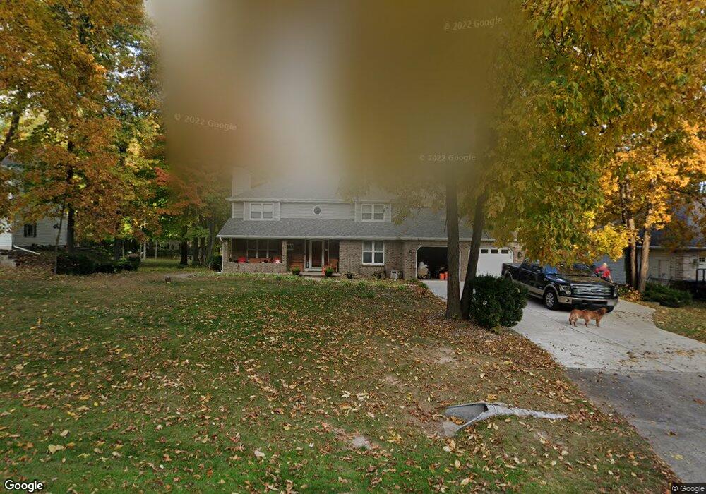
1812 Berkshire Dr Green Bay, WI 54313
Estimated Value: $435,811 - $525,000
--
Bed
--
Bath
--
Sq Ft
0.66
Acres
About This Home
This home is located at 1812 Berkshire Dr, Green Bay, WI 54313 and is currently estimated at $477,453. 1812 Berkshire Dr is a home located in Brown County with nearby schools including Hillcrest Elementary School, Pulaski Community Middle School, and Pulaski High School.
Ownership History
Date
Name
Owned For
Owner Type
Purchase Details
Closed on
Jun 4, 2002
Sold by
M & I Marshall & Ilsley Bank
Bought by
Brilli Angiolo J
Current Estimated Value
Home Financials for this Owner
Home Financials are based on the most recent Mortgage that was taken out on this home.
Original Mortgage
$188,900
Outstanding Balance
$80,661
Interest Rate
6.95%
Estimated Equity
$396,792
Purchase Details
Closed on
Mar 5, 2002
Sold by
Deboth Edward J and Deboth Patricia A
Bought by
M & I Marshall & Ilsley Bank and M&I Bank Northeast
Create a Home Valuation Report for This Property
The Home Valuation Report is an in-depth analysis detailing your home's value as well as a comparison with similar homes in the area
Home Values in the Area
Average Home Value in this Area
Purchase History
| Date | Buyer | Sale Price | Title Company |
|---|---|---|---|
| Brilli Angiolo J | $198,900 | Evans Title | |
| M & I Marshall & Ilsley Bank | -- | -- |
Source: Public Records
Mortgage History
| Date | Status | Borrower | Loan Amount |
|---|---|---|---|
| Open | Brilli Angiolo J | $188,900 |
Source: Public Records
Tax History Compared to Growth
Tax History
| Year | Tax Paid | Tax Assessment Tax Assessment Total Assessment is a certain percentage of the fair market value that is determined by local assessors to be the total taxable value of land and additions on the property. | Land | Improvement |
|---|---|---|---|---|
| 2024 | $5,185 | $323,200 | $68,100 | $255,100 |
| 2023 | $5,241 | $323,200 | $68,100 | $255,100 |
| 2022 | $4,494 | $323,200 | $68,100 | $255,100 |
| 2021 | $4,266 | $323,200 | $68,100 | $255,100 |
| 2020 | $4,842 | $275,800 | $56,000 | $219,800 |
| 2019 | $4,923 | $275,800 | $56,000 | $219,800 |
| 2018 | $4,895 | $275,800 | $56,000 | $219,800 |
| 2017 | $4,783 | $275,800 | $56,000 | $219,800 |
| 2016 | $4,818 | $275,800 | $56,000 | $219,800 |
| 2015 | $4,922 | $275,800 | $56,000 | $219,800 |
| 2014 | $5,125 | $275,800 | $56,000 | $219,800 |
| 2013 | $5,125 | $275,800 | $56,000 | $219,800 |
Source: Public Records
Map
Nearby Homes
- 4600 Seminole Trail
- 541 Security Blvd
- 181 Parkside Ct
- 486 Dewey Decker Dr
- 2833 Friendly Cir
- 2560 N Trillium Cir
- 4527 Choctaw Trail
- 2882 Howard Commons
- 4514 Mohawk Ct
- 0 Packerland Dr Unit 50252275
- 0 Packerland Dr Unit 50159218
- 4551 Choctaw Trail
- 652 Lincoln Ridge
- 692 Lincoln Ridge
- 2850 Elm Tree Hill
- 2610 Sumac Place
- 411 Woodfield Dr
- 407 Woodfield Dr
- 3130 Early Bird Ln
- 730 Pinecrest Rd
- 1804 Berkshire Dr
- 1824 Berkshire Dr
- 1819 Berkshire Dr
- 1750 Riverdale Dr
- 1794 Berkshire Dr
- 1781 Maidstone Cir
- 1795 Berkshire Dr
- 1773 Maidstone Cir
- 1782 Berkshire Dr
- 4355 Chatham Place
- 1749 Riverdale Dr
- 4377 Chatham Dr E
- 4343 Chatham Place
- 1763 Maidstone Cir
- 1737 Riverdale Dr
- 1770 Maidstone Cir
- 1788 Maidstone Cir
- 1727 Riverdale Dr
- 0 Chatham Dr E
- 1770 Berkshire Dr