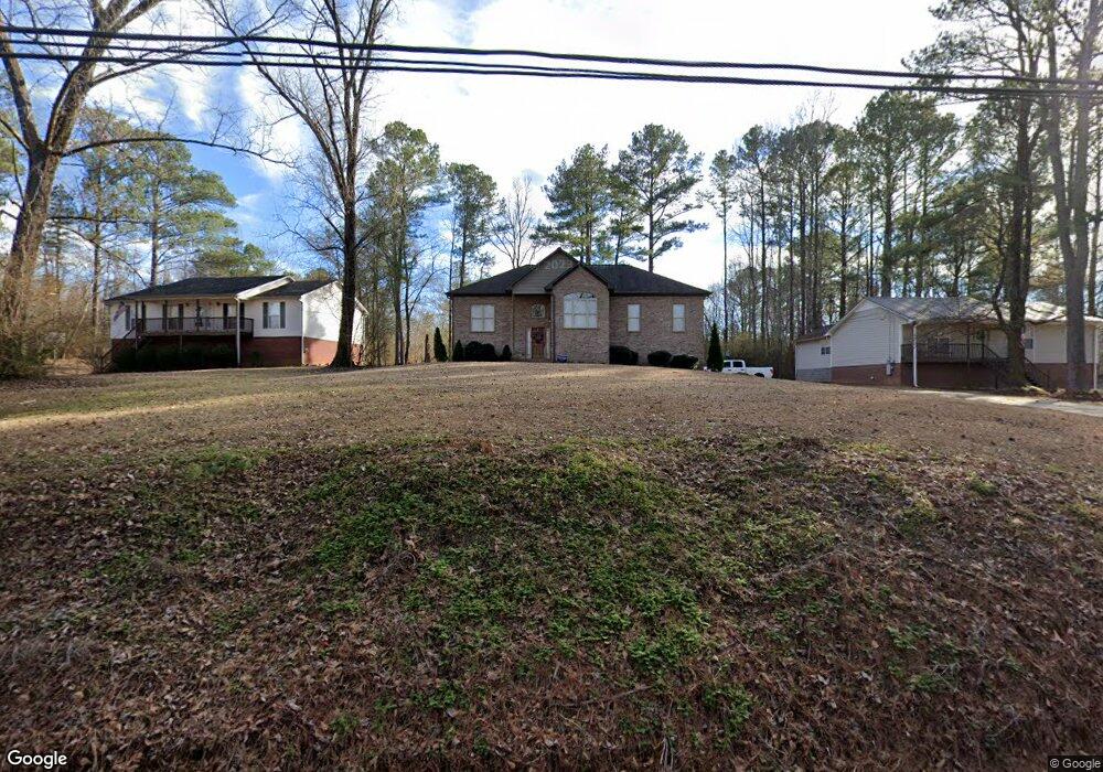
1812 Brookside Rd Mount Olive, AL 35117
Estimated Value: $302,000 - $358,000
3
Beds
3
Baths
1,728
Sq Ft
$192/Sq Ft
Est. Value
About This Home
This home is located at 1812 Brookside Rd, Mount Olive, AL 35117 and is currently estimated at $332,408, approximately $192 per square foot. 1812 Brookside Rd is a home located in Jefferson County with nearby schools including Mt. Olive Elementary School, Bragg Middle School, and Gardendale High School.
Ownership History
Date
Name
Owned For
Owner Type
Purchase Details
Closed on
Aug 14, 2017
Sold by
Holcombe Anthony Scott
Bought by
Sanderson Ronnie Dale and Sanderson Emilt R
Current Estimated Value
Home Financials for this Owner
Home Financials are based on the most recent Mortgage that was taken out on this home.
Original Mortgage
$204,130
Outstanding Balance
$166,197
Interest Rate
3.62%
Mortgage Type
FHA
Estimated Equity
$166,211
Purchase Details
Closed on
Feb 13, 2007
Sold by
Holcombe Jerry L and Holcombe Donna J
Bought by
Holcombe Anthony Scott and Holcombe Jennifer R
Create a Home Valuation Report for This Property
The Home Valuation Report is an in-depth analysis detailing your home's value as well as a comparison with similar homes in the area
Home Values in the Area
Average Home Value in this Area
Purchase History
| Date | Buyer | Sale Price | Title Company |
|---|---|---|---|
| Sanderson Ronnie Dale | $208,000 | -- | |
| Holcombe Anthony Scott | $12,500 | None Available |
Source: Public Records
Mortgage History
| Date | Status | Borrower | Loan Amount |
|---|---|---|---|
| Open | Sanderson Ronnie Dale | $204,130 |
Source: Public Records
Tax History
| Year | Tax Paid | Tax Assessment Tax Assessment Total Assessment is a certain percentage of the fair market value that is determined by local assessors to be the total taxable value of land and additions on the property. | Land | Improvement |
|---|---|---|---|---|
| 2025 | $1,693 | $34,500 | -- | -- |
| 2024 | $1,711 | $35,200 | -- | -- |
| 2022 | $1,475 | $30,500 | $2,420 | $28,080 |
| 2021 | $1,198 | $24,960 | $1,940 | $23,020 |
| 2020 | $1,198 | $24,960 | $1,940 | $23,020 |
| 2019 | $1,198 | $24,960 | $0 | $0 |
| 2018 | $990 | $20,820 | $0 | $0 |
| 2017 | $990 | $20,820 | $0 | $0 |
| 2016 | $990 | $20,820 | $0 | $0 |
| 2015 | $990 | $20,820 | $0 | $0 |
| 2014 | $198 | $1,660 | $0 | $0 |
| 2013 | $198 | $3,300 | $0 | $0 |
Source: Public Records
Map
Nearby Homes
- 5834 Goode Rd
- 1864 Kelly Loop Rd
- 6407 Water Works Rd
- 6043 Lakeside Dr
- 6220 Dorsett Woods Dr
- 1478 Brookfield Cir
- 5737 Acorn Ln Unit 58
- 1462 Acorn Way E
- 6242 Swann Rd
- 2040 Brookside Rd
- 1730 Mcconnell Ln
- 6323 Swann Rd
- 1220 McCravy Ln
- 1298 Belcher Ln
- 1251 Mcpherson Rd
- 3093 Mount Olive Rd
- 5868 Tommy Town Rd
- 5473 Newfound Rd
- 3024 Brookside Rd
- 3716 Mount Olive Rd
- 1808 Brookside Rd
- 1816 Brookside Rd
- 5938 Goode Rd
- 1820 Brookside Rd
- 1821 Brookside Rd
- 1828 Brookside Rd
- 5957 Goode Rd
- 1790 Brookside Rd
- 5920 Goode Rd
- 1831 Brookside Rd
- 1811 Brookside Rd
- 1811 Brookside Rd Unit 29
- 1842 Brookside Rd
- 1843 Brookside Rd
- 5914 Goode Rd
- 1780 Brookside Rd Unit 1
- 1839 Brookside Rd
- 1825 Brookside Rd
- 5937 Goode Rd Unit 1
- 5909 Goode Rd
Your Personal Tour Guide
Ask me questions while you tour the home.