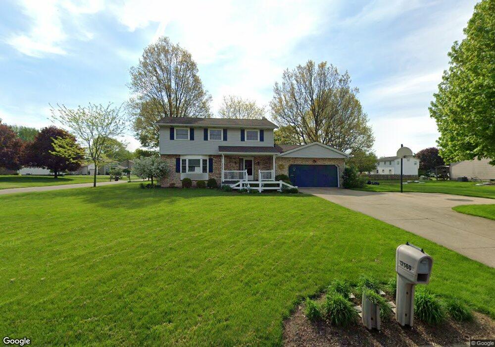
1812 Cove St NW Uniontown, OH 44685
Estimated Value: $266,894 - $305,000
3
Beds
3
Baths
1,632
Sq Ft
$176/Sq Ft
Est. Value
About This Home
This home is located at 1812 Cove St NW, Uniontown, OH 44685 and is currently estimated at $287,724, approximately $176 per square foot. 1812 Cove St NW is a home located in Stark County with nearby schools including Lake Middle/High School and Lake Center Christian School.
Ownership History
Date
Name
Owned For
Owner Type
Purchase Details
Closed on
Jun 18, 2015
Sold by
Sherry Wilfred Jeffrey A and Sherry Wilfred
Bought by
Sherry Wilfred Jeffrey A and Sherry Wilfred
Current Estimated Value
Purchase Details
Closed on
Jan 20, 2005
Sold by
Wilfred Kathleen A
Bought by
Wilfred Jeffrey A
Purchase Details
Closed on
Jul 26, 1999
Sold by
Frank John M and Frank Tricia L
Bought by
Wilfred Jeffrey A and Wilfred Kathleen A
Home Financials for this Owner
Home Financials are based on the most recent Mortgage that was taken out on this home.
Original Mortgage
$121,500
Outstanding Balance
$34,997
Interest Rate
7.68%
Mortgage Type
Purchase Money Mortgage
Estimated Equity
$252,727
Purchase Details
Closed on
Dec 12, 1989
Purchase Details
Closed on
Sep 29, 1988
Create a Home Valuation Report for This Property
The Home Valuation Report is an in-depth analysis detailing your home's value as well as a comparison with similar homes in the area
Home Values in the Area
Average Home Value in this Area
Purchase History
| Date | Buyer | Sale Price | Title Company |
|---|---|---|---|
| Sherry Wilfred Jeffrey A | -- | Attorney | |
| Wilfred Jeffrey A | -- | -- | |
| Wilfred Jeffrey A | $135,000 | Gateway Title Agency Inc | |
| -- | $89,000 | -- | |
| -- | $82,500 | -- |
Source: Public Records
Mortgage History
| Date | Status | Borrower | Loan Amount |
|---|---|---|---|
| Open | Wilfred Jeffrey A | $121,500 |
Source: Public Records
Tax History Compared to Growth
Tax History
| Year | Tax Paid | Tax Assessment Tax Assessment Total Assessment is a certain percentage of the fair market value that is determined by local assessors to be the total taxable value of land and additions on the property. | Land | Improvement |
|---|---|---|---|---|
| 2025 | -- | $73,090 | $19,990 | $53,100 |
| 2024 | -- | $73,090 | $19,990 | $53,100 |
| 2023 | $2,911 | $57,130 | $16,280 | $40,850 |
| 2022 | $1,461 | $57,130 | $16,280 | $40,850 |
| 2021 | $2,953 | $57,130 | $16,280 | $40,850 |
| 2020 | $2,857 | $49,390 | $14,040 | $35,350 |
| 2019 | $2,834 | $49,390 | $14,040 | $35,350 |
| 2018 | $2,837 | $49,390 | $14,040 | $35,350 |
| 2017 | $2,716 | $43,760 | $11,100 | $32,660 |
| 2016 | $2,721 | $43,760 | $11,100 | $32,660 |
| 2015 | $2,720 | $43,760 | $11,100 | $32,660 |
| 2014 | $267 | $37,490 | $9,490 | $28,000 |
| 2013 | $1,133 | $37,490 | $9,490 | $28,000 |
Source: Public Records
Map
Nearby Homes
- 1711 Batavia St NW Unit 518B
- 12340 Waterfall Ave NW
- 1905 Hampshire Cir NW
- 2348 Ledgestone Dr NW
- 2452 Ledgestone Dr NW
- 12201 King Church Ave NW
- 2399 Ledgestone Dr NW
- 2455 Ledgestone Dr NW
- 2439 Ledgestone Dr NW
- 2411 Ledgestone Dr NW
- 2498 Foxfire St NW
- 2693 Ledgestone Dr NW
- 12055 King Church Ave NW
- 12494 Bridgemont Ave NW
- 13341 Sugar Bush Ave NW
- 1581 Poppy Dr NW
- 835 Brodie Ct
- 843 Brodie Ct
- 1241 Saint Abigail St SW
- 0 Pontius Rd Unit 5163828
- 1796 Cove St NW
- 12560 Springwater Ave NW
- 1778 Cove St NW
- 1837 Gulf St NW
- 1823 Gulf St NW
- 1815 Cove St NW
- 1805 Gulf St NW
- 1799 Cove St NW
- 12592 Springwater Ave NW
- 12514 Springwater Ave NW
- 1762 Cove St NW
- 1783 Cove St NW
- 1787 Gulf St NW
- 12543 Springwater Ave NW
- 12565 Springwater Ave NW
- 1765 Cove St NW
- 12585 Springwater Ave NW
- 12614 Springwater Ave NW
- 1752 Cove St NW
- 1771 Gulf St NW