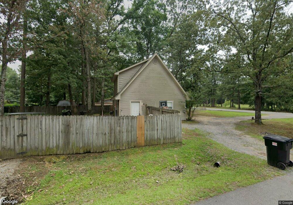
1812 Matt Ln Hensley, AR 72065
Estimated Value: $129,569 - $166,000
--
Bed
2
Baths
1,092
Sq Ft
$138/Sq Ft
Est. Value
About This Home
This home is located at 1812 Matt Ln, Hensley, AR 72065 and is currently estimated at $150,392, approximately $137 per square foot. 1812 Matt Ln is a home located in Saline County with nearby schools including Sheridan High School.
Ownership History
Date
Name
Owned For
Owner Type
Purchase Details
Closed on
May 5, 2014
Sold by
Herring Michael E and Snyder Annie Elizabeth
Bought by
Mcgehee Clyde M
Current Estimated Value
Home Financials for this Owner
Home Financials are based on the most recent Mortgage that was taken out on this home.
Original Mortgage
$69,600
Outstanding Balance
$53,241
Interest Rate
4.43%
Mortgage Type
New Conventional
Estimated Equity
$97,151
Purchase Details
Closed on
May 14, 2008
Sold by
Menden Melissa and Menden Joseph D
Bought by
Snyder Annie Elizabeth
Home Financials for this Owner
Home Financials are based on the most recent Mortgage that was taken out on this home.
Original Mortgage
$845,333
Interest Rate
5.89%
Mortgage Type
FHA
Purchase Details
Closed on
Jan 2, 2004
Bought by
Menden
Purchase Details
Closed on
Apr 16, 1999
Bought by
Ashmead
Purchase Details
Closed on
Jul 17, 1996
Bought by
Forte
Purchase Details
Closed on
Jan 1, 1994
Bought by
Barte
Create a Home Valuation Report for This Property
The Home Valuation Report is an in-depth analysis detailing your home's value as well as a comparison with similar homes in the area
Home Values in the Area
Average Home Value in this Area
Purchase History
| Date | Buyer | Sale Price | Title Company |
|---|---|---|---|
| Mcgehee Clyde M | $87,000 | Lenders Title Co | |
| Snyder Annie Elizabeth | $85,000 | Standard Abstract And Title | |
| Menden | $72,000 | -- | |
| Ashmead | $67,000 | -- | |
| Forte | $57,000 | -- | |
| Barte | $51,000 | -- |
Source: Public Records
Mortgage History
| Date | Status | Borrower | Loan Amount |
|---|---|---|---|
| Open | Mcgehee Clyde M | $69,600 | |
| Previous Owner | Snyder Annie Elizabeth | $845,333 |
Source: Public Records
Tax History Compared to Growth
Tax History
| Year | Tax Paid | Tax Assessment Tax Assessment Total Assessment is a certain percentage of the fair market value that is determined by local assessors to be the total taxable value of land and additions on the property. | Land | Improvement |
|---|---|---|---|---|
| 2025 | $1,007 | $22,030 | $5,520 | $16,510 |
| 2024 | $923 | $22,030 | $5,520 | $16,510 |
| 2023 | $1,852 | $22,030 | $5,520 | $16,510 |
| 2022 | $1,662 | $22,030 | $5,520 | $16,510 |
| 2021 | $1,478 | $18,600 | $4,600 | $14,000 |
| 2020 | $1,478 | $18,600 | $4,600 | $14,000 |
| 2019 | $1,478 | $18,600 | $4,600 | $14,000 |
| 2018 | $1,371 | $18,600 | $4,600 | $14,000 |
| 2017 | $1,310 | $18,600 | $4,600 | $14,000 |
| 2016 | $658 | $15,700 | $4,000 | $11,700 |
| 2015 | $1,149 | $15,700 | $4,000 | $11,700 |
| 2014 | $1,149 | $15,700 | $4,000 | $11,700 |
Source: Public Records
Map
Nearby Homes
- 3042 E Woodson Lateral Rd
- 1436 Lakeshore Dr
- 000 Nabholtz Rd
- 000 Hwy 167
- 1102 Wilma Sue
- 000 Warnix Ln
- 12697 Highway 167 N
- Lot 10 Three Corners Acres
- 188 Kelton Ln
- 157 Kelton Ln
- 149 Kelton Ln
- 000 Buddy Dr
- 348 Alyece Ln
- 17825 Cullipher Ln
- 19101 Oaklawn Cove
- 1627 Lorance Dr
- 1024 Ridgewood Dr
- 1641 Lorance Dr
- 335 Mckenzie Ln
- 3401 W Hensley Rd
- 1820 Matt Ln
- 1802 Matt Ln
- 1517 Suger Maple Ln
- 1826 Matt Ln
- 21952 Mountain Maple Cir
- 1738 Matt Ln
- 1516 Sugar Maple Ln
- 21944 Mountain Maple Cir
- 1832 Matt Ln
- 1532 Sugar Maple Ln
- 21938 Mountain Maple Cir
- 1836 Matt Ln
- 21971 Mountain Maple Cir
- 1550 Sugar Maple Ln
- 21945 Mountain Maple Cir
- 21930 Mountain Maple Cir
- 1900 Matt Ln
- 21843 Henley Ln
- 1726 Matt Ln