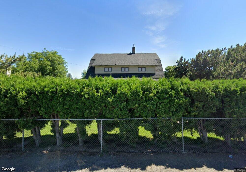
1812 Mcnair Ave Union Gap, WA 98903
Estimated Value: $260,000 - $366,000
2
Beds
2
Baths
1,406
Sq Ft
$220/Sq Ft
Est. Value
About This Home
This home is located at 1812 Mcnair Ave, Union Gap, WA 98903 and is currently estimated at $309,003, approximately $219 per square foot. 1812 Mcnair Ave is a home located in Yakima County with nearby schools including Martin Luther King Jr. Elementary School, Lewis & Clark Middle School, and Davis High School.
Ownership History
Date
Name
Owned For
Owner Type
Purchase Details
Closed on
Aug 19, 2019
Sold by
Williams Sherri L and Heaverlo Sherri L
Bought by
Williams Dale D
Current Estimated Value
Home Financials for this Owner
Home Financials are based on the most recent Mortgage that was taken out on this home.
Original Mortgage
$139,000
Outstanding Balance
$121,738
Interest Rate
3.7%
Mortgage Type
New Conventional
Estimated Equity
$187,265
Purchase Details
Closed on
Jun 1, 1998
Sold by
Eing Jack and Eing Beverly J
Bought by
Williams Jack L and Heaverlo Sherri L
Home Financials for this Owner
Home Financials are based on the most recent Mortgage that was taken out on this home.
Original Mortgage
$104,500
Interest Rate
7.1%
Purchase Details
Closed on
Jan 9, 1978
Sold by
Norton Beatrice A
Bought by
Norton Nelson L
Create a Home Valuation Report for This Property
The Home Valuation Report is an in-depth analysis detailing your home's value as well as a comparison with similar homes in the area
Home Values in the Area
Average Home Value in this Area
Purchase History
| Date | Buyer | Sale Price | Title Company |
|---|---|---|---|
| Williams Dale D | $157,059 | Pacific Alliance Title | |
| Williams Jack L | $114,500 | First American Title Ins Co | |
| Norton Nelson L | -- | -- |
Source: Public Records
Mortgage History
| Date | Status | Borrower | Loan Amount |
|---|---|---|---|
| Open | Williams Dale D | $139,000 | |
| Previous Owner | Williams Jack L | $104,500 |
Source: Public Records
Tax History Compared to Growth
Tax History
| Year | Tax Paid | Tax Assessment Tax Assessment Total Assessment is a certain percentage of the fair market value that is determined by local assessors to be the total taxable value of land and additions on the property. | Land | Improvement |
|---|---|---|---|---|
| 2025 | $2,763 | $304,600 | $73,400 | $231,200 |
| 2023 | $2,389 | $189,500 | $31,300 | $158,200 |
| 2022 | $1,908 | $178,500 | $31,300 | $147,200 |
| 2021 | $1,756 | $154,300 | $31,300 | $123,000 |
| 2019 | $1,273 | $126,900 | $31,300 | $95,600 |
| 2018 | $1,332 | $109,300 | $31,300 | $78,000 |
| 2017 | $1,251 | $109,400 | $31,300 | $78,100 |
| 2016 | $1,336 | $106,900 | $31,200 | $75,700 |
| 2015 | $1,336 | $110,700 | $31,200 | $79,500 |
| 2014 | $1,336 | $111,800 | $31,200 | $80,600 |
| 2013 | $1,336 | $111,800 | $31,200 | $80,600 |
Source: Public Records
Map
Nearby Homes
- 1812 S 18th St
- 18 W Washington Ave Unit 61
- 18 W Washington Ave Unit 76
- 18 W Washington Ave Unit 69
- 1706 S 18th St
- 1710 Rudkin Rd
- 1903 Simpson Ln
- 1702 S 13th St
- 1910 Boggess St
- 812 E Tennant Ln
- 500 Richards Rd
- 207 W Oak St
- 1305 S 7th St
- 2007 Longfibre Rd
- 403 W Ahtanum Rd
- 2005 Ledwich Ave
- 55 W Washington Ave Unit 153
- 55 W Washington Ave Unit 174
- 55 W Washington Ave Unit 80
- 55 W Washington Ave Unit 202
- 1806 Mcnair Ave
- 1814 Mcnair Ave
- 1811 Lakeata Ave
- 1813 Lakeata Ave
- 1805 Lakeata Ave
- 1811 Mcnair Ave
- 1809 Mcnair Ave
- 1807 Mcnair Ave
- 1815 Lakeata Ave
- 1813 Mcnair Ave
- 1802 Mcnair Ave
- 1902 Mcnair Ave
- 1803 Mcnair Ave
- 1803 Lakeata Ave
- 1815 Mcnair Ave
- 1801 Mcnair Ave
- 1901 Mcnair Ave
- 1904 Mcnair Ave
- 1812 Lakeata Ave
- 1814 Lakeata Ave