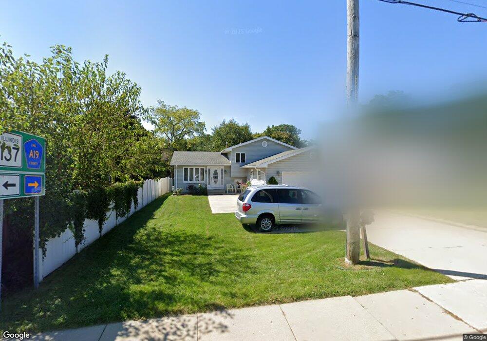
1812 N Sheridan Rd Waukegan, IL 60087
Greenwood Park NeighborhoodEstimated Value: $282,000 - $310,820
3
Beds
2
Baths
1,352
Sq Ft
$215/Sq Ft
Est. Value
About This Home
This home is located at 1812 N Sheridan Rd, Waukegan, IL 60087 and is currently estimated at $290,705, approximately $215 per square foot. 1812 N Sheridan Rd is a home located in Lake County with nearby schools including Greenwood Elementary School, Edith M Smith Middle School, and Waukegan High School.
Ownership History
Date
Name
Owned For
Owner Type
Purchase Details
Closed on
Nov 22, 1993
Sold by
Colon Felipe
Bought by
Martinez Salvador and Martinez Maria L
Current Estimated Value
Home Financials for this Owner
Home Financials are based on the most recent Mortgage that was taken out on this home.
Original Mortgage
$116,081
Interest Rate
6.88%
Mortgage Type
FHA
Create a Home Valuation Report for This Property
The Home Valuation Report is an in-depth analysis detailing your home's value as well as a comparison with similar homes in the area
Home Values in the Area
Average Home Value in this Area
Purchase History
| Date | Buyer | Sale Price | Title Company |
|---|---|---|---|
| Martinez Salvador | $77,666 | Chicago Title Insurance Co |
Source: Public Records
Mortgage History
| Date | Status | Borrower | Loan Amount |
|---|---|---|---|
| Closed | Martinez Salvador | $116,081 |
Source: Public Records
Tax History Compared to Growth
Tax History
| Year | Tax Paid | Tax Assessment Tax Assessment Total Assessment is a certain percentage of the fair market value that is determined by local assessors to be the total taxable value of land and additions on the property. | Land | Improvement |
|---|---|---|---|---|
| 2024 | $5,950 | $89,999 | $13,551 | $76,448 |
| 2023 | $5,950 | $81,211 | $12,227 | $68,984 |
| 2022 | $5,983 | $76,313 | $9,525 | $66,788 |
| 2021 | $6,029 | $68,826 | $8,496 | $60,330 |
| 2020 | $7,268 | $64,120 | $7,915 | $56,205 |
| 2019 | $7,315 | $58,756 | $7,253 | $51,503 |
| 2018 | $6,446 | $49,861 | $10,267 | $39,594 |
| 2017 | $6,275 | $44,113 | $9,083 | $35,030 |
| 2016 | $5,924 | $38,333 | $7,893 | $30,440 |
| 2015 | $5,795 | $34,308 | $7,064 | $27,244 |
| 2014 | $5,073 | $29,985 | $8,050 | $21,935 |
| 2012 | $6,287 | $32,485 | $8,721 | $23,764 |
Source: Public Records
Map
Nearby Homes
- 616 W Keith Ave
- 1336 N Ash St
- 1905 Linden Ave
- 1335 Chestnut St
- 2213 Alta Vista Dr
- 1018 W Atlantic Ave
- 2246 Alta Vista Dr
- 1110 N Ash St
- 2232 Walnut St
- 1312 N Linden Ave
- 415 W Ridgeland Ave
- 301 W Eagle Ct
- 0 Traditions Dr
- 1105 Woodlawn Cir
- 918 N Ash St
- 1504 W Glen Flora Ave
- 723 N County St
- 917 N Linden Ave
- 1000 Pine St
- 325 4th St
- 310 W Greenwood Ave
- 308 W Greenwood Ave
- 312 W Greenwood Ave
- 306 W Greenwood Ave
- 1818 N Sheridan Rd
- 308 Glendenning Place
- 304 Glendenning Place
- 316 Glendenning Place
- 1824 N Sheridan Rd
- 324 Glendenning Place
- 1828 N Sheridan Rd
- 328 Glendenning Place
- 297 W Greenwood Ave
- 305 Glendenning Place
- 301 W Greenwood Ave
- 330 Glendenning Place
- 317 Glendenning Place
- 305 W Greenwood Ave
- 323 Glendenning Place