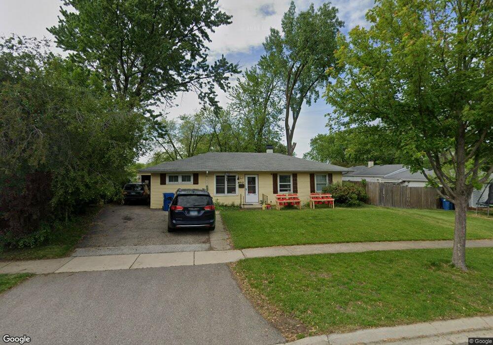
1812 Poplar Ave Hanover Park, IL 60133
Estimated Value: $283,000 - $318,000
3
Beds
1
Bath
1,032
Sq Ft
$293/Sq Ft
Est. Value
About This Home
This home is located at 1812 Poplar Ave, Hanover Park, IL 60133 and is currently estimated at $302,345, approximately $292 per square foot. 1812 Poplar Ave is a home located in Cook County with nearby schools including Laurel Hill Elementary School, Tefft Middle School, and Bartlett High School.
Ownership History
Date
Name
Owned For
Owner Type
Purchase Details
Closed on
Dec 28, 2001
Sold by
Rhodes Marvin L and Rhodes Sherry
Bought by
Friedman Brock and Friedman Theresa
Current Estimated Value
Home Financials for this Owner
Home Financials are based on the most recent Mortgage that was taken out on this home.
Original Mortgage
$133,200
Outstanding Balance
$56,208
Interest Rate
7.5%
Estimated Equity
$246,137
Create a Home Valuation Report for This Property
The Home Valuation Report is an in-depth analysis detailing your home's value as well as a comparison with similar homes in the area
Home Values in the Area
Average Home Value in this Area
Purchase History
| Date | Buyer | Sale Price | Title Company |
|---|---|---|---|
| Friedman Brock | -- | 1St American Title |
Source: Public Records
Mortgage History
| Date | Status | Borrower | Loan Amount |
|---|---|---|---|
| Open | Friedman Brock | $133,200 |
Source: Public Records
Tax History Compared to Growth
Tax History
| Year | Tax Paid | Tax Assessment Tax Assessment Total Assessment is a certain percentage of the fair market value that is determined by local assessors to be the total taxable value of land and additions on the property. | Land | Improvement |
|---|---|---|---|---|
| 2024 | $5,925 | $22,000 | $4,140 | $17,860 |
| 2023 | $5,739 | $22,000 | $4,140 | $17,860 |
| 2022 | $5,739 | $22,000 | $4,140 | $17,860 |
| 2021 | $5,637 | $18,184 | $2,898 | $15,286 |
| 2020 | $5,678 | $18,184 | $2,898 | $15,286 |
| 2019 | $5,653 | $20,205 | $2,898 | $17,307 |
| 2018 | $3,897 | $13,791 | $2,484 | $11,307 |
| 2017 | $3,882 | $13,791 | $2,484 | $11,307 |
| 2016 | $3,966 | $13,791 | $2,484 | $11,307 |
| 2015 | $4,555 | $14,510 | $2,277 | $12,233 |
| 2014 | $4,486 | $14,510 | $2,277 | $12,233 |
| 2013 | $4,319 | $14,510 | $2,277 | $12,233 |
Source: Public Records
Map
Nearby Homes
- 1899 Redwood Ave
- 1712 Poplar Ave
- 7211 Jonquil Terrace
- 1648 Linden Ave
- 1649 Park Ave
- 2040 Poplar Ave
- 7321 Jonquil Terrace
- 1591 Hillcrest Ave
- 6830 Appletree St
- 2110 Cherry Ave
- 1531 Birch Ave
- 6641 Church St
- 6988 Plumtree Ln
- 6640 Peach Tree St
- 6870 Highland St
- 7523 Bristol Ln Unit A
- 7526 Bristol Ln Unit 502
- 804 Bussey Ct
- 819 Robinson Ave
- 6551 Center Ave
- 1824 Poplar Ave
- 7100 Church St
- 1817 Linden Ave
- 1836 Poplar Ave
- 1829 Linden Ave
- 7120 Church St
- 1817 Poplar Ave
- 1841 Linden Ave
- 1829 Poplar Ave
- 7070 Church St
- 1848 Poplar Ave
- 7101 Church St
- 1841 Poplar Ave
- 1853 Linden Ave
- 1777 Linden Ave
- 1853 Poplar Ave
- 7071 Church St
- 1860 Poplar Ave
- 1760 Poplar Ave
- 1812 Redwood Ave