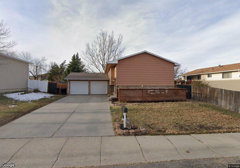
1812 Shattuck Ave Casper, WY 82601
Central Casper NeighborhoodEstimated Value: $304,000 - $355,063
5
Beds
3
Baths
1,078
Sq Ft
$303/Sq Ft
Est. Value
About This Home
This home is located at 1812 Shattuck Ave, Casper, WY 82601 and is currently estimated at $326,688, approximately $303 per square foot. 1812 Shattuck Ave is a home located in Natrona County with nearby schools including Wyoming Behavioral Institute.
Ownership History
Date
Name
Owned For
Owner Type
Purchase Details
Closed on
Jul 7, 2020
Sold by
Atkin Michael L and Atkin Micheal L
Bought by
Fus Hunter J and Fus Christopher Savannah
Current Estimated Value
Home Financials for this Owner
Home Financials are based on the most recent Mortgage that was taken out on this home.
Original Mortgage
$216,505
Outstanding Balance
$192,339
Interest Rate
3.2%
Mortgage Type
FHA
Estimated Equity
$134,349
Purchase Details
Closed on
Sep 28, 2012
Sold by
Potter Heather E and Taylor Donald E
Bought by
Atkin Michael L
Create a Home Valuation Report for This Property
The Home Valuation Report is an in-depth analysis detailing your home's value as well as a comparison with similar homes in the area
Home Values in the Area
Average Home Value in this Area
Purchase History
| Date | Buyer | Sale Price | Title Company |
|---|---|---|---|
| Fus Hunter J | -- | First American Title | |
| Atkin Michael L | -- | -- |
Source: Public Records
Mortgage History
| Date | Status | Borrower | Loan Amount |
|---|---|---|---|
| Open | Fus Hunter J | $216,505 |
Source: Public Records
Tax History Compared to Growth
Tax History
| Year | Tax Paid | Tax Assessment Tax Assessment Total Assessment is a certain percentage of the fair market value that is determined by local assessors to be the total taxable value of land and additions on the property. | Land | Improvement |
|---|---|---|---|---|
| 2025 | $1,716 | $23,893 | $3,062 | $20,831 |
| 2024 | $2,239 | $31,182 | $4,476 | $26,706 |
| 2023 | $2,192 | $30,077 | $4,052 | $26,025 |
| 2022 | $2,097 | $28,763 | $4,067 | $24,696 |
| 2021 | $1,826 | $25,047 | $4,201 | $20,846 |
| 2020 | $1,719 | $23,581 | $6,703 | $16,878 |
| 2019 | $1,477 | $20,266 | $3,687 | $16,579 |
| 2018 | $1,504 | $20,628 | $3,687 | $16,941 |
| 2017 | $1,480 | $20,303 | $3,687 | $16,616 |
| 2015 | $1,573 | $21,575 | $3,687 | $17,888 |
| 2014 | $1,503 | $20,622 | $3,687 | $16,935 |
Source: Public Records
Map
Nearby Homes
- 1800 S Beverly St
- 1854 S Lennox
- 1831 Glendale Ave
- 2111 E 24th St
- 2120 Glendale Ave
- 1905 Farnum St
- 2654 Ali Cir
- 2779 E 15th St
- 2009 S Beverly St
- 2641 E 15th St
- 1415 E 24th St
- 2611 E 15th St
- 2520 Mercy Ln
- 1450 S Illinois Ave
- 2251 S Washington St
- 1726 S Jackson St
- 1234 S Wilson St
- 1224 S Mckinley St
- 1242 Saker Ct
- 1601 E 26th St
- 1812 Shattuck Ave Unit Amherst Avenue
- 2013 Amherst Ave
- 1815 Shattuck Ave
- 2009 Amherst Ave
- 1825 Shattuck Ave
- 1811 Shumway Ave
- 2015 Amherst Ave
- 1821 Shumway Ave
- 1832 Shattuck Ave
- 1835 Shattuck Ave
- 1842 Shattuck Ave
- 1831 Shumway Ave
- 1841 Shumway Ave
- 1759 Shumway Ave
- 1812 Shumway Ave
- 1812 Breck Ave
- 2019 Amherst Ave
- 2019 Amherst Ave Unit Beverly
- 1822 Shumway Ave
- 1822 Breck Ave Unit Amherst