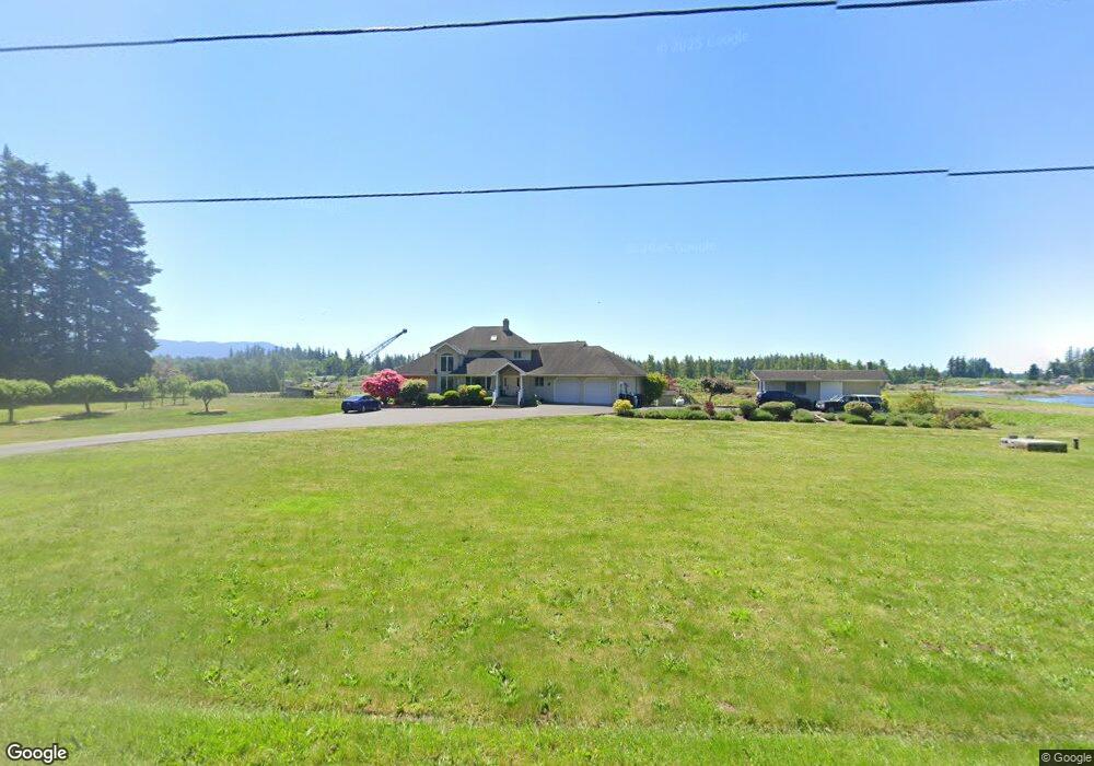
1813 E Pole Rd Everson, WA 98247
Estimated Value: $813,000 - $1,368,000
4
Beds
2
Baths
2,879
Sq Ft
$384/Sq Ft
Est. Value
About This Home
This home is located at 1813 E Pole Rd, Everson, WA 98247 and is currently estimated at $1,105,061, approximately $383 per square foot. 1813 E Pole Rd is a home located in Whatcom County with nearby schools including Lynden High School.
Ownership History
Date
Name
Owned For
Owner Type
Purchase Details
Closed on
Feb 10, 2016
Sold by
Thom Irving and Thom Ruth
Bought by
Pole Thom Pit Llc
Current Estimated Value
Home Financials for this Owner
Home Financials are based on the most recent Mortgage that was taken out on this home.
Original Mortgage
$450,000
Outstanding Balance
$353,947
Interest Rate
3.79%
Mortgage Type
Future Advance Clause Open End Mortgage
Estimated Equity
$751,114
Create a Home Valuation Report for This Property
The Home Valuation Report is an in-depth analysis detailing your home's value as well as a comparison with similar homes in the area
Purchase History
| Date | Buyer | Sale Price | Title Company |
|---|---|---|---|
| Pole Thom Pit Llc | $750,000 | First American Title |
Source: Public Records
Mortgage History
| Date | Status | Borrower | Loan Amount |
|---|---|---|---|
| Open | Pole Thom Pit Llc | $450,000 |
Source: Public Records
Tax History
| Year | Tax Paid | Tax Assessment Tax Assessment Total Assessment is a certain percentage of the fair market value that is determined by local assessors to be the total taxable value of land and additions on the property. | Land | Improvement |
|---|---|---|---|---|
| 2025 | $10,198 | $1,228,749 | $442,200 | $786,549 |
| 2024 | $8,399 | $1,207,465 | $440,100 | $767,365 |
| 2023 | $8,399 | $1,075,058 | $406,796 | $668,262 |
| 2022 | $7,783 | $986,273 | $373,200 | $613,073 |
| 2021 | $6,725 | $770,518 | $291,560 | $478,958 |
| 2020 | $5,745 | $631,567 | $238,982 | $392,585 |
| 2019 | $5,521 | $556,457 | $210,560 | $345,897 |
| 2018 | $6,611 | $547,048 | $207,000 | $340,048 |
| 2017 | $5,859 | $540,465 | $208,007 | $332,458 |
| 2016 | $5,893 | $508,989 | $195,893 | $313,096 |
| 2015 | $4,966 | $508,989 | $195,893 | $313,096 |
| 2014 | -- | $495,049 | $190,527 | $304,522 |
| 2013 | -- | $449,637 | $173,050 | $276,587 |
Source: Public Records
Map
Nearby Homes
- 1822 E Pole Rd
- 1817 Central Rd
- 1206 Ashlynn Ct
- 1005 Night Hawk Way
- 128 Sable Dr
- 130 Sable Dr
- 800 Cedar Dr
- 715 Red Maple Loop
- 2495 River Rock Dr
- 1379 Ten Mile Rd
- 616 Strandell St
- 6850 Raspberry Dr Unit A
- 6849 Raspberry Dr
- 918 Citadel Dr
- 6981 Hannegan Rd
- 6917 Red Ridge Dr
- 7393 Hannegan Rd
- 6786 La Bello Dr
- 6744 La Bello Dr
- 5818 Everson Goshen Rd
Your Personal Tour Guide
Ask me questions while you tour the home.