1813 Michael Wayne Dr Austin, TX 78728
Wells Branch NeighborhoodEstimated Value: $433,000 - $469,000
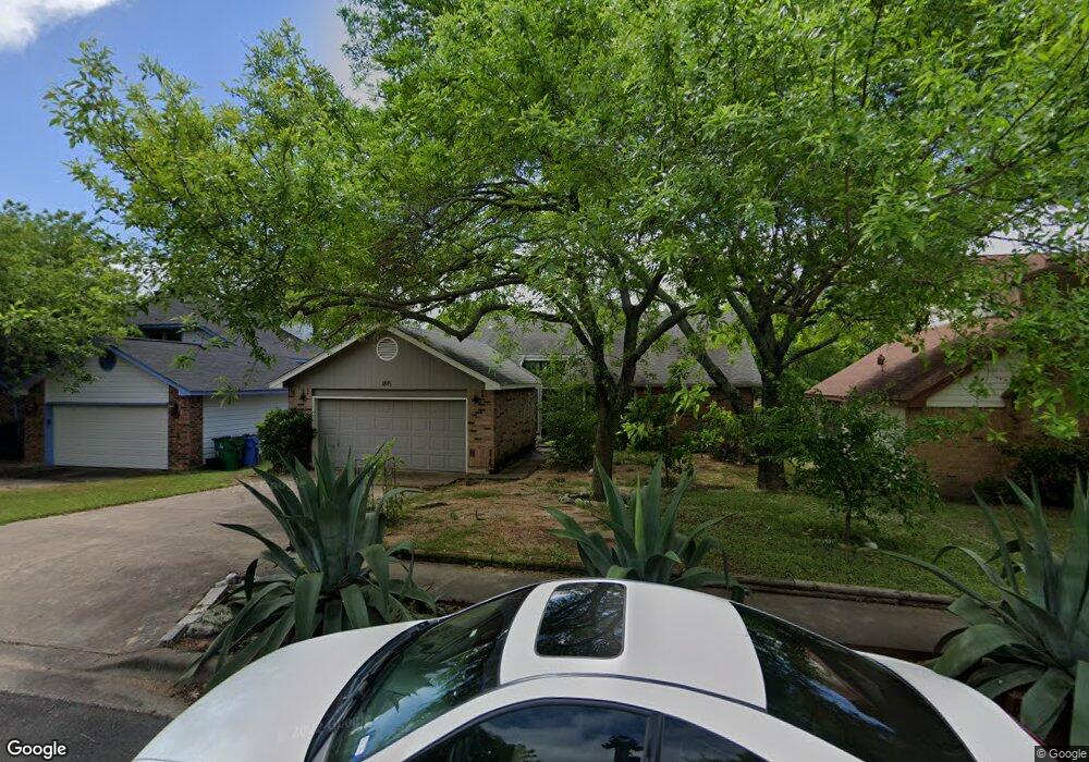
About This Home
This home is located at 1813 Michael Wayne Dr, Austin, TX 78728 and is currently estimated at $454,158, approximately $244 per square foot. 1813 Michael Wayne Dr is a home located in Travis County with nearby schools including Northwest Elementary School, Westview Middle School, and John B Connally High School.
Ownership History
We collect this data history from publicly available records. To have your information removed, we recommend requesting removal directly through your county’s website.
Purchase Details
Home Financials for this Owner
Home Financials are based on the most recent Mortgage that was taken out on this home.Purchase Details
Home Financials for this Owner
Home Financials are based on the most recent Mortgage that was taken out on this home.Home Values in the Area
Average Home Value in this Area
Purchase History
We collect this data history from publicly available records. To have your information removed, we recommend requesting removal directly through your county’s website.
| Date | Buyer | Sale Price | Title Company |
|---|---|---|---|
| -- | -- | ||
| -- | -- |
Mortgage History
We collect this data history from publicly available records. To have your information removed, we recommend requesting removal directly through your county’s website.
| Date | Status | Borrower | Loan Amount |
|---|---|---|---|
| Open | $145,900 | ||
| Previous Owner | $104,400 |
Tax History
We collect this data history from publicly available records. To have your information removed, we recommend requesting removal directly through your county’s website.
| Year | Tax Paid | Tax Assessment Tax Assessment Total Assessment is a certain percentage of the fair market value that is determined by local assessors to be the total taxable value of land and additions on the property. | Land | Improvement |
|---|---|---|---|---|
| 2025 | $6,288 | $431,276 | -- | -- |
| 2023 | $5,090 | $356,426 | $0 | $0 |
| 2022 | $6,704 | $324,024 | $0 | $0 |
| 2021 | $6,914 | $294,567 | $75,000 | $240,991 |
| 2020 | $6,421 | $267,788 | $75,000 | $192,788 |
| 2018 | $6,450 | $258,423 | $75,000 | $186,462 |
| 2017 | $5,924 | $234,930 | $75,000 | $165,934 |
| 2016 | $5,386 | $213,573 | $40,000 | $176,378 |
| 2015 | $4,091 | $194,157 | $40,000 | $159,330 |
| 2014 | $4,091 | $176,506 | $0 | $0 |
Map
- 1910 Margalene Way
- 1710 Gaylord Dr
- 2013 Margalene Way
- 14220 Anita Marie Ln
- 2202 Warfield Way
- 14513 Robert I Walker Blvd
- 2314 Klattenhoff Dr
- 2214 Gardenia Dr
- 14405 Tiffer Ln
- 13625 Campesina Dr
- 1717 Fleischer Dr
- 1900 Scofield Ridge Pkwy Unit 5403
- 2402 Spring Wagon Ln
- 14818 Yellowleaf Trail
- 2409 Water Well Ln
- 13501 Metric Blvd Unit 3
- 13501 Metric Blvd Unit 15
- 13501 Metric Blvd Unit 14
- 14600 Lake Victor Dr
- 2205 Waterway Bend
- 1811 Michael Wayne Dr
- 1817 Michael Wayne Dr
- 1809 Michael Wayne Dr
- 14300 Richard Walker Blvd
- 1819 Michael Wayne Dr
- 14301 Richard Walker Blvd
- 1807 Michael Wayne Dr
- 14303 Richard Walker Blvd
- 14302 Richard Walker Blvd
- 14201 Terisu Ln
- 1805 Michael Wayne Dr
- 1821 Michael Wayne Dr
- 14300 Jennave Ln
- 14305 Richard Walker Blvd
- 14203 Terisu Ln
- 14302 Jennave Ln
- 14304 Richard Walker Blvd
- 1803 Michael Wayne Dr
- 1823 Michael Wayne Dr
- 14307 Richard Walker Blvd
Ask me questions while you tour the home.