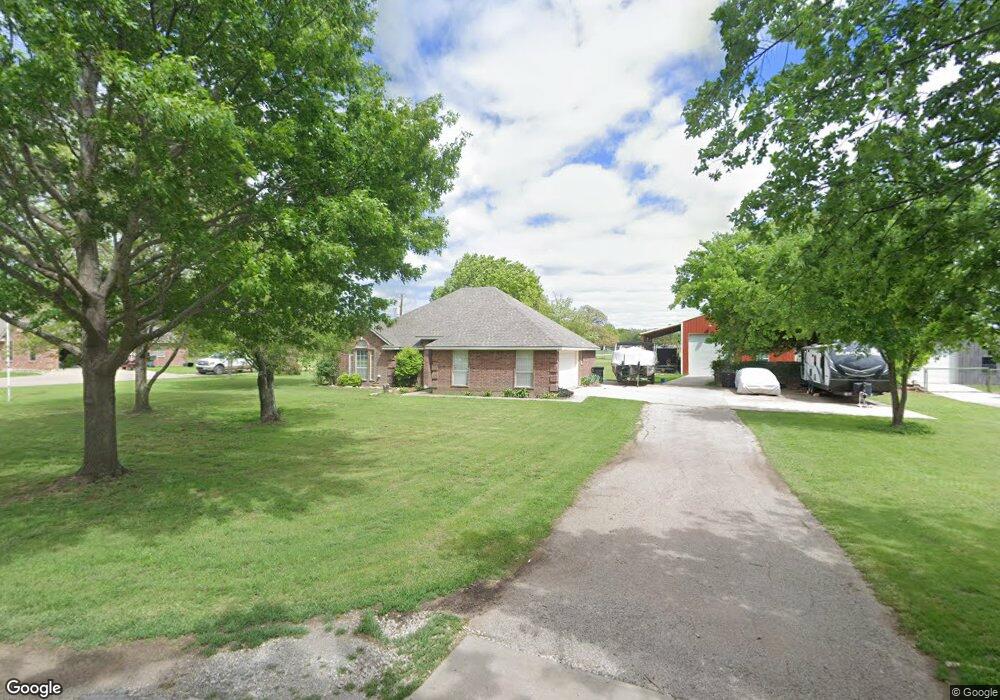
1813 Newport Rd Weatherford, TX 76086
Estimated Value: $310,000 - $341,000
3
Beds
2
Baths
1,468
Sq Ft
$222/Sq Ft
Est. Value
About This Home
This home is located at 1813 Newport Rd, Weatherford, TX 76086 and is currently estimated at $325,553, approximately $221 per square foot. 1813 Newport Rd is a home located in Parker County with nearby schools including Wright Elementary School, Hall Middle School, and Weatherford High School.
Ownership History
Date
Name
Owned For
Owner Type
Purchase Details
Closed on
Jul 30, 2015
Sold by
Grice Joe Don and Grice Michael W
Bought by
Roberts Nick and Mcmillan Angie
Current Estimated Value
Home Financials for this Owner
Home Financials are based on the most recent Mortgage that was taken out on this home.
Original Mortgage
$120,000
Outstanding Balance
$46,044
Interest Rate
3.31%
Mortgage Type
Purchase Money Mortgage
Estimated Equity
$279,509
Purchase Details
Closed on
Jun 29, 2001
Sold by
Blue Billy R and Blue Denise
Bought by
Roberts Nick and Mcmillan Angie
Create a Home Valuation Report for This Property
The Home Valuation Report is an in-depth analysis detailing your home's value as well as a comparison with similar homes in the area
Home Values in the Area
Average Home Value in this Area
Purchase History
| Date | Buyer | Sale Price | Title Company |
|---|---|---|---|
| Roberts Nick | -- | Attorney | |
| Roberts Nick | -- | -- |
Source: Public Records
Mortgage History
| Date | Status | Borrower | Loan Amount |
|---|---|---|---|
| Open | Roberts Nick | $120,000 |
Source: Public Records
Tax History Compared to Growth
Tax History
| Year | Tax Paid | Tax Assessment Tax Assessment Total Assessment is a certain percentage of the fair market value that is determined by local assessors to be the total taxable value of land and additions on the property. | Land | Improvement |
|---|---|---|---|---|
| 2025 | $4,551 | $332,012 | -- | -- |
| 2024 | $4,551 | $301,829 | -- | -- |
| 2023 | $4,551 | $274,390 | $0 | $0 |
| 2022 | $5,533 | $249,450 | $35,000 | $214,450 |
| 2021 | $5,531 | $249,450 | $35,000 | $214,450 |
| 2020 | $5,059 | $209,380 | $35,000 | $174,380 |
| 2019 | $5,095 | $209,380 | $35,000 | $174,380 |
| 2018 | $3,986 | $155,410 | $35,000 | $120,410 |
| 2017 | $4,089 | $155,410 | $35,000 | $120,410 |
| 2016 | $3,662 | $139,180 | $30,000 | $109,180 |
| 2015 | $1,567 | $139,180 | $30,000 | $109,180 |
| 2014 | $1,696 | $124,930 | $30,000 | $94,930 |
Source: Public Records
Map
Nearby Homes
- 106 Marys Ln
- 1413 Westwood Dr
- 1525 Oak Tree Cir
- 918 El Dorado St
- 905 Eldorado St
- 1816 Barberry
- 1813 Barberry Way
- 741 Nandina Rd
- 102 Bob White Ave
- 612 W Park Ave
- 1921 Bay Laurel Dr
- 1031 Estancia Blvd
- 3009 Codigo Dr
- 2008 Vaquero Dr
- 1015 W Park Ave Unit D
- 1015 W Park Ave Unit LOT A
- 1015 W Park Ave Unit LOT B
- 423 Live Oak Ln
- 209 S Hill Dr
- 122 Rachel Rd
- 1811 Newport Rd
- 1817 Newport Rd
- 1815 Newport Rd
- 1807 Newport Rd
- 1800 Newport Rd
- 1810 Newport Rd
- 1798 Newport Rd
- 1796 Newport Rd
- 1794 Newport Rd
- 1801 Newport Rd
- 301 Old Brock Rd
- 1225 Charles St
- 1399 Charles St
- 2001 Newport Rd
- 101 Marys Ln
- 319 Old Brock Rd
- 0 Newport Rd Unit 11935809
- TBD Newport Rd
- 102 Marys Ln
- 1406 Randy Dr