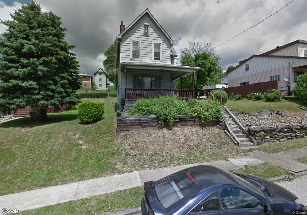
1813 Port Vue Ave McKeesport, PA 15133
Estimated Value: $92,000 - $125,924
2
Beds
2
Baths
1,368
Sq Ft
$81/Sq Ft
Est. Value
About This Home
This home is located at 1813 Port Vue Ave, McKeesport, PA 15133 and is currently estimated at $110,981, approximately $81 per square foot. 1813 Port Vue Ave is a home located in Allegheny County with nearby schools including South Allegheny Elementary School, South Allegheny High School, and Young Scholars of Greater Allegheny Charter School.
Ownership History
Date
Name
Owned For
Owner Type
Purchase Details
Closed on
Jul 16, 2019
Sold by
Underwood Douglas S and Underwood Diane L
Bought by
Underwood Douglas S
Current Estimated Value
Home Financials for this Owner
Home Financials are based on the most recent Mortgage that was taken out on this home.
Original Mortgage
$50,000
Outstanding Balance
$43,892
Interest Rate
3.6%
Mortgage Type
Credit Line Revolving
Estimated Equity
$67,089
Purchase Details
Closed on
Oct 30, 1992
Bought by
Underwood Douglas S and Underwood Diane L
Create a Home Valuation Report for This Property
The Home Valuation Report is an in-depth analysis detailing your home's value as well as a comparison with similar homes in the area
Home Values in the Area
Average Home Value in this Area
Purchase History
| Date | Buyer | Sale Price | Title Company |
|---|---|---|---|
| Underwood Douglas S | -- | None Available | |
| Underwood Douglas S | $43,500 | -- |
Source: Public Records
Mortgage History
| Date | Status | Borrower | Loan Amount |
|---|---|---|---|
| Open | Underwood Douglas S | $50,000 |
Source: Public Records
Tax History Compared to Growth
Tax History
| Year | Tax Paid | Tax Assessment Tax Assessment Total Assessment is a certain percentage of the fair market value that is determined by local assessors to be the total taxable value of land and additions on the property. | Land | Improvement |
|---|---|---|---|---|
| 2025 | $1,277 | $33,500 | $12,200 | $21,300 |
| 2024 | $1,277 | $33,500 | $12,200 | $21,300 |
| 2023 | $1,227 | $33,500 | $12,200 | $21,300 |
| 2022 | $1,149 | $33,500 | $12,200 | $21,300 |
| 2021 | $1,119 | $33,500 | $12,200 | $21,300 |
| 2020 | $1,093 | $33,500 | $12,200 | $21,300 |
| 2019 | $1,038 | $33,500 | $12,200 | $21,300 |
| 2018 | $158 | $33,500 | $12,200 | $21,300 |
| 2017 | $984 | $33,500 | $12,200 | $21,300 |
| 2016 | $158 | $33,500 | $12,200 | $21,300 |
| 2015 | $158 | $33,500 | $12,200 | $21,300 |
| 2014 | $984 | $33,500 | $12,200 | $21,300 |
Source: Public Records
Map
Nearby Homes
- 1817 Gray St
- 813 Lauck Ave
- 603 Hays St
- 320 Dersam St
- 335-345 Dersam St
- 1317 New York Ave
- 1120 Portsmouth Dr
- 1332 Beverly Rd
- 2908 Woodrow St
- 1220 Romine Ave
- 112 Kollar Dr
- 1310 Beverly Rd
- 0 Washington Blvd
- 2302 Walnut St
- 2834 Washington Blvd
- 1419 Washington Blvd
- 1009 Oakland Ave
- 1517 Beaver St
- 1405/1407 Walnut St
- 607-609 1/2 Allegheny Ave
- 1817 Port Vue Ave
- 1809 Port Vue Ave
- 1819 Port Vue Ave
- 1805 Port Vue Ave
- 1814 Stegman Ave
- 1820 Stegman Ave
- 816 Burbridge St
- 1812 Port Vue Ave
- 1822 Stegman Ave
- 1812 Stegman Ave
- 1810 Port Vue Ave
- 1816 Port Vue Ave
- 808 Burbridge St
- 1810 Stegman Ave
- 1801 Port Vue Ave
- 1820 Port Vue Ave
- 1829 Port Vue Ave
- 800 Burbridge St
- 1824 Port Vue Ave
- 1804 Stegman Ave