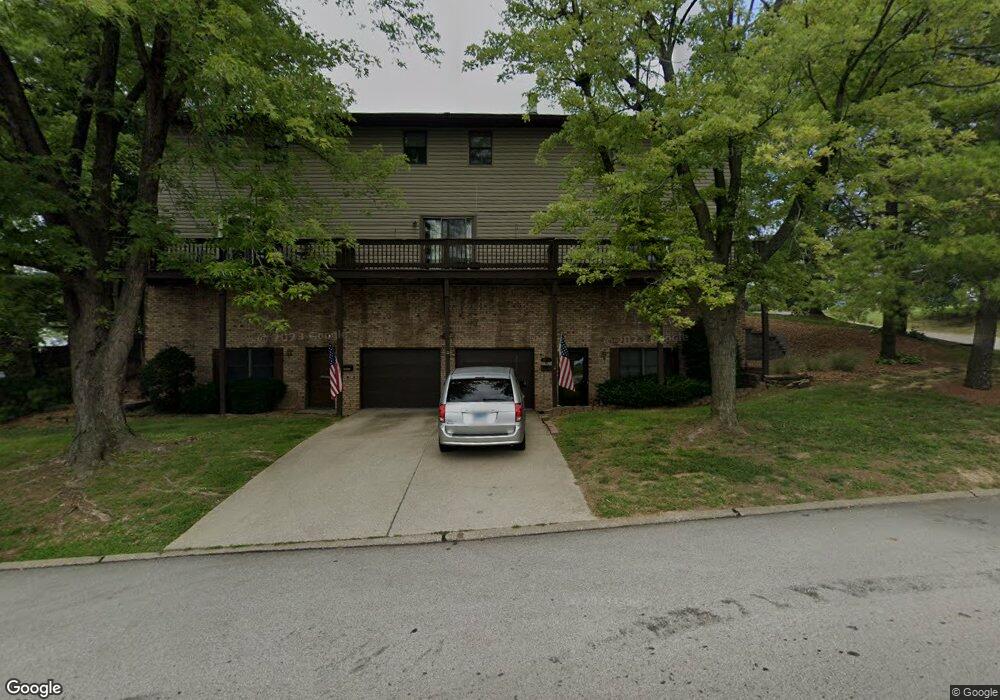
1813 Ramada Blvd Unit 1 Collinsville, IL 62234
Estimated Value: $69,000 - $104,000
1
Bed
1
Bath
600
Sq Ft
$143/Sq Ft
Est. Value
About This Home
This home is located at 1813 Ramada Blvd Unit 1, Collinsville, IL 62234 and is currently estimated at $85,927, approximately $143 per square foot. 1813 Ramada Blvd Unit 1 is a home located in Madison County with nearby schools including Dorris Intermediate School, Twin Echo Elementary School, and Collinsville Middle School.
Ownership History
Date
Name
Owned For
Owner Type
Purchase Details
Closed on
Aug 17, 2016
Sold by
Sonnenberg Walter
Bought by
Sonnenberg Walter and Sonnenberg Patricia
Current Estimated Value
Purchase Details
Closed on
Jan 5, 2009
Sold by
Raya Miguel A
Bought by
Sonnenberg Walter
Purchase Details
Closed on
Sep 8, 2004
Sold by
Raya Miguel A
Bought by
Raya Miguel A
Create a Home Valuation Report for This Property
The Home Valuation Report is an in-depth analysis detailing your home's value as well as a comparison with similar homes in the area
Home Values in the Area
Average Home Value in this Area
Purchase History
| Date | Buyer | Sale Price | Title Company |
|---|---|---|---|
| Sonnenberg Walter | -- | Attorney | |
| Sonnenberg Walter | $64,000 | Abstracts & Titles Inc | |
| Raya Miguel A | -- | -- |
Source: Public Records
Tax History Compared to Growth
Tax History
| Year | Tax Paid | Tax Assessment Tax Assessment Total Assessment is a certain percentage of the fair market value that is determined by local assessors to be the total taxable value of land and additions on the property. | Land | Improvement |
|---|---|---|---|---|
| 2024 | $243 | $19,700 | $1,510 | $18,190 |
| 2023 | $243 | $17,850 | $1,370 | $16,480 |
| 2022 | $250 | $16,510 | $1,270 | $15,240 |
| 2021 | $262 | $15,510 | $1,190 | $14,320 |
| 2020 | $265 | $14,800 | $1,140 | $13,660 |
| 2019 | $437 | $19,020 | $1,090 | $17,930 |
| 2018 | $440 | $18,030 | $1,040 | $16,990 |
| 2017 | $511 | $17,670 | $1,020 | $16,650 |
| 2016 | $485 | $17,670 | $1,020 | $16,650 |
| 2015 | $465 | $17,210 | $990 | $16,220 |
| 2014 | $465 | $17,210 | $990 | $16,220 |
| 2013 | $465 | $17,210 | $990 | $16,220 |
Source: Public Records
Map
Nearby Homes
- 1051 Lafayette Ct Unit A
- 1059 Lafayette Ct Unit A
- 1035 Lafayette Ct Unit B
- 1121 Carraway Ct
- 100 Debbie Dr
- 2007 Belt Line Rd
- 5 Brookwood Dr
- 22 Brookwood Dr
- 45 Bellevue Dr
- 123 Elliot St
- 101 Westminster Dr
- 510 N Combs Ave
- 205 Audrey Ave
- 414 Bunker Hill Dr
- 0 Strong Ave
- 580 N Guernsey St
- 0 Elm St
- 1224 Cedar Ridge Ct
- 123 W Wickliffe Ave
- 221 N Hesperia St Unit 221 A and 221 B
- 1813 Ramada Blvd
- 1813 Ramada Blvd Unit 2
- 1813 Ramada Blvd Unit 5
- 1813 Ramada Blvd Unit 3
- 105 Sandridge Dr
- 107 Sandridge Dr
- 111 Sandridge Dr
- 115 Sandridge Dr Unit 5
- 101 Sandridge Dr Unit 4
- 109 Sandridge Dr
- 113 Sandridge Dr
- 103 Sandridge Dr
- 1931 Ramada Blvd
- 1941 Ramada Blvd
- 1937 Ramada Blvd
- 1933 Ramada Blvd Unit 48
- 1935 Ramada Blvd Unit 44
- 127 Sandridge Dr
- 131 Sandridge Dr
- 123 Sandridge Dr