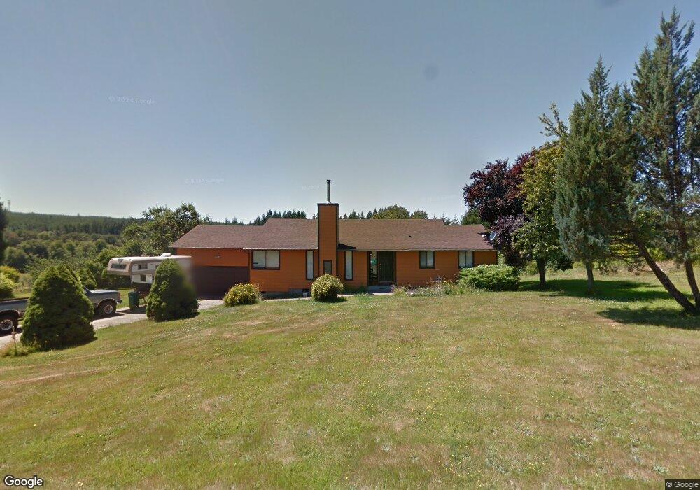
18132 Keasey Rd Vernonia, OR 97064
Estimated Value: $472,572 - $636,000
2
Beds
2
Baths
1,378
Sq Ft
$402/Sq Ft
Est. Value
About This Home
This home is located at 18132 Keasey Rd, Vernonia, OR 97064 and is currently estimated at $554,286, approximately $402 per square foot. 18132 Keasey Rd is a home located in Columbia County with nearby schools including Vernonia High School.
Ownership History
Date
Name
Owned For
Owner Type
Purchase Details
Closed on
May 13, 2004
Sold by
Davies Scott and Davies Deborah
Bought by
Pratt Mallory J
Current Estimated Value
Home Financials for this Owner
Home Financials are based on the most recent Mortgage that was taken out on this home.
Original Mortgage
$172,900
Outstanding Balance
$82,489
Interest Rate
5.75%
Mortgage Type
Purchase Money Mortgage
Estimated Equity
$471,797
Purchase Details
Closed on
Mar 26, 2004
Sold by
Davies Scott
Bought by
Davies Scott and Davies Deborah
Home Financials for this Owner
Home Financials are based on the most recent Mortgage that was taken out on this home.
Original Mortgage
$172,900
Outstanding Balance
$82,489
Interest Rate
5.75%
Mortgage Type
Purchase Money Mortgage
Estimated Equity
$471,797
Create a Home Valuation Report for This Property
The Home Valuation Report is an in-depth analysis detailing your home's value as well as a comparison with similar homes in the area
Home Values in the Area
Average Home Value in this Area
Purchase History
| Date | Buyer | Sale Price | Title Company |
|---|---|---|---|
| Pratt Mallory J | $247,000 | Ticor Title | |
| Davies Scott | -- | Ticor Title | |
| Davies Scott | -- | Ticor Title | |
| Davies Scott | -- | Ticor Title |
Source: Public Records
Mortgage History
| Date | Status | Borrower | Loan Amount |
|---|---|---|---|
| Open | Pratt Mallory J | $172,900 |
Source: Public Records
Tax History Compared to Growth
Tax History
| Year | Tax Paid | Tax Assessment Tax Assessment Total Assessment is a certain percentage of the fair market value that is determined by local assessors to be the total taxable value of land and additions on the property. | Land | Improvement |
|---|---|---|---|---|
| 2024 | $3,444 | $279,480 | $131,900 | $147,580 |
| 2023 | $3,434 | $271,340 | $125,540 | $145,800 |
| 2022 | $3,247 | $263,440 | $121,880 | $141,560 |
| 2021 | $3,153 | $255,770 | $123,760 | $132,010 |
| 2020 | $3,079 | $248,330 | $114,640 | $133,690 |
| 2019 | $2,825 | $241,100 | $110,380 | $130,720 |
| 2018 | $2,817 | $234,080 | $120,200 | $113,880 |
| 2017 | $2,758 | $227,270 | $116,700 | $110,570 |
| 2016 | $2,526 | $220,660 | $113,300 | $107,360 |
| 2015 | $2,348 | $213,350 | $98,950 | $114,400 |
| 2014 | $2,276 | $198,730 | $103,550 | $95,180 |
Source: Public Records
Map
Nearby Homes
- 18122 Keasey Rd
- 18174 Keasey Rd
- 18115 Keasey Rd
- 18209 Keasey Rd
- 18209 Rock Creek Rd
- 18200 Keasey Rd
- 18062 Keasey Rd
- 18235 Keasey Rd
- 18260 Keasey Rd
- 18300 Keasey Rd
- 18275 Keasey Rd
- 0 Keasey Rd Unit 516258536
- 0 Keasey Rd Unit 22512922
- 0 Keasey Rd
- 17933 Keasey Rd
- 0 Cleveland Rd Unit 2300 23643808
- 0 Cleveland Rd Unit 2000
- 1898 Rose Ave
- 1902 Weed Ave
- 1910 Weed Ave