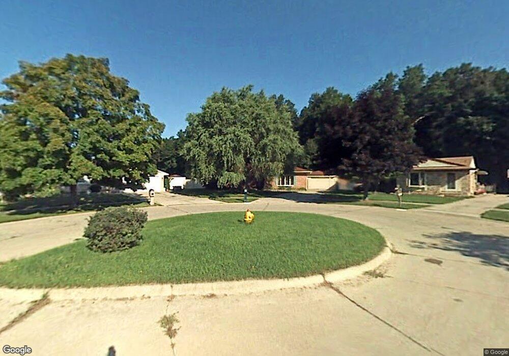
18134 Townsend Ct Brownstown, MI 48193
Estimated Value: $242,000 - $273,000
3
Beds
2
Baths
1,425
Sq Ft
$178/Sq Ft
Est. Value
About This Home
This home is located at 18134 Townsend Ct, Brownstown, MI 48193 and is currently estimated at $253,505, approximately $177 per square foot. 18134 Townsend Ct is a home located in Wayne County with nearby schools including Gudith Elementary School, Patrick Henry Middle School, and Brownstown Middle School.
Ownership History
Date
Name
Owned For
Owner Type
Purchase Details
Closed on
Jun 16, 2009
Sold by
Federal National Mortgage Association
Bought by
Evitts Lisa M
Current Estimated Value
Home Financials for this Owner
Home Financials are based on the most recent Mortgage that was taken out on this home.
Original Mortgage
$77,569
Outstanding Balance
$49,247
Interest Rate
4.86%
Mortgage Type
FHA
Estimated Equity
$204,258
Purchase Details
Closed on
Aug 28, 2008
Sold by
Mortgage Electronic Registration Systems
Bought by
Federal National Mortgage Association
Purchase Details
Closed on
Aug 21, 2008
Sold by
Mulligan Sally
Bought by
Mortgage Electronic Registration Systems
Purchase Details
Closed on
Jan 11, 2001
Sold by
Mulligan John
Bought by
Mulligan Sally
Create a Home Valuation Report for This Property
The Home Valuation Report is an in-depth analysis detailing your home's value as well as a comparison with similar homes in the area
Home Values in the Area
Average Home Value in this Area
Purchase History
| Date | Buyer | Sale Price | Title Company |
|---|---|---|---|
| Evitts Lisa M | $79,000 | Warranty Title Agency Llc | |
| Federal National Mortgage Association | -- | None Available | |
| Mortgage Electronic Registration Systems | $136,312 | None Available | |
| Mulligan Sally | -- | -- |
Source: Public Records
Mortgage History
| Date | Status | Borrower | Loan Amount |
|---|---|---|---|
| Open | Evitts Lisa M | $77,569 |
Source: Public Records
Tax History Compared to Growth
Tax History
| Year | Tax Paid | Tax Assessment Tax Assessment Total Assessment is a certain percentage of the fair market value that is determined by local assessors to be the total taxable value of land and additions on the property. | Land | Improvement |
|---|---|---|---|---|
| 2025 | $1,355 | $137,400 | $0 | $0 |
| 2024 | $1,355 | $120,300 | $0 | $0 |
| 2023 | $1,293 | $104,100 | $0 | $0 |
| 2022 | $2,457 | $94,200 | $0 | $0 |
| 2021 | $2,285 | $89,500 | $0 | $0 |
| 2020 | $2,549 | $90,400 | $0 | $0 |
| 2019 | $2,220 | $73,900 | $0 | $0 |
| 2018 | $1,130 | $64,800 | $0 | $0 |
| 2017 | $2,097 | $64,000 | $0 | $0 |
| 2016 | $2,136 | $64,400 | $0 | $0 |
| 2015 | $4,315 | $59,000 | $0 | $0 |
| 2013 | $4,180 | $43,300 | $0 | $0 |
| 2012 | -- | $44,300 | $14,000 | $30,300 |
Source: Public Records
Map
Nearby Homes
- 23089 Suffield Ln
- 17157 Higdon Dr Unit 10
- 17834 Dennis St Unit 451
- 23504 Matts Dr Unit 66
- 23604 Matts Dr Unit 63
- 17761 Feather Ln
- 23653 Maple Ln Unit 139
- 17763 Covey Ct
- 17262 Oak Gove St Unit 314
- 23654 Pine Dr Unit 201
- 23675 Maple Ln Unit 141
- 23633 Hickory Dr Unit 211
- 17282 Oak Gove St Unit 309
- 17501 Cedar Grove Unit 181
- 17528 Cedar Grove
- 23678 Hickory Dr Unit 261
- 17324 Oak Gove St Unit 300
- 23686 Hickory Dr Unit 260
- 23705 Hickory Dr Unit 220
- 17416 Oak Gove St Unit 287
- 18146 Townsend Ct
- 18122 Townsend Ct
- 18129 Doncaster Ct
- 18141 Doncaster Ct
- 18158 Townsend Ct
- 18133 Townsend Ct
- 18153 Doncaster Ct
- 18118 Doncaster Ct
- 18147 Townsend Ct
- 18170 Townsend Ct
- 18159 Townsend Ct
- 18167 Doncaster Ct
- 18171 Townsend Ct
- 18148 Franklin Ct
- 18130 Doncaster Ct
- 18136 Franklin Ct
- 18142 Doncaster Ct
- 18154 Doncaster Ct
- 18160 Franklin Ct
- 18166 Doncaster Ct
