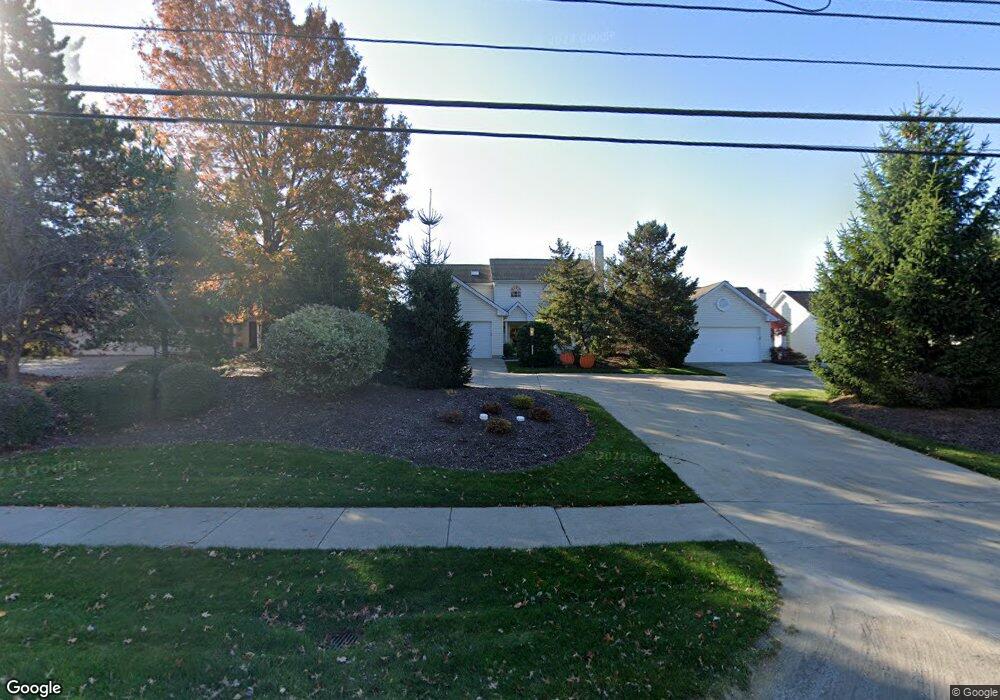
18135 Drake Rd Strongsville, OH 44136
Estimated Value: $364,093 - $389,000
3
Beds
2
Baths
2,768
Sq Ft
$135/Sq Ft
Est. Value
About This Home
This home is located at 18135 Drake Rd, Strongsville, OH 44136 and is currently estimated at $374,023, approximately $135 per square foot. 18135 Drake Rd is a home located in Cuyahoga County with nearby schools including Strongsville High School and Sts Joseph & John Interparochial School.
Ownership History
Date
Name
Owned For
Owner Type
Purchase Details
Closed on
Mar 5, 2004
Sold by
Georgeadis Philip N
Bought by
Georgeadis Jeanne M
Current Estimated Value
Purchase Details
Closed on
Jun 30, 2003
Sold by
Georgeadis Jeanne M and Georgeadis Philip N
Bought by
Georgeadis Philip N and Georgeadis Jeanne M
Home Financials for this Owner
Home Financials are based on the most recent Mortgage that was taken out on this home.
Original Mortgage
$150,000
Interest Rate
4.75%
Mortgage Type
Purchase Money Mortgage
Purchase Details
Closed on
Jan 1, 1993
Bought by
Georgead Jeanne M
Create a Home Valuation Report for This Property
The Home Valuation Report is an in-depth analysis detailing your home's value as well as a comparison with similar homes in the area
Home Values in the Area
Average Home Value in this Area
Purchase History
| Date | Buyer | Sale Price | Title Company |
|---|---|---|---|
| Georgeadis Jeanne M | -- | -- | |
| Georgeadis Philip N | -- | Chelsea Title Agency | |
| Georgead Jeanne M | -- | -- |
Source: Public Records
Mortgage History
| Date | Status | Borrower | Loan Amount |
|---|---|---|---|
| Closed | Georgeadis Philip N | $150,000 |
Source: Public Records
Tax History Compared to Growth
Tax History
| Year | Tax Paid | Tax Assessment Tax Assessment Total Assessment is a certain percentage of the fair market value that is determined by local assessors to be the total taxable value of land and additions on the property. | Land | Improvement |
|---|---|---|---|---|
| 2024 | $4,305 | $101,500 | $19,810 | $81,690 |
| 2023 | $5,091 | $90,480 | $19,990 | $70,490 |
| 2022 | $5,080 | $90,480 | $19,990 | $70,490 |
| 2021 | $5,040 | $90,480 | $19,990 | $70,490 |
| 2020 | $4,924 | $79,380 | $17,540 | $61,850 |
| 2019 | $4,780 | $226,800 | $50,100 | $176,700 |
| 2018 | $2,169 | $79,380 | $17,540 | $61,850 |
| 2017 | $4,077 | $70,210 | $14,350 | $55,860 |
| 2016 | $4,044 | $70,210 | $14,350 | $55,860 |
| 2015 | $4,101 | $70,210 | $14,350 | $55,860 |
| 2014 | $4,101 | $70,210 | $14,350 | $55,860 |
Source: Public Records
Map
Nearby Homes
- 18294 Drake Rd
- 17934 Cambridge Oval
- 17682 Drake Rd
- 17024 Bear Creek Ln
- 18411 Yorktown Oval
- 17159 Turkey Meadow Ln
- 17259 Woodshire Dr
- 18848 Pearl Rd
- 19297 Lauren Way
- 18162 Fawn Cir
- 19311 Bradford Ct
- 16486 S Red Rock Dr
- 16650 Lanier Ave
- 20393 Wildwood Ln
- 16711 Beech Cir
- 17130 Golden Star Dr
- 20114 Drake Rd
- 18630 Shurmer Rd
- 20121 Driftwood Ct
- 19908 Stoughton Dr
- 18147 Drake Rd
- 18119 Drake Rd
- 18175 Drake Rd
- 18203 Drake Rd
- 18215 Drake Rd
- 2135 Heritage Trail
- 2111 Heritage Trail
- 18124 Drake Rd
- 17862 Heritage Trail
- 18158 Drake Rd
- 17884 Heritage Trail
- 18090 Drake Rd
- 18243 Drake Rd
- 17840 Heritage Trail
- 18192 Drake Rd
- 17906 Heritage Trail
- 18226 Drake Rd
- 17801 Cambridge Oval
- 17823 Cambridge Oval
- 17847 Cambridge Oval