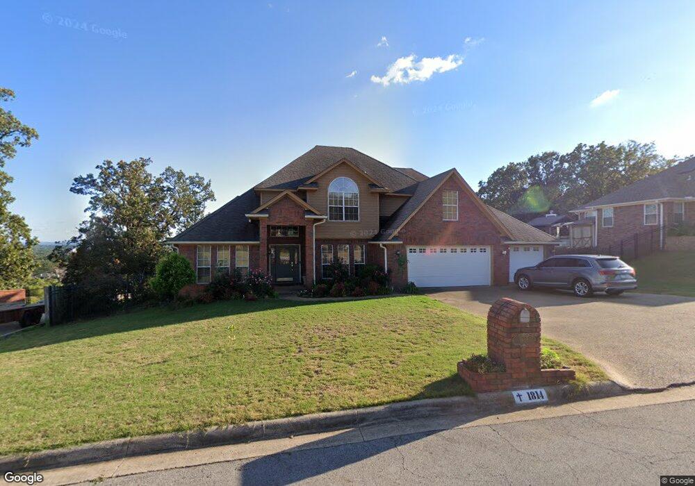
1814 Bunker Hill Dr van Buren, AR 72956
Estimated Value: $341,000 - $458,000
--
Bed
4
Baths
3,158
Sq Ft
$127/Sq Ft
Est. Value
About This Home
This home is located at 1814 Bunker Hill Dr, van Buren, AR 72956 and is currently estimated at $400,428, approximately $126 per square foot. 1814 Bunker Hill Dr is a home located in Crawford County with nearby schools including Northridge Middle School, Van Buren High School, and River Valley Virtual Academy.
Ownership History
Date
Name
Owned For
Owner Type
Purchase Details
Closed on
Aug 22, 2008
Sold by
Ferguson Niba Audra R
Bought by
Niba Suh N
Current Estimated Value
Purchase Details
Closed on
Sep 8, 2005
Sold by
Goodlin Derek L and Goodlin Janice L
Bought by
Niba Suh N and Ferguson Niba Audra R
Home Financials for this Owner
Home Financials are based on the most recent Mortgage that was taken out on this home.
Original Mortgage
$277,800
Outstanding Balance
$147,056
Interest Rate
5.78%
Mortgage Type
New Conventional
Estimated Equity
$253,372
Purchase Details
Closed on
Mar 27, 2001
Bought by
Hale-Goodlin
Purchase Details
Closed on
Jun 22, 1999
Bought by
Hammer-Hale
Purchase Details
Closed on
May 11, 1998
Bought by
Sirmon-Hammer
Purchase Details
Closed on
Nov 17, 1997
Bought by
S and -Sirmon
Create a Home Valuation Report for This Property
The Home Valuation Report is an in-depth analysis detailing your home's value as well as a comparison with similar homes in the area
Home Values in the Area
Average Home Value in this Area
Purchase History
| Date | Buyer | Sale Price | Title Company |
|---|---|---|---|
| Niba Suh N | -- | None Available | |
| Niba Suh N | $293,000 | Eugene A Wahl | |
| Hale-Goodlin | $243,000 | -- | |
| Hammer-Hale | $235,000 | -- | |
| Sirmon-Hammer | $215,000 | -- | |
| S | $34,000 | -- |
Source: Public Records
Mortgage History
| Date | Status | Borrower | Loan Amount |
|---|---|---|---|
| Open | Niba Suh N | $277,800 |
Source: Public Records
Tax History Compared to Growth
Tax History
| Year | Tax Paid | Tax Assessment Tax Assessment Total Assessment is a certain percentage of the fair market value that is determined by local assessors to be the total taxable value of land and additions on the property. | Land | Improvement |
|---|---|---|---|---|
| 2025 | $2,352 | $79,980 | $5,600 | $74,380 |
| 2024 | $2,323 | $79,980 | $5,600 | $74,380 |
| 2023 | $2,270 | $79,980 | $5,600 | $74,380 |
| 2022 | $2,191 | $49,450 | $4,500 | $44,950 |
| 2021 | $2,191 | $49,450 | $4,500 | $44,950 |
| 2020 | $2,191 | $49,450 | $4,500 | $44,950 |
| 2019 | $2,168 | $49,450 | $4,500 | $44,950 |
| 2018 | $2,078 | $49,450 | $4,500 | $44,950 |
| 2017 | $1,962 | $44,550 | $4,500 | $40,050 |
| 2016 | $1,962 | $44,550 | $4,500 | $40,050 |
| 2015 | $1,828 | $44,550 | $4,500 | $40,050 |
| 2014 | $1,829 | $44,550 | $4,500 | $40,050 |
Source: Public Records
Map
Nearby Homes
- 2028 Wisteria Ln
- 1526 Saratoga Ct
- 2312 Amy Ln
- 2325 Amy Ln
- 1300 Northview Dr
- 1106 N 21st St
- 2406 Lisa Ct
- 1704 Broaddrick Ln
- 1119 N 24th St
- 1318 Taos Dr
- 1736 N 24th St
- 1502 N 10th St
- 1322 Bon Air St
- 1401 N 10th St
- 1316 Bon Air St
- 1204 Breckenridge Dr
- 1400 N 9th St
- 1105 Taos Dr
- 1507 N 9th St
- 1513 N 9th St
- 1812 Bunker Hill Dr
- 1816 Bunker Hill Dr
- 1819 Bunker Hill Dr
- 1810 Bunker Hill Dr
- 1818 Bunker Hill Dr
- 1817 Bunker Hill Dr
- 1808 Bunker Hill Dr
- 1815 Bunker Hill Dr
- 1820 Bunker Hill Dr
- 1828 Heritage Dr
- 1826 Heritage Dr
- 1813 Bunker Hill Dr
- 1806 Bunker Hill Dr
- 1824 Heritage Dr
- 1904 Heritage Dr
- 1822 Heritage Dr
- 1811 Bunker Hill Dr
- 1513 Trenton Cir
- 1515 Trenton Cir
- 1804 Bunker Hill Dr