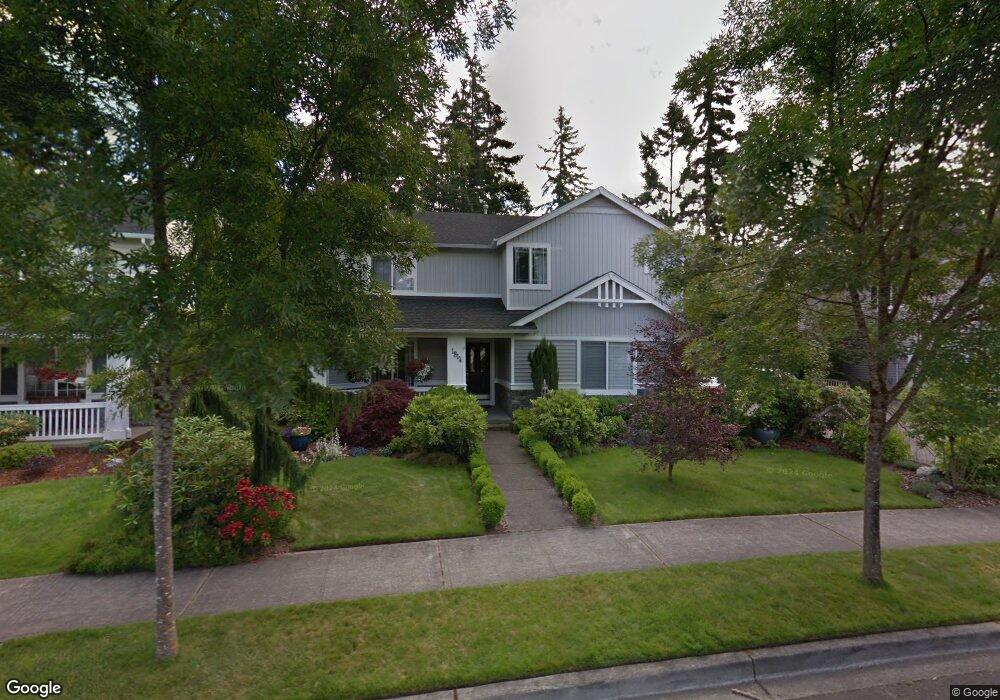
1814 Fisher Ave Dupont, WA 98327
Estimated Value: $720,732 - $835,000
4
Beds
3
Baths
3,377
Sq Ft
$232/Sq Ft
Est. Value
About This Home
This home is located at 1814 Fisher Ave, Dupont, WA 98327 and is currently estimated at $781,933, approximately $231 per square foot. 1814 Fisher Ave is a home located in Pierce County with nearby schools including Chloe Clark Elementary School, Saltars Point Elementary School, and Pioneer Middle School.
Ownership History
Date
Name
Owned For
Owner Type
Purchase Details
Closed on
Sep 8, 2000
Sold by
The Quadrant Corp
Bought by
Delgado David G and Delgado Crystal M
Current Estimated Value
Home Financials for this Owner
Home Financials are based on the most recent Mortgage that was taken out on this home.
Original Mortgage
$233,068
Outstanding Balance
$85,005
Interest Rate
8.11%
Estimated Equity
$696,928
Create a Home Valuation Report for This Property
The Home Valuation Report is an in-depth analysis detailing your home's value as well as a comparison with similar homes in the area
Home Values in the Area
Average Home Value in this Area
Purchase History
| Date | Buyer | Sale Price | Title Company |
|---|---|---|---|
| Delgado David G | $285,422 | Chicago Title |
Source: Public Records
Mortgage History
| Date | Status | Borrower | Loan Amount |
|---|---|---|---|
| Open | Delgado David G | $233,068 |
Source: Public Records
Tax History Compared to Growth
Tax History
| Year | Tax Paid | Tax Assessment Tax Assessment Total Assessment is a certain percentage of the fair market value that is determined by local assessors to be the total taxable value of land and additions on the property. | Land | Improvement |
|---|---|---|---|---|
| 2025 | $4,964 | $674,900 | $247,000 | $427,900 |
| 2024 | $4,964 | $642,800 | $237,900 | $404,900 |
| 2023 | $4,964 | $617,200 | $235,400 | $381,800 |
| 2022 | $4,949 | $628,800 | $235,400 | $393,400 |
| 2021 | $4,730 | $470,100 | $149,500 | $320,600 |
| 2019 | $4,242 | $429,700 | $124,600 | $305,100 |
| 2018 | $4,594 | $415,100 | $124,600 | $290,500 |
| 2017 | $4,128 | $393,800 | $110,600 | $283,200 |
| 2016 | $3,943 | $357,100 | $93,300 | $263,800 |
| 2014 | $3,797 | $350,500 | $93,300 | $257,200 |
| 2013 | $3,797 | $322,900 | $94,800 | $228,100 |
Source: Public Records
Map
Nearby Homes
- 1875 Mcneil Cir Unit E-1
- 1821 Mcneil Cir Unit D-3
- 1856 Spencer Ct Unit 12F
- 2055 Garry Oaks Ave Unit B
- 1607 Kincaid St Unit E-8
- 2357 Wallace St
- 1451 Thompson Cir Unit 4A
- 1625 Palisade Blvd
- 1449 Bobs Hollow Ln
- 2420 Simmons St
- 2176 McDonald Ave
- 2160 Anderson Ave
- 2104 Palisade Blvd Unit B-7
- 2702 Meyer St
- 2147 Hammond Ave Unit B10
- 2176 Palisade Blvd Unit F-3
- 2198 Palisade Blvd Unit C2
- 2237 Tolmie St
- 604 Dupont Ave
- 1373 Hudson St Unit 1373
- 1810 Fisher Ave
- 182 Fisher Ave
- 1806 Fisher Ave
- 1822 Fisher Ave
- 1815 Fisher Ave
- 1819 Fisher Ave
- 1811 Fisher Ave
- 1821 Fisher Ave
- 1802 Fisher Ave
- 1826 Fisher Ave
- 1823 Fisher Ave
- 1823 Fisher St
- 1822 Mcneil St
- 1827 Fisher Ave
- 1844 Mcneil St
- 1912 Braget St
- 1906 Braget St
- 1829 Fisher Ave
- 1866 Mcneil St
- 1830 Fisher Ave