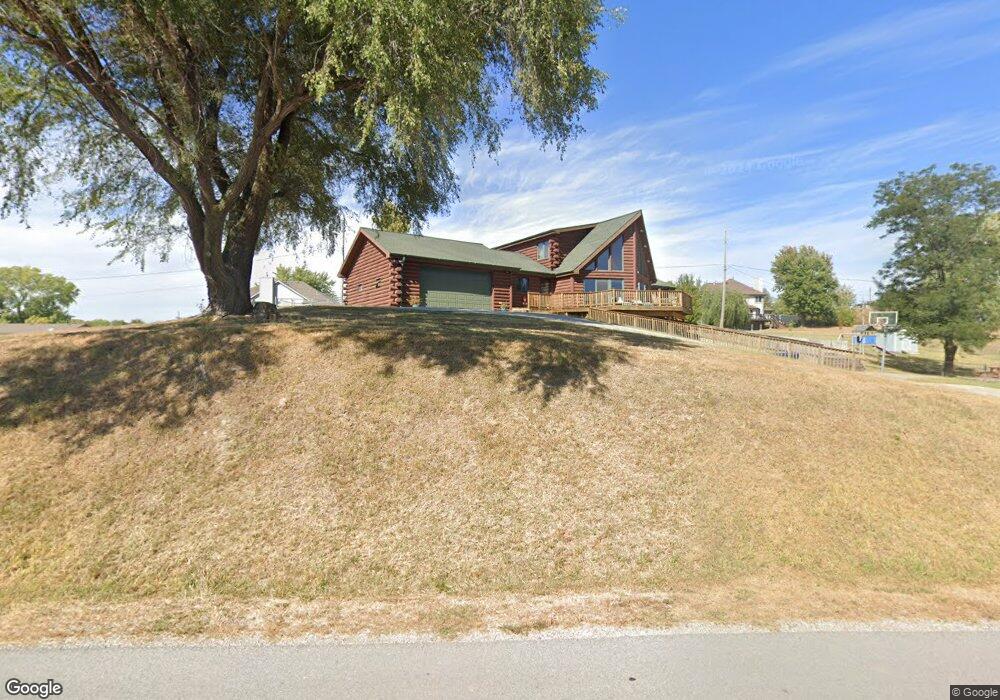
1814 S Dunbar Dr Murray, NE 68048
Estimated Value: $434,000 - $522,000
3
Beds
6
Baths
2,862
Sq Ft
$167/Sq Ft
Est. Value
About This Home
This home is located at 1814 S Dunbar Dr, Murray, NE 68048 and is currently estimated at $477,644, approximately $166 per square foot. 1814 S Dunbar Dr is a home located in Cass County with nearby schools including Conestoga Elementary School and Conestoga Junior/Senior High School.
Ownership History
Date
Name
Owned For
Owner Type
Purchase Details
Closed on
Feb 27, 2020
Sold by
Gardner Cheryl R and Matney Kenneth W
Bought by
Day Christian E and Day Tricia L
Current Estimated Value
Home Financials for this Owner
Home Financials are based on the most recent Mortgage that was taken out on this home.
Original Mortgage
$301,785
Outstanding Balance
$267,274
Interest Rate
3.5%
Mortgage Type
New Conventional
Estimated Equity
$210,370
Purchase Details
Closed on
Feb 11, 2010
Sold by
Secretary Of Veterans Affairs
Bought by
Serkiz Joseph G and Serkiz Jennifer R
Home Financials for this Owner
Home Financials are based on the most recent Mortgage that was taken out on this home.
Original Mortgage
$193,498
Interest Rate
4.95%
Create a Home Valuation Report for This Property
The Home Valuation Report is an in-depth analysis detailing your home's value as well as a comparison with similar homes in the area
Home Values in the Area
Average Home Value in this Area
Purchase History
| Date | Buyer | Sale Price | Title Company |
|---|---|---|---|
| Day Christian E | $295,000 | None Available | |
| Serkiz Joseph G | $189,426 | -- |
Source: Public Records
Mortgage History
| Date | Status | Borrower | Loan Amount |
|---|---|---|---|
| Open | Day Christian E | $301,785 | |
| Previous Owner | Serkiz Joseph G | $193,498 |
Source: Public Records
Tax History Compared to Growth
Tax History
| Year | Tax Paid | Tax Assessment Tax Assessment Total Assessment is a certain percentage of the fair market value that is determined by local assessors to be the total taxable value of land and additions on the property. | Land | Improvement |
|---|---|---|---|---|
| 2024 | $4,887 | $384,800 | $37,255 | $347,545 |
| 2023 | $4,887 | $365,398 | $34,498 | $330,900 |
| 2022 | $4,995 | $347,984 | $36,223 | $311,761 |
| 2021 | $4,619 | $310,632 | $13,717 | $296,915 |
| 2020 | $4,556 | $297,121 | $12,757 | $284,364 |
| 2019 | $4,247 | $261,388 | $3,367 | $258,021 |
| 2018 | $4,178 | $261,388 | $3,367 | $258,021 |
| 2017 | $3,939 | $243,328 | $3,367 | $239,961 |
| 2016 | $3,254 | $210,077 | $3,367 | $206,710 |
| 2015 | $3,241 | $210,077 | $3,367 | $206,710 |
| 2014 | $3,650 | $210,077 | $3,367 | $206,710 |
Source: Public Records
Map
Nearby Homes
- 1715 Rock Bluff Rd
- 9518 Sterling Cir
- 9315 Clubhouse Cir
- 1709 Dunbar Dr
- 1524 Trumball Terrace
- 1443 Koby Cir
- 113 Rock Bluff Rd Unit 1
- 113 Rock Bluff Rd
- 9811 Rock Creek Rd
- 1402 Elm Creek Rd
- 9109 Murray Dr
- 8883 Verdon Cir
- 8887 Verdon Cir
- 914 Beaver Lake Blvd
- 8862 Greenwood Rd
- 9012 Murray Dr
- 9019 Bellvue Dr
- 1928 Beaver Lake Blvd
- 2206 Beaver Lake Blvd
- 1812 Beaver Lake Blvd
- 1814 Dunbar Dr
- 1820 Dunbar Dr
- 1810 Dunbar Dr
- 1815 Rock Bluff Rd
- 1813 Rock Bluff Rd
- 0 Dunbar & Lincoln Ct Dr
- 1817 Dunbar Dr
- 1903 Rock Bluff Rd
- 1813 Dunbar Dr
- 1809 Rock Bluff Rd
- 1802 Dunbar Dr
- 1809 Dunbar Dr
- 1906 Dunbar Dr
- 1805 Dunbar Dr
- 1907 Rock Bluff Rd
- 9611 Lincoln Ct
- 1801 Rock Bluff Rd
- 1909 Rock Bluff Rd
- 1912 Dunbar Dr
- 9605 Lincoln Ct