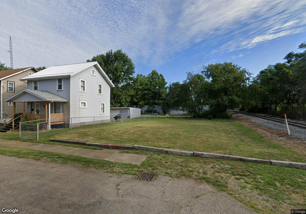
1815 17th St NE Canton, OH 44705
Gibbs Area NeighborhoodEstimated Value: $64,000 - $93,000
2
Beds
1
Bath
1,042
Sq Ft
$71/Sq Ft
Est. Value
About This Home
This home is located at 1815 17th St NE, Canton, OH 44705 and is currently estimated at $73,667, approximately $70 per square foot. 1815 17th St NE is a home located in Stark County with nearby schools including Belle Stone Elementary School, Early Learning Center @ Schreiber, and Youtz Intermediate School.
Ownership History
Date
Name
Owned For
Owner Type
Purchase Details
Closed on
Sep 18, 2020
Sold by
County Of Stark
Bought by
Stark County Land Reutilization Corp
Current Estimated Value
Purchase Details
Closed on
Jul 9, 2007
Sold by
Theil Rebecca A and Theil Larry D
Bought by
Theil Larry D and Theil Rebecca A
Home Financials for this Owner
Home Financials are based on the most recent Mortgage that was taken out on this home.
Original Mortgage
$50,000
Interest Rate
6.42%
Mortgage Type
Stand Alone Refi Refinance Of Original Loan
Purchase Details
Closed on
Jan 9, 2007
Sold by
Estate Of James N Fronsman Jr
Bought by
Theil Rebecca A
Purchase Details
Closed on
Apr 14, 2003
Sold by
Fronsman James N and Fronsman Dolly D
Bought by
Theil Rebecca A and Fronsman James N
Purchase Details
Closed on
Mar 26, 1992
Create a Home Valuation Report for This Property
The Home Valuation Report is an in-depth analysis detailing your home's value as well as a comparison with similar homes in the area
Home Values in the Area
Average Home Value in this Area
Purchase History
| Date | Buyer | Sale Price | Title Company |
|---|---|---|---|
| Stark County Land Reutilization Corp | -- | None Available | |
| Stark County Land Reutilization Corp | -- | None Available | |
| Theil Larry D | -- | Tower City Title Agency Llc | |
| Theil Rebecca A | -- | None Available | |
| Theil Rebecca A | -- | -- | |
| -- | $23,500 | -- |
Source: Public Records
Mortgage History
| Date | Status | Borrower | Loan Amount |
|---|---|---|---|
| Previous Owner | Theil Larry D | $50,000 | |
| Closed | Stark County Land Reutilization Corp | $0 |
Source: Public Records
Tax History Compared to Growth
Tax History
| Year | Tax Paid | Tax Assessment Tax Assessment Total Assessment is a certain percentage of the fair market value that is determined by local assessors to be the total taxable value of land and additions on the property. | Land | Improvement |
|---|---|---|---|---|
| 2025 | -- | $1,260 | $1,260 | -- |
| 2024 | -- | $1,260 | $1,260 | -- |
| 2023 | $70 | $1,120 | $1,120 | -- |
| 2022 | $66 | $1,120 | $1,120 | $0 |
| 2021 | $476 | $9,170 | $2,100 | $7,070 |
| 2020 | $290 | $7,810 | $1,820 | $5,990 |
| 2019 | $1,719 | $7,810 | $1,820 | $5,990 |
| 2018 | $453 | $7,810 | $1,820 | $5,990 |
| 2017 | $6,706 | $8,200 | $2,560 | $5,640 |
| 2016 | $5,883 | $8,200 | $2,560 | $5,640 |
| 2015 | $553 | $8,200 | $2,560 | $5,640 |
| 2014 | $575 | $8,410 | $2,630 | $5,780 |
| 2013 | $278 | $8,410 | $2,630 | $5,780 |
Source: Public Records
Map
Nearby Homes
- 1815 Virginia Place NE
- 1630 Bonnot Place NE
- 2005 17th St NE
- 1602 18th St NE
- 1643 Olive Place NE
- 1607 18th St NE
- 1517 16th St NE
- 2102 16th St NE
- 2100 Maple Ave NE
- 1607 20th St NE
- 0 Dover Ave NE
- 2211 17th St NE
- 2216 17th St NE
- 1417 Harrisburg Rd NE
- 1515 Parkhill Place NE
- 1734 Rowland Ave NE
- 2028 Saint Elmo Ave NE
- 1525 14th St NE
- 1513 22nd St NE
- 1219 17th St NE
- 1811 17th St NE
- 1809 17th St NE
- 1805 17th St NE
- 1810 17th St NE
- 1801 17th St NE
- 1806 17th St NE
- 1733 17th St NE
- 1826 17th St NE
- 1813 Bonnot Place NE
- 1729 17th St NE
- 1809 Bonnot Place NE
- 1730 17th St NE
- 1732 17th St NE
- 1805 Bonnot Place NE
- 1725 17th St NE
- 1737 Bonnot Place NE
- 1724 17th St NE
- 1733 Bonnot Place NE
- 1721 17th St NE
- 1727 Bonnot Place NE