Estimated Value: $162,537 - $191,000
3
Beds
1
Bath
1,086
Sq Ft
$158/Sq Ft
Est. Value
About This Home
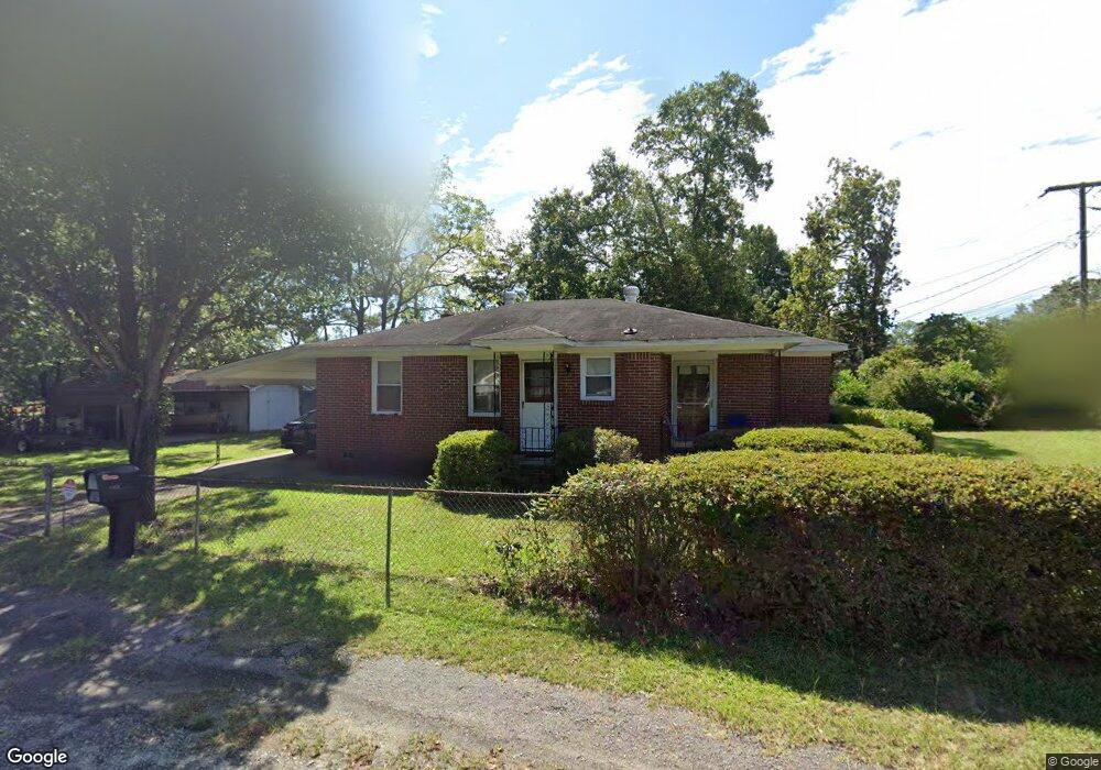
This home is located at 1815 Benton Cir, Cayce, SC 29033 and is currently estimated at $171,134, approximately $157 per square foot. 1815 Benton Cir is a home located in Lexington County with nearby schools including Cayce Elementary, Cyril B. Busbee Creative Arts Academy, and Brookland-Cayce High School.
Ownership History
Date
Name
Owned For
Owner Type
Purchase Details
Closed on
Nov 30, 2016
Sold by
Todys Investment Properties Llc
Bought by
Pierson William Clay and Pierson Briana
Current Estimated Value
Home Financials for this Owner
Home Financials are based on the most recent Mortgage that was taken out on this home.
Original Mortgage
$64,000
Outstanding Balance
$51,711
Interest Rate
3.54%
Mortgage Type
New Conventional
Estimated Equity
$119,423
Purchase Details
Closed on
Aug 22, 2011
Sold by
Rodgers Phillip Vincent and Miller Teresa Bernice Rodgers
Bought by
Tobys Investment Properties Llc
Create a Home Valuation Report for This Property
The Home Valuation Report is an in-depth analysis detailing your home's value as well as a comparison with similar homes in the area
Home Values in the Area
Average Home Value in this Area
Purchase History
| Date | Buyer | Sale Price | Title Company |
|---|---|---|---|
| Pierson William Clay | $80,000 | None Available | |
| Tobys Investment Properties Llc | -- | -- |
Source: Public Records
Mortgage History
| Date | Status | Borrower | Loan Amount |
|---|---|---|---|
| Open | Pierson William Clay | $64,000 |
Source: Public Records
Tax History Compared to Growth
Tax History
| Year | Tax Paid | Tax Assessment Tax Assessment Total Assessment is a certain percentage of the fair market value that is determined by local assessors to be the total taxable value of land and additions on the property. | Land | Improvement |
|---|---|---|---|---|
| 2024 | $1,983 | $4,736 | $1,200 | $3,536 |
| 2023 | $1,821 | $4,736 | $1,200 | $3,536 |
| 2022 | $1,702 | $4,736 | $1,200 | $3,536 |
| 2020 | $1,625 | $4,736 | $1,200 | $3,536 |
| 2019 | $1,663 | $4,800 | $1,200 | $3,600 |
| 2018 | $1,629 | $4,800 | $1,200 | $3,600 |
| 2017 | $1,605 | $4,800 | $1,200 | $3,600 |
| 2016 | $1,089 | $3,234 | $1,200 | $2,034 |
| 2015 | $1,042 | $3,234 | $1,200 | $2,034 |
| 2014 | $1,042 | $3,603 | $1,035 | $2,568 |
| 2013 | -- | $3,600 | $1,040 | $2,560 |
Source: Public Records
Map
Nearby Homes
- 1414 Hazel St
- 1409 Hazel St
- Dunbar II Plan at Dunbar Village
- 105 Odell Dr
- 109 Odell Dr
- 113 Odell Dr
- 117 Odell Dr
- 121 Odell Dr
- 125 Odell Dr
- 129 Odell Dr
- 133 Odell Dr
- 1519 Benedict St
- 1515 Benedict St
- 141 Odell Dr
- 000 Frink St
- 0 Highway 302 Hwy Unit 589442
- TBD Poplar Lots A B & C St
- 1832 Wadsworth Dr
- 2335 Laurie St
- 2337 Laurie St
- 1819 Benton Cir
- 0 Benton Cir Unit 282858
- 1604 Benton Cir
- 1600 Benton Cir
- 1533 Benton Cir
- 1823 Benton Cir
- 1534 Benton Cir
- 1534 Hazel St
- 1529 Benton Cir
- 1901 Benton Cir
- 1528 Hazel St
- 1525 Benton Cir
- 1524 Benton Cir
- 1524 Hazel St
- 1905 Benton Cir
- 1533 Hazel St
- 1521 Benton Cir
- 1520 Benton Cir
- 1529 Hazel St
- 1506 Hazel St