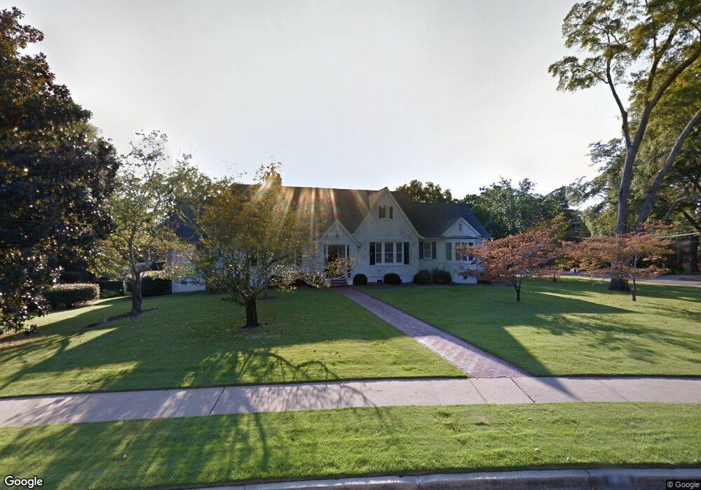
1815 Carter Ave Columbus, GA 31906
Wynnton Grove NeighborhoodEstimated Value: $766,000 - $857,000
4
Beds
6
Baths
3,839
Sq Ft
$212/Sq Ft
Est. Value
About This Home
This home is located at 1815 Carter Ave, Columbus, GA 31906 and is currently estimated at $813,872, approximately $212 per square foot. 1815 Carter Ave is a home located in Muscogee County with nearby schools including Richards Middle School, Hardaway High School, and Wynnton Elementary School.
Ownership History
Date
Name
Owned For
Owner Type
Purchase Details
Closed on
Jun 1, 2021
Sold by
Houser Barbara L
Bought by
Springer Angela C and Springer Robert L
Current Estimated Value
Home Financials for this Owner
Home Financials are based on the most recent Mortgage that was taken out on this home.
Original Mortgage
$548,250
Outstanding Balance
$496,372
Interest Rate
2.9%
Mortgage Type
New Conventional
Estimated Equity
$317,500
Purchase Details
Closed on
Feb 9, 2015
Sold by
Houser Rembert C
Bought by
Houser Barbara L
Create a Home Valuation Report for This Property
The Home Valuation Report is an in-depth analysis detailing your home's value as well as a comparison with similar homes in the area
Home Values in the Area
Average Home Value in this Area
Purchase History
| Date | Buyer | Sale Price | Title Company |
|---|---|---|---|
| Springer Angela C | $625,000 | -- | |
| Houser Barbara L | -- | -- |
Source: Public Records
Mortgage History
| Date | Status | Borrower | Loan Amount |
|---|---|---|---|
| Open | Springer Angela C | $548,250 |
Source: Public Records
Tax History
| Year | Tax Paid | Tax Assessment Tax Assessment Total Assessment is a certain percentage of the fair market value that is determined by local assessors to be the total taxable value of land and additions on the property. | Land | Improvement |
|---|---|---|---|---|
| 2025 | $10,729 | $287,277 | $25,208 | $262,069 |
| 2024 | $1,073 | $287,277 | $25,208 | $262,069 |
| 2023 | $9,846 | $330,232 | $25,208 | $305,024 |
| 2022 | $10,206 | $249,948 | $25,208 | $224,740 |
| 2021 | $3,542 | $166,476 | $25,208 | $141,268 |
| 2020 | $3,543 | $166,476 | $25,208 | $141,268 |
| 2019 | $3,556 | $166,476 | $25,208 | $141,268 |
| 2018 | $3,556 | $166,476 | $25,208 | $141,268 |
| 2017 | $3,569 | $166,700 | $25,208 | $141,492 |
| 2016 | $3,583 | $185,674 | $22,618 | $163,056 |
| 2015 | $3,593 | $185,674 | $22,618 | $163,056 |
| 2014 | $3,602 | $185,674 | $22,618 | $163,056 |
| 2013 | -- | $185,674 | $22,618 | $163,056 |
Source: Public Records
Map
Nearby Homes
- 1717 Stark Ave
- 2108 Young St
- 1706 Stark Ave
- 1700 Stark Ave
- 2008 Stark Ave
- 2114 Forest Ct
- 2010 Cherokee Ave
- 2016 Poplar Dr
- 2243 14th St
- 2000 Poplar Dr
- 2230 Cherokee Ave Unit 10
- 1817 18th Ave
- 2133 13th St
- 2012 17th Ave
- 1534 Dixon Dr
- 2134 13th St
- 1319 Hilton Ave
- 1557 18th Ave
- 1315 Eberhart Ave
- 1513 Wells Dr
- 1804 Wildwood Ave
- 1808 Wildwood Ave
- 1816 Wildwood Ave
- 1720 Wildwood Ave
- 1816 Carter Ave
- 1801 Carter Ave
- 1714 Wildwood Ave
- 1812 Carter Ave
- 2111 19th St
- 2201 19th St
- 1712 Wildwood Ave
- 2101 19th St
- 2206 19th St
- 1805 Wildwood Ave
- 1809 Wildwood Ave
- 1715 Carter Ave
- 1811 Wildwood Ave
- 1800 Carter Ave
- 1801 Wildwood Ave
- 1717 Wildwood Ave