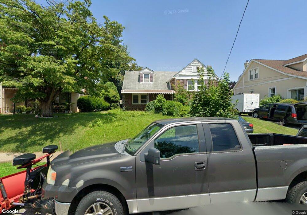
1815 Emerson St Philadelphia, PA 19152
Rhawnhurst NeighborhoodEstimated Value: $370,000 - $405,000
3
Beds
2
Baths
1,898
Sq Ft
$204/Sq Ft
Est. Value
About This Home
This home is located at 1815 Emerson St, Philadelphia, PA 19152 and is currently estimated at $387,741, approximately $204 per square foot. 1815 Emerson St is a home located in Philadelphia County with nearby schools including Farrell Louis H School, Northeast High School, and Tacony Academy Charter School.
Ownership History
Date
Name
Owned For
Owner Type
Purchase Details
Closed on
Jun 2, 2010
Sold by
Manuel Antonio Tania Isabel Ferreira and Manuel Antonio Nimi Mondlane
Bought by
Chimuco Azenaida Generosa Valentim
Current Estimated Value
Purchase Details
Closed on
Dec 4, 2002
Sold by
Junior Paixao
Bought by
Manuel Antonio Tania Isabel Ferreira and Manuel Antonio Nimi Mondlane
Purchase Details
Closed on
Apr 7, 2001
Sold by
Browne John E and Browne Karen J
Bought by
Junior Paixao
Create a Home Valuation Report for This Property
The Home Valuation Report is an in-depth analysis detailing your home's value as well as a comparison with similar homes in the area
Home Values in the Area
Average Home Value in this Area
Purchase History
| Date | Buyer | Sale Price | Title Company |
|---|---|---|---|
| Chimuco Azenaida Generosa Valentim | $96,821 | None Available | |
| Manuel Antonio Tania Isabel Ferreira | -- | -- | |
| Junior Paixao | $112,500 | -- |
Source: Public Records
Tax History Compared to Growth
Tax History
| Year | Tax Paid | Tax Assessment Tax Assessment Total Assessment is a certain percentage of the fair market value that is determined by local assessors to be the total taxable value of land and additions on the property. | Land | Improvement |
|---|---|---|---|---|
| 2025 | $4,226 | $367,600 | $73,520 | $294,080 |
| 2024 | $4,226 | $367,600 | $73,520 | $294,080 |
| 2023 | $4,226 | $301,900 | $60,380 | $241,520 |
| 2022 | $3,385 | $301,900 | $60,380 | $241,520 |
| 2021 | $3,385 | $0 | $0 | $0 |
| 2020 | $3,385 | $0 | $0 | $0 |
| 2019 | $3,277 | $0 | $0 | $0 |
| 2018 | $3,089 | $0 | $0 | $0 |
| 2017 | $3,089 | $0 | $0 | $0 |
| 2016 | $3,089 | $0 | $0 | $0 |
| 2015 | $2,957 | $0 | $0 | $0 |
| 2014 | -- | $220,700 | $89,440 | $131,260 |
| 2012 | -- | $31,648 | $7,553 | $24,095 |
Source: Public Records
Map
Nearby Homes
- 1702 Arthur St
- 1617 Solly Ave
- 1704 Stanwood St
- 1711 Kendrick St
- 1716 Bergen St
- 1718 Rhawn St
- 1625 Rhawn St
- 1931 33 Rhawn St
- 2013 Fuller St
- 1804 Megargee St
- 1828 Megargee St
- 1719 Loney St
- 2155 Benson St
- 1712 Tustin St
- 2162 Strahle St
- 7950 Algon Ave
- 1907 Tustin St
- 1443 Rhawn St
- 7912 14 Loretto Ave
- 2029 Loney St
- 1809 Emerson St
- 1817 Emerson St Unit 19
- 1821 Emerson St
- 1805 Emerson St
- 1814 Hoffnagle St
- 1812 Hoffnagle St
- 1816 Hoffnagle St
- 1810 Hoffnagle St
- 1808 Hoffnagle St
- 1820 Hoffnagle St
- 1822 Hoffnagle St
- 1801 Emerson St
- 1804 Hoffnagle St
- 1829 Emerson St
- 1810 Emerson St
- 1824 Hoffnagle St
- 1814 Emerson St
- 1806 Emerson St
- 1826 Hoffnagle St