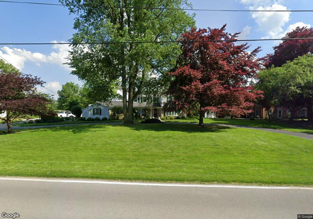
1815 Port Clinton Rd Fremont, OH 43420
Estimated Value: $329,000 - $404,000
4
Beds
4
Baths
2,782
Sq Ft
$131/Sq Ft
Est. Value
About This Home
This home is located at 1815 Port Clinton Rd, Fremont, OH 43420 and is currently estimated at $363,805, approximately $130 per square foot. 1815 Port Clinton Rd is a home located in Sandusky County with nearby schools including Fremont Ross High School, St. Ann Catholic School, and St. Joseph School.
Ownership History
Date
Name
Owned For
Owner Type
Purchase Details
Closed on
Aug 10, 2000
Sold by
Trst Alfred J Cooper
Bought by
Foos Mark A and Foos Lisa M
Current Estimated Value
Home Financials for this Owner
Home Financials are based on the most recent Mortgage that was taken out on this home.
Original Mortgage
$195,000
Interest Rate
8.24%
Mortgage Type
New Conventional
Create a Home Valuation Report for This Property
The Home Valuation Report is an in-depth analysis detailing your home's value as well as a comparison with similar homes in the area
Home Values in the Area
Average Home Value in this Area
Purchase History
| Date | Buyer | Sale Price | Title Company |
|---|---|---|---|
| Foos Mark A | $245,000 | -- |
Source: Public Records
Mortgage History
| Date | Status | Borrower | Loan Amount |
|---|---|---|---|
| Previous Owner | Foos Mark A | $195,000 |
Source: Public Records
Tax History Compared to Growth
Tax History
| Year | Tax Paid | Tax Assessment Tax Assessment Total Assessment is a certain percentage of the fair market value that is determined by local assessors to be the total taxable value of land and additions on the property. | Land | Improvement |
|---|---|---|---|---|
| 2024 | $4,264 | $113,330 | $21,630 | $91,700 |
| 2023 | $4,264 | $90,480 | $17,120 | $73,360 |
| 2022 | $3,618 | $90,480 | $17,120 | $73,360 |
| 2021 | $3,733 | $90,480 | $17,120 | $73,360 |
| 2020 | $3,319 | $79,140 | $17,120 | $62,020 |
| 2019 | $3,315 | $79,140 | $17,120 | $62,020 |
| 2018 | $3,321 | $79,140 | $17,120 | $62,020 |
| 2017 | $3,096 | $73,510 | $17,120 | $56,390 |
| 2016 | $2,728 | $73,510 | $17,120 | $56,390 |
| 2015 | $2,683 | $73,510 | $17,120 | $56,390 |
| 2014 | $2,880 | $75,150 | $16,730 | $58,420 |
| 2013 | $2,819 | $75,150 | $16,730 | $58,420 |
Source: Public Records
Map
Nearby Homes
- 1730 Port Clinton Rd Unit 41
- 1730 Port Clinton Rd
- 1730 Port Clinton Rd Unit 33
- 0 Sean Dr
- Outlot A Sean Dr
- 711 Bloom Rd
- 2100 Ohio 53
- 900 Spring St
- 612 2nd St
- 711 Rawson Ave
- 533 Sandusky Ave Unit 535
- 1441 White Ave
- 1227 White Ave
- 433 Sandusky Ave
- 516 N Front St
- 340 340 Sandusky Ave
- 818 Franklin Ave
- 224 Sandusky Ave Unit 226
- 427 N Clover St
- 1707 North St
- 1801 Port Clinton Rd
- 0 Port Clinton Rd
- 1831 Port Clinton Rd
- 1799 Port Clinton Rd
- 1820 Port Clinton Rd
- 1814 Port Clinton Rd
- 1839 Port Clinton Rd
- 1800 Port Clinton Rd
- 1797 Port Clinton Rd
- 1806 Port Clinton Rd
- 1830 Port Clinton Rd
- 1795 Port Clinton Rd
- 1798 Port Clinton Rd
- 1847 Port Clinton Rd
- 1838 Port Clinton Rd
- 1789 Port Clinton Rd
- 1855 Port Clinton Rd
- 1865 Port Clinton Rd
- 1911 Melody Dr
- 1917 Melody Dr