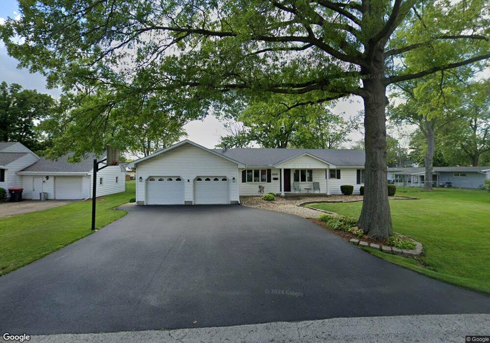
1815 S Montrose Ave Decatur, IL 62521
Muffley NeighborhoodEstimated Value: $152,591 - $172,000
--
Bed
--
Bath
1,888
Sq Ft
$85/Sq Ft
Est. Value
About This Home
This home is located at 1815 S Montrose Ave, Decatur, IL 62521 and is currently estimated at $161,148, approximately $85 per square foot. 1815 S Montrose Ave is a home located in Macon County with nearby schools including Muffley Elementary School, Stephen Decatur Middle School, and Hillside Bethel Tabernacle.
Ownership History
Date
Name
Owned For
Owner Type
Purchase Details
Closed on
Sep 2, 2010
Sold by
Lathoff Lori A
Bought by
Althoff Michel A
Current Estimated Value
Home Financials for this Owner
Home Financials are based on the most recent Mortgage that was taken out on this home.
Original Mortgage
$11,348
Outstanding Balance
$7,497
Interest Rate
4.45%
Mortgage Type
New Conventional
Estimated Equity
$153,651
Purchase Details
Closed on
Sep 1, 1987
Create a Home Valuation Report for This Property
The Home Valuation Report is an in-depth analysis detailing your home's value as well as a comparison with similar homes in the area
Home Values in the Area
Average Home Value in this Area
Purchase History
| Date | Buyer | Sale Price | Title Company |
|---|---|---|---|
| Althoff Michel A | -- | None Available | |
| -- | $58,000 | -- |
Source: Public Records
Mortgage History
| Date | Status | Borrower | Loan Amount |
|---|---|---|---|
| Open | Althoff Michel A | $11,348 |
Source: Public Records
Tax History Compared to Growth
Tax History
| Year | Tax Paid | Tax Assessment Tax Assessment Total Assessment is a certain percentage of the fair market value that is determined by local assessors to be the total taxable value of land and additions on the property. | Land | Improvement |
|---|---|---|---|---|
| 2024 | $2,710 | $37,969 | $6,524 | $31,445 |
| 2023 | $2,501 | $35,281 | $6,062 | $29,219 |
| 2022 | $1,936 | $33,173 | $5,700 | $27,473 |
| 2021 | $1,946 | $31,448 | $5,403 | $26,045 |
| 2020 | $2,007 | $30,056 | $5,164 | $24,892 |
| 2019 | $2,007 | $30,056 | $5,164 | $24,892 |
| 2018 | $1,982 | $29,398 | $5,051 | $24,347 |
| 2017 | $1,946 | $29,035 | $4,989 | $24,046 |
| 2016 | $2,084 | $30,283 | $4,986 | $25,297 |
| 2015 | $2,497 | $29,894 | $4,922 | $24,972 |
| 2014 | $2,342 | $29,894 | $4,922 | $24,972 |
| 2013 | $2,331 | $29,894 | $4,922 | $24,972 |
Source: Public Records
Map
Nearby Homes
- 1748 S Montrose Ave
- 3645 E Fulton Ave
- 3552 E Orchard Dr
- 1968 S Baltimore Ave
- 1715 S 34th Place
- 1745 S 44th St
- 3254 E Fulton Ave
- 3234 E Fulton Ave
- 3215 E Fulton Ave
- 1809 S 32nd St
- 2458 Quail Dr
- 2488 S Fontaine Dr
- 3290 E Fitzgerald Rd
- 4545 Hayden Ct
- 3405 Fontenac Ct
- 2504 S Nantucket Dr
- 2554 S Nantucket Dr
- 1490 S Lynnwood Dr
- 2571 Lansdowne Dr
- 3210 Fields Ct
- 1823 S Montrose Ave
- 3675 E Maynor St
- 1820 S Montrose Ave
- 1839 S Montrose Ave
- 1826 S Albany St
- 1856 S Montrose Ave
- 3709 E Maynor St
- 3611 E Maynor St
- 1779 S Montrose Ave
- 1826 S Albany St
- 1830 S Montrose Ave
- 1840 S Albany St
- 1855 S Montrose Ave
- 3710 E Maynor St
- 1850 S Albany St
- 3602 E Maynor St
- 0 S Albany St
- 1759 S Montrose Ave
- 1870 S Albany St
- 1870 S Montrose Ave