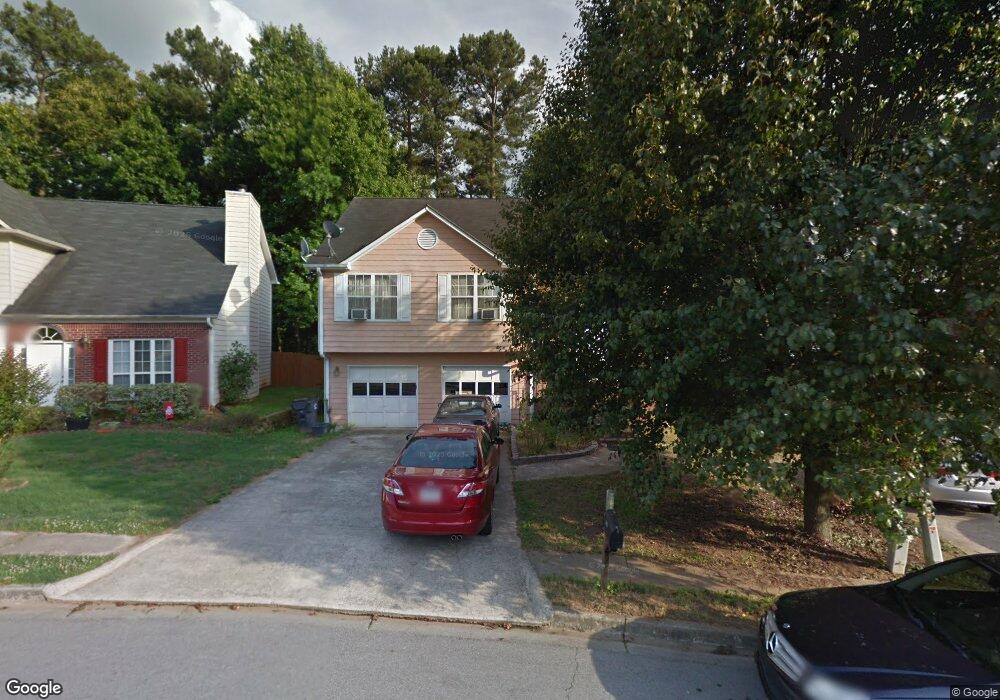
1815 Stoneoak Cir Unit 2 Lawrenceville, GA 30043
Estimated Value: $310,000 - $365,000
4
Beds
3
Baths
1,376
Sq Ft
$245/Sq Ft
Est. Value
About This Home
This home is located at 1815 Stoneoak Cir Unit 2, Lawrenceville, GA 30043 and is currently estimated at $336,801, approximately $244 per square foot. 1815 Stoneoak Cir Unit 2 is a home located in Gwinnett County with nearby schools including Jackson Elementary School, Northbrook Middle School, and Peachtree Ridge High School.
Ownership History
Date
Name
Owned For
Owner Type
Purchase Details
Closed on
Jan 6, 2003
Sold by
Mam Noroneath
Bought by
Mam Moldary
Current Estimated Value
Home Financials for this Owner
Home Financials are based on the most recent Mortgage that was taken out on this home.
Original Mortgage
$142,759
Outstanding Balance
$60,411
Interest Rate
6.16%
Mortgage Type
FHA
Estimated Equity
$276,390
Purchase Details
Closed on
Apr 29, 1996
Sold by
Jenkins D G Dev Corp
Bought by
Mam Nooneath
Create a Home Valuation Report for This Property
The Home Valuation Report is an in-depth analysis detailing your home's value as well as a comparison with similar homes in the area
Home Values in the Area
Average Home Value in this Area
Purchase History
| Date | Buyer | Sale Price | Title Company |
|---|---|---|---|
| Mam Moldary | $145,000 | -- | |
| Mam Nooneath | $124,900 | -- |
Source: Public Records
Mortgage History
| Date | Status | Borrower | Loan Amount |
|---|---|---|---|
| Open | Mam Moldary | $142,759 | |
| Closed | Mam Nooneath | $0 |
Source: Public Records
Tax History Compared to Growth
Tax History
| Year | Tax Paid | Tax Assessment Tax Assessment Total Assessment is a certain percentage of the fair market value that is determined by local assessors to be the total taxable value of land and additions on the property. | Land | Improvement |
|---|---|---|---|---|
| 2025 | $5,829 | $156,560 | $30,240 | $126,320 |
| 2024 | $4,644 | $121,240 | $30,000 | $91,240 |
| 2023 | $4,644 | $121,240 | $30,000 | $91,240 |
| 2022 | $3,440 | $88,240 | $26,000 | $62,240 |
| 2021 | $3,141 | $78,800 | $18,680 | $60,120 |
| 2020 | $3,158 | $78,800 | $18,680 | $60,120 |
| 2019 | $2,637 | $67,160 | $18,000 | $49,160 |
| 2018 | $2,636 | $67,160 | $18,000 | $49,160 |
| 2016 | $2,264 | $56,040 | $12,400 | $43,640 |
| 2015 | $1,751 | $40,880 | $8,000 | $32,880 |
| 2014 | $1,759 | $40,880 | $8,000 | $32,880 |
Source: Public Records
Map
Nearby Homes
- 1771 Kristi Dr
- 2070 Stoneoak Dr
- 1702 Herrington Rd
- 1923 Thomas Pointe Trace
- 1943 Thomas Pointe Trace
- 1694 Herrington Rd
- 1915 Westfield Dr
- 2261 Ewell Park Dr
- 2210 Atkinson Park Dr
- 2180 Atkinson Park Dr
- 579 Collections Dr
- 2163 Pebble Beach Dr
- 2174 Pebble Beach Dr
- 2116 Tidal Cove
- 1622 Halliard Dr
- 1644 Sandy Beach Point
- 1587 Herrington Rd
- 1590 Margate Ct
- 1825 Stoneoak Cir
- 1805 Stoneoak Cir
- 1835 Stoneoak Cir Unit 2
- 2073 Atkinson Ln
- 2067 Atkinson Ln
- 1795 Stoneoak Cir
- 2079 Atkinson Ln
- 1800 Stoneoak Cir Unit 2
- 1802 Herrington Rd
- 1802 Herrington Rd
- 1845 Stoneoak Cir Unit 1845
- 1845 Stoneoak Cir
- 1785 Stoneoak Cir Unit II
- 1840 Stoneoak Cir Unit 2
- 1796 Herrington Rd
- 2085 Atkinson Ln
- 1770 Stoneoak Cir Unit II
- 1775 Stoneoak Cir
- 1855 Stoneoak Cir Unit II
- 1870 Stoneoak Cir