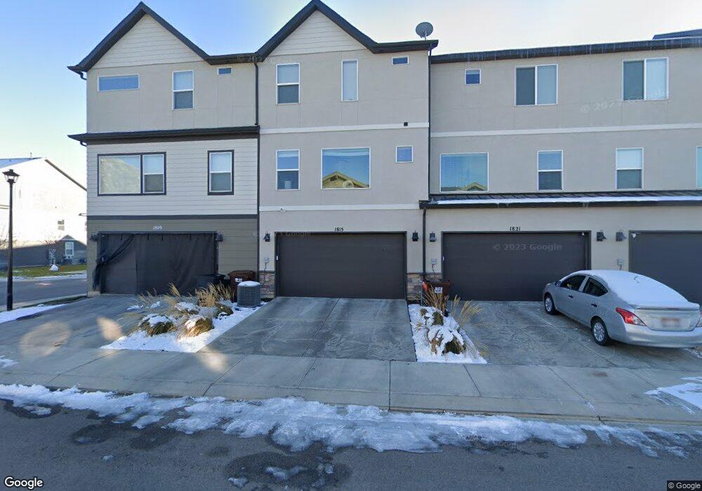
1815 W 20 N Pleasant Grove, UT 84062
Estimated Value: $444,000 - $500,000
4
Beds
4
Baths
1,963
Sq Ft
$240/Sq Ft
Est. Value
About This Home
This home is located at 1815 W 20 N, Pleasant Grove, UT 84062 and is currently estimated at $470,836, approximately $239 per square foot. 1815 W 20 N is a home located in Utah County with nearby schools including Barratt Elementary School, American Fork Junior High School, and American Fork High School.
Ownership History
Date
Name
Owned For
Owner Type
Purchase Details
Closed on
Jan 20, 2025
Sold by
West Kerry J
Bought by
Kj West Properties Llc
Current Estimated Value
Purchase Details
Closed on
Jun 16, 2017
Sold by
Harris Devin K and Harris Whitney A
Bought by
West Kerry J
Purchase Details
Closed on
Nov 17, 2014
Sold by
D R Horton Inc
Bought by
Harris Kevin K and Harris Whitney A
Home Financials for this Owner
Home Financials are based on the most recent Mortgage that was taken out on this home.
Original Mortgage
$9,500
Interest Rate
4.1%
Mortgage Type
Stand Alone Second
Create a Home Valuation Report for This Property
The Home Valuation Report is an in-depth analysis detailing your home's value as well as a comparison with similar homes in the area
Home Values in the Area
Average Home Value in this Area
Purchase History
| Date | Buyer | Sale Price | Title Company |
|---|---|---|---|
| Kj West Properties Llc | -- | None Listed On Document | |
| West Kerry J | -- | Old Republic Title | |
| Harris Kevin K | -- | Provo Land Title Co |
Source: Public Records
Mortgage History
| Date | Status | Borrower | Loan Amount |
|---|---|---|---|
| Previous Owner | Harris Kevin K | $9,500 |
Source: Public Records
Tax History Compared to Growth
Tax History
| Year | Tax Paid | Tax Assessment Tax Assessment Total Assessment is a certain percentage of the fair market value that is determined by local assessors to be the total taxable value of land and additions on the property. | Land | Improvement |
|---|---|---|---|---|
| 2025 | $2,027 | $235,730 | $63,000 | $365,600 |
| 2024 | $2,027 | $241,340 | $0 | $0 |
| 2023 | $1,776 | $217,030 | $0 | $0 |
| 2022 | $1,926 | $234,190 | $0 | $0 |
| 2021 | $1,659 | $307,100 | $46,100 | $261,000 |
| 2020 | $1,538 | $279,100 | $41,900 | $237,200 |
| 2019 | $1,487 | $279,100 | $41,900 | $237,200 |
| 2018 | $1,409 | $250,000 | $37,500 | $212,500 |
| 2017 | $1,339 | $126,500 | $0 | $0 |
| 2016 | $1,387 | $126,500 | $0 | $0 |
| 2015 | $1,465 | $126,500 | $0 | $0 |
Source: Public Records
Map
Nearby Homes
- 29 S 2000 W
- 1584 W 110 N
- 1559 W 50 N
- 1775 W 120 S Unit 54
- 1795 W 120 S Unit 52
- The Hastings Plan at Tayside Farm - Townhome
- The Henley A Plan at Tayside Farm - Single Family Home
- The Denton Plan at Tayside Farm - Townhome
- The Henley B Plan at Tayside Farm - Single Family Home
- 1542 W 110 N
- 128 S 1700 W Unit 12
- 1593 W 220 N
- 1512 W 50 N
- 1541 W 250 N
- 293 N 1630 W
- 1429 W 110 N
- 1406 W 50 N
- 1525 W 300 N
- 1088 E 390 S
- 150 N 1300 W
- 1821 W 20 N Unit 178
- 1809 W 20 N
- 1829 W 20 N Unit 177
- 1829 W 20 N
- 24 S 1800 W
- 1835 W 20 N
- 28 S 1800 W
- 1841 W 20 N
- 50 S 1800 W Unit 49
- 100 S 1800 W Unit 48
- 188 S 1800 W Unit 1
- 34 S 1800 W Unit 203
- 34 S 1800 W
- 1816 W 20 N Unit 123
- 1806 W 20 N Unit 124
- 1826 W 20 N
- 1826 W 20 N Unit 122
- 46 S 1800 W
- 1798 W 10 S Unit 174
- 56 S 1800 W