Estimated Value: $473,000 - $515,000
4
Beds
2
Baths
1,576
Sq Ft
$318/Sq Ft
Est. Value
About This Home
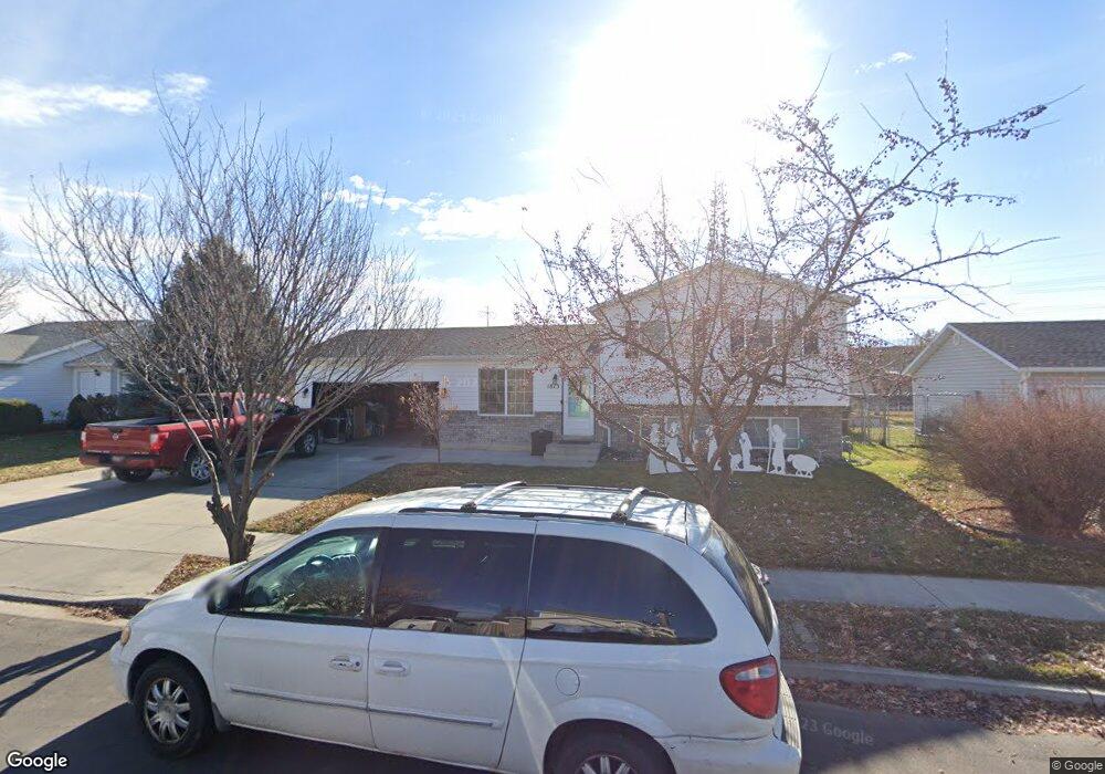
This home is located at 1815 W 525 S, Lehi, UT 84043 and is currently estimated at $500,935, approximately $317 per square foot. 1815 W 525 S is a home located in Utah County with nearby schools including Snow Springs Elementary, Willowcreek Middle School, and Lehi High School.
Ownership History
Date
Name
Owned For
Owner Type
Purchase Details
Closed on
Nov 13, 2009
Sold by
Knox Derek C and Knox Eva Lynette
Bought by
Neil Brandon and Neil Jamie L
Current Estimated Value
Home Financials for this Owner
Home Financials are based on the most recent Mortgage that was taken out on this home.
Original Mortgage
$188,977
Outstanding Balance
$122,635
Interest Rate
4.88%
Mortgage Type
VA
Estimated Equity
$378,300
Purchase Details
Closed on
Oct 5, 1998
Sold by
Salisbury Development L C
Bought by
Knox Derek C and Knox Eva Lynette
Home Financials for this Owner
Home Financials are based on the most recent Mortgage that was taken out on this home.
Original Mortgage
$107,500
Interest Rate
6.88%
Mortgage Type
Seller Take Back
Create a Home Valuation Report for This Property
The Home Valuation Report is an in-depth analysis detailing your home's value as well as a comparison with similar homes in the area
Home Values in the Area
Average Home Value in this Area
Purchase History
| Date | Buyer | Sale Price | Title Company |
|---|---|---|---|
| Neil Brandon | -- | Meridian Title Company | |
| Knox Derek C | -- | Provo Land Title |
Source: Public Records
Mortgage History
| Date | Status | Borrower | Loan Amount |
|---|---|---|---|
| Open | Neil Brandon | $188,977 | |
| Previous Owner | Knox Derek C | $107,500 |
Source: Public Records
Tax History Compared to Growth
Tax History
| Year | Tax Paid | Tax Assessment Tax Assessment Total Assessment is a certain percentage of the fair market value that is determined by local assessors to be the total taxable value of land and additions on the property. | Land | Improvement |
|---|---|---|---|---|
| 2025 | $1,510 | $249,095 | $188,100 | $264,800 |
| 2024 | $1,510 | $227,315 | $0 | $0 |
| 2023 | $1,425 | $228,965 | $0 | $0 |
| 2022 | $1,727 | $241,175 | $0 | $0 |
| 2021 | $1,472 | $324,300 | $108,900 | $215,400 |
| 2020 | $1,373 | $302,100 | $100,800 | $201,300 |
| 2019 | $1,454 | $278,300 | $100,800 | $177,500 |
| 2018 | $1,122 | $250,400 | $93,600 | $156,800 |
| 2017 | $1,043 | $125,840 | $0 | $0 |
| 2016 | $1,014 | $115,830 | $0 | $0 |
| 2015 | $1,254 | $106,260 | $0 | $0 |
| 2014 | $1,149 | $96,745 | $0 | $0 |
Source: Public Records
Map
Nearby Homes
- 1743 W Grays Place
- 1784 W Grays Place
- 131 S 1900 W Unit 2
- 202 S 2035 W
- 380 S 1500 W
- 1664 W 800 S
- 581 S 1500 W
- 161 S 1475 W
- 1379 W 425 S
- 1363 W 425 S
- 2162 W Main St Unit E303
- 210 S Tamarak Cir
- 928 Gander Way
- 786 S 1430 W
- 2178 W Main St Unit D301
- The Annie Plan at Longhorn Meadows
- The Kaitlyn Plan at Longhorn Meadows
- The Autumn Plan at Longhorn Meadows
- The Aurora Plan at Longhorn Meadows
- The Roosevelt Plan at Longhorn Meadows
- 1799 W 525 S
- 1831 W 525 S
- 1834 W Snow Spring Dr
- 1834 Snow Spring Dr
- 1781 W 525 S
- 1849 W 525 S
- 1850 W Snow Springs
- 1850 W Snow Spring Dr
- 1850 Snow Spring Dr
- 1794 W Snow Spring Dr
- 1794 W Snow Spring Dr
- 1816 W 525 S
- 1802 W 525 S
- 1813 Snow Spring Dr
- 1816 Snow Spring Dr
- 1832 W 525 S
- 1868 Snow Spring Dr
- 1765 W 525 S
- 1865 W 525 S
- 1780 W 525 S