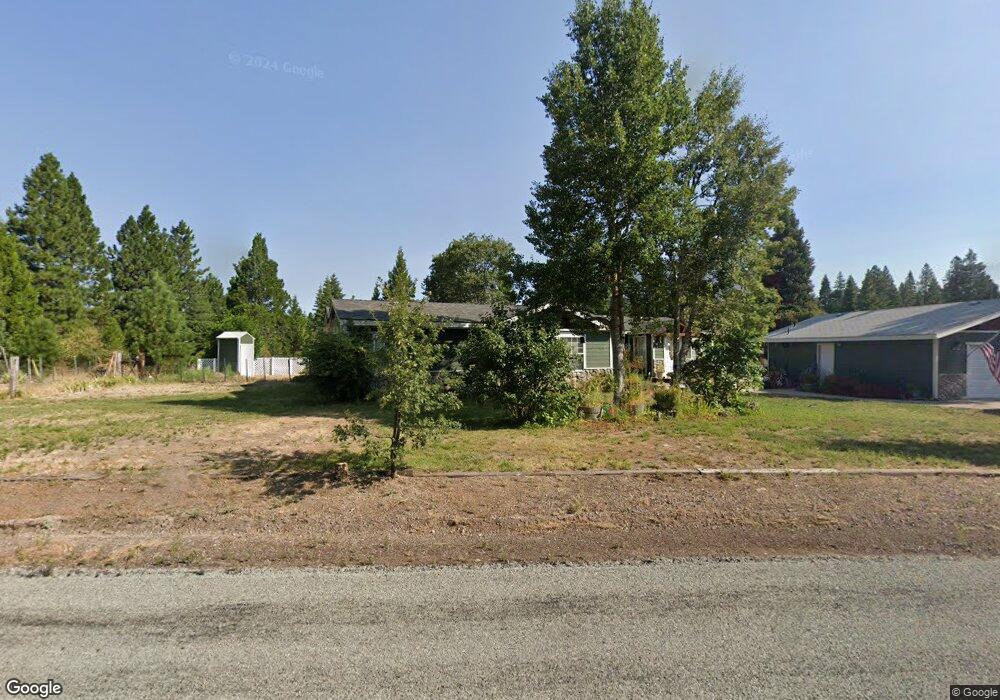
1816 Davis Place Rd Mount Shasta, CA 96067
Estimated Value: $341,000 - $550,000
4
Beds
2
Baths
2,239
Sq Ft
$213/Sq Ft
Est. Value
About This Home
This home is located at 1816 Davis Place Rd, Mount Shasta, CA 96067 and is currently estimated at $476,734, approximately $212 per square foot. 1816 Davis Place Rd is a home located in Siskiyou County with nearby schools including Mt. Shasta Elementary School and Mt. Shasta High School.
Ownership History
Date
Name
Owned For
Owner Type
Purchase Details
Closed on
Sep 8, 2017
Sold by
Taylor Mary Jo and Ashton Mary Jo
Bought by
Dickinson Raymond H and Dickinson Kelly L
Current Estimated Value
Home Financials for this Owner
Home Financials are based on the most recent Mortgage that was taken out on this home.
Original Mortgage
$226,717
Outstanding Balance
$196,876
Interest Rate
5.5%
Mortgage Type
FHA
Estimated Equity
$279,858
Purchase Details
Closed on
Mar 9, 2010
Sold by
Ronge Keith G
Bought by
Ashton Mary Jo
Purchase Details
Closed on
Nov 5, 2003
Sold by
Connors Thomas J and Ashton Connors Mary Jo
Bought by
Ronge Keith G and Ashton Mary Jo
Home Financials for this Owner
Home Financials are based on the most recent Mortgage that was taken out on this home.
Original Mortgage
$112,000
Interest Rate
6.04%
Mortgage Type
Purchase Money Mortgage
Create a Home Valuation Report for This Property
The Home Valuation Report is an in-depth analysis detailing your home's value as well as a comparison with similar homes in the area
Purchase History
| Date | Buyer | Sale Price | Title Company |
|---|---|---|---|
| Dickinson Raymond H | $231,000 | Mt Shasta Title & Escrow Co | |
| Ashton Mary Jo | -- | None Available | |
| Ronge Keith G | -- | -- |
Source: Public Records
Mortgage History
| Date | Status | Borrower | Loan Amount |
|---|---|---|---|
| Open | Dickinson Raymond H | $226,717 | |
| Previous Owner | Ronge Keith G | $112,000 |
Source: Public Records
Tax History
| Year | Tax Paid | Tax Assessment Tax Assessment Total Assessment is a certain percentage of the fair market value that is determined by local assessors to be the total taxable value of land and additions on the property. | Land | Improvement |
|---|---|---|---|---|
| 2025 | $2,928 | $281,039 | $85,335 | $195,704 |
| 2023 | $2,928 | $270,127 | $82,022 | $188,105 |
| 2022 | $2,816 | $264,831 | $80,414 | $184,417 |
| 2021 | $2,767 | $259,639 | $78,838 | $180,801 |
| 2020 | $2,766 | $256,978 | $78,030 | $178,948 |
| 2019 | $2,715 | $251,940 | $76,500 | $175,440 |
| 2018 | $2,662 | $247,000 | $75,000 | $172,000 |
| 2017 | $0 | $182,930 | $65,715 | $117,215 |
| 2016 | $2,030 | $179,344 | $64,427 | $114,917 |
| 2015 | -- | $176,651 | $63,460 | $113,191 |
| 2014 | -- | $173,191 | $62,217 | $110,974 |
Source: Public Records
Map
Nearby Homes
- 1601 Timber Hills Rd
- #000 Audubon Rd
- 1224 Timber Hills Rd
- 848 Mac Ln
- 503 Pony Trail
- 217 Pony Trail
- 1.4 Acres Summit Dr
- 00 Summit Dr
- 2430 Pine Grove Dr
- 1846 Highland Dr
- 3719 Summit Dr
- 1221 Woodland Park Dr
- 9.2 acres Spring Hill Rd
- 1335 W Scenic Dr
- 1135 Quail Meadow Dr
- Lot 36 N Ridge Ct
- 1434 Kingston Rd
- 1422 Kingston Rd
- 1420 Kingston Rd
- 1044 N Mt Shasta Blv
- 1737 Davis Place Rd
- 2034 Davis Place Rd
- 1630 Davis Place Rd
- 2004 Davis Place Rd
- 1835 Davis Place Rd
- 2038 Davis Place Rd
- 1534 Davis Place Rd
- 1905 Davis Place Rd
- 0000 Weston Ln
- 1434 Ayer Ln
- 0 Weston Ln
- 1633 Davis Place Rd
- 1924 Davis Place Rd
- 1631 Davis Place Rd
- 1647 Davis Place Rd
- 00 Davis Place
- 00 Davis Place Rd
- 2106 Davis Place Rd
- 2035 Weston Ln
- 1501 Davis Place Rd
Your Personal Tour Guide
Ask me questions while you tour the home.