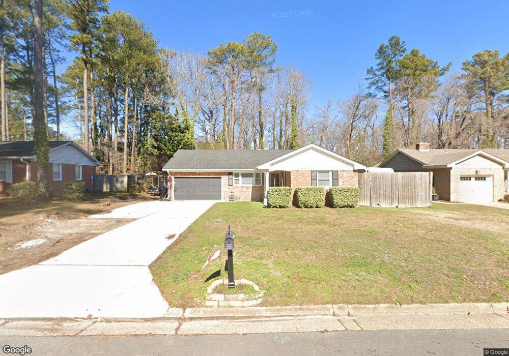
1816 Michael Ct Virginia Beach, VA 23454
Great Neck NeighborhoodEstimated Value: $548,000 - $574,000
3
Beds
2
Baths
1,625
Sq Ft
$345/Sq Ft
Est. Value
About This Home
This home is located at 1816 Michael Ct, Virginia Beach, VA 23454 and is currently estimated at $561,179, approximately $345 per square foot. 1816 Michael Ct is a home located in Virginia Beach City with nearby schools including Linkhorn Park Elementary School, Lynnhaven Middle School, and First Colonial High School.
Ownership History
Date
Name
Owned For
Owner Type
Purchase Details
Closed on
Oct 4, 2021
Sold by
Hiltibran Mark
Bought by
Brooks Adam
Current Estimated Value
Purchase Details
Closed on
May 13, 2019
Sold by
Kovalchick Aaron J and Kovalchick Reachel M
Bought by
Brooks Adam David and Brooks Lauren
Home Financials for this Owner
Home Financials are based on the most recent Mortgage that was taken out on this home.
Original Mortgage
$318,250
Interest Rate
4.1%
Mortgage Type
New Conventional
Purchase Details
Closed on
Nov 16, 2016
Sold by
Brown Thomas A
Bought by
Kovalchick Aaron J and Kovalchick Rachel M
Purchase Details
Closed on
Mar 15, 2016
Sold by
Midgett Richard D
Bought by
Brown Thomas A
Create a Home Valuation Report for This Property
The Home Valuation Report is an in-depth analysis detailing your home's value as well as a comparison with similar homes in the area
Home Values in the Area
Average Home Value in this Area
Purchase History
| Date | Buyer | Sale Price | Title Company |
|---|---|---|---|
| Brooks Adam | -- | None Available | |
| Brooks Adam David | $335,000 | Attorney | |
| Kovalchick Aaron J | $307,000 | Preferred Escrow & Title Inc | |
| Brown Thomas A | $135,000 | Preferred Escrow & Title Inc |
Source: Public Records
Mortgage History
| Date | Status | Borrower | Loan Amount |
|---|---|---|---|
| Previous Owner | Brooks Adam David | $318,250 |
Source: Public Records
Tax History
| Year | Tax Paid | Tax Assessment Tax Assessment Total Assessment is a certain percentage of the fair market value that is determined by local assessors to be the total taxable value of land and additions on the property. | Land | Improvement |
|---|---|---|---|---|
| 2025 | $4,261 | $480,000 | $170,000 | $310,000 |
| 2024 | $4,261 | $439,300 | $150,000 | $289,300 |
| 2023 | $3,839 | $387,800 | $145,000 | $242,800 |
| 2022 | $3,435 | $347,000 | $132,000 | $215,000 |
| 2021 | $3,050 | $308,100 | $110,000 | $198,100 |
| 2020 | $3,113 | $305,900 | $110,000 | $195,900 |
| 2019 | $3,009 | $291,400 | $110,000 | $181,400 |
| 2018 | $2,921 | $291,400 | $110,000 | $181,400 |
| 2017 | $2,800 | $279,300 | $110,000 | $169,300 |
| 2016 | $2,514 | $253,900 | $110,000 | $143,900 |
| 2015 | $2,357 | $238,100 | $110,000 | $128,100 |
| 2014 | $2,326 | $250,100 | $159,900 | $90,200 |
Source: Public Records
Map
Nearby Homes
- MM Woodside @ Prosperity
- 1833 Durham W
- 813 Benjamin Place
- 1005 Hanson Way
- 913 Royal Cove Way
- 1018 Colonial Meadows Way
- 1728 Royal Cove Ct
- 1012 Autumn Woods Ln Unit 110
- 949 Lindsley Dr
- 1005 Autumn Woods Ln Unit 105
- 1020 Autumn Woods Ln Unit 101
- 809 Seward Ln
- 1008 Timber Ct
- 2210 Wolfsnare Rd
- 2211 Sedgewick Dr
- 427 Fountain Dr
- 504 Biltmore Dr
- 2300 Plantation Dr
- 701 Earl of Chesterfield Ct
- 520 W Plantation Rd
- 1820 Michael Ct
- 1812 Michael Ct
- 1808 Michael Ct
- 1813 Michael Ct
- 940 Baillio Dr
- 936 Baillio Dr
- 1811 Michael Ct
- 1817 Michael Ct
- 3288 3288 Ave
- MM Harriet
- MM Chelsea @ Prosperity
- 301 Living Water Way Unit 36437269
- 808 Azusa Way St Unit 36437100
- 808 Azusa Way St Unit 36466729
- 808 Azusa Way St Unit 36501528
- 808 Azusa Way St Unit 36446698
- 808 Azusa Way St Unit 36474234
- 808 Azusa Way St Unit 36459905
- 808 Azusa Way St Unit 36480390
- 511 20 5 St
Your Personal Tour Guide
Ask me questions while you tour the home.