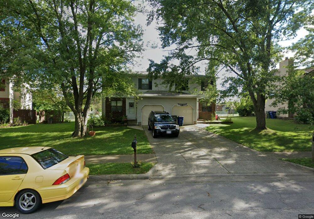
1817 Laramie Dr Powell, OH 43065
Western Hills NeighborhoodEstimated Value: $261,000 - $336,000
3
Beds
2
Baths
1,237
Sq Ft
$250/Sq Ft
Est. Value
About This Home
This home is located at 1817 Laramie Dr, Powell, OH 43065 and is currently estimated at $308,682, approximately $249 per square foot. 1817 Laramie Dr is a home located in Franklin County with nearby schools including Liberty Elementary School, McCord Middle School, and Worthington Kilbourne High School.
Ownership History
Date
Name
Owned For
Owner Type
Purchase Details
Closed on
Aug 14, 2014
Sold by
The Brophy Co Ltd
Bought by
Caro Ohio Llc
Current Estimated Value
Purchase Details
Closed on
Mar 4, 1996
Sold by
Bently Philip E
Bought by
Ali Akbar Mahdi and Ali Nina Samssami
Home Financials for this Owner
Home Financials are based on the most recent Mortgage that was taken out on this home.
Original Mortgage
$84,000
Interest Rate
7.07%
Mortgage Type
New Conventional
Purchase Details
Closed on
Aug 1, 1986
Create a Home Valuation Report for This Property
The Home Valuation Report is an in-depth analysis detailing your home's value as well as a comparison with similar homes in the area
Home Values in the Area
Average Home Value in this Area
Purchase History
| Date | Buyer | Sale Price | Title Company |
|---|---|---|---|
| Caro Ohio Llc | $842,000 | Cardinal Title | |
| Ali Akbar Mahdi | $120,000 | -- | |
| -- | -- | -- |
Source: Public Records
Mortgage History
| Date | Status | Borrower | Loan Amount |
|---|---|---|---|
| Previous Owner | Ali Akbar Mahdi | $84,000 |
Source: Public Records
Tax History Compared to Growth
Tax History
| Year | Tax Paid | Tax Assessment Tax Assessment Total Assessment is a certain percentage of the fair market value that is determined by local assessors to be the total taxable value of land and additions on the property. | Land | Improvement |
|---|---|---|---|---|
| 2024 | $5,248 | $83,830 | $19,250 | $64,580 |
| 2023 | $5,022 | $83,825 | $19,250 | $64,575 |
| 2022 | $4,365 | $57,790 | $13,410 | $44,380 |
| 2021 | $4,034 | $57,790 | $13,410 | $44,380 |
| 2020 | $3,889 | $57,790 | $13,410 | $44,380 |
| 2019 | $3,595 | $48,170 | $11,170 | $37,000 |
| 2018 | $2,976 | $48,170 | $11,170 | $37,000 |
| 2017 | $3,232 | $48,170 | $11,170 | $37,000 |
| 2016 | $2,465 | $33,780 | $10,190 | $23,590 |
| 2015 | $2,465 | $33,780 | $10,190 | $23,590 |
| 2014 | $2,464 | $33,780 | $10,190 | $23,590 |
| 2013 | $1,227 | $33,775 | $10,185 | $23,590 |
Source: Public Records
Map
Nearby Homes
- 1914 Laramie Dr Unit 26
- 8266 Waco Ln
- 1827 Calico Ct
- 1486 Clubview Blvd S
- 2053 Stancrest Rd
- 8345 Smoky Row Rd Unit 8345
- 8351 Smoky Row Rd Unit 48351
- 1399 Briarmeadow Dr
- 2074 Hard Rd
- 1949 Hamrock Dr
- 2120 Sharwood Ct
- 1865 Weather Stone Ln
- 2280 Saberly Ct
- 1938 Slaton Ct
- 8594 Broadacre Dr
- 1827 Watertower Dr Unit 1827
- 2220 Surreygate Dr
- 1825 Watertower Dr Unit 1825
- 2251 Surreygate Dr
- 2228 Gnarled Pine Dr
- 1823 Laramie Dr
- 1811 Laramie Dr
- 1827 Laramie Dr
- 1805 Laramie Dr
- 1831 Laramie Dr
- 1835 Laramie Dr
- 1799 Laramie Dr
- 1839 Laramie Dr
- 1795 Laramie Dr
- 1812 Laramie Dr
- 1818 Laramie Dr
- 1843 Laramie Dr
- 1791 Laramie Dr
- 8143 Longhorn Rd
- 1826 Laramie Dr
- 1847 Laramie Dr
- 1832 Laramie Dr
- 1787 Laramie Dr
- 8151 Longhorn Rd
- 8099 Saddle Run