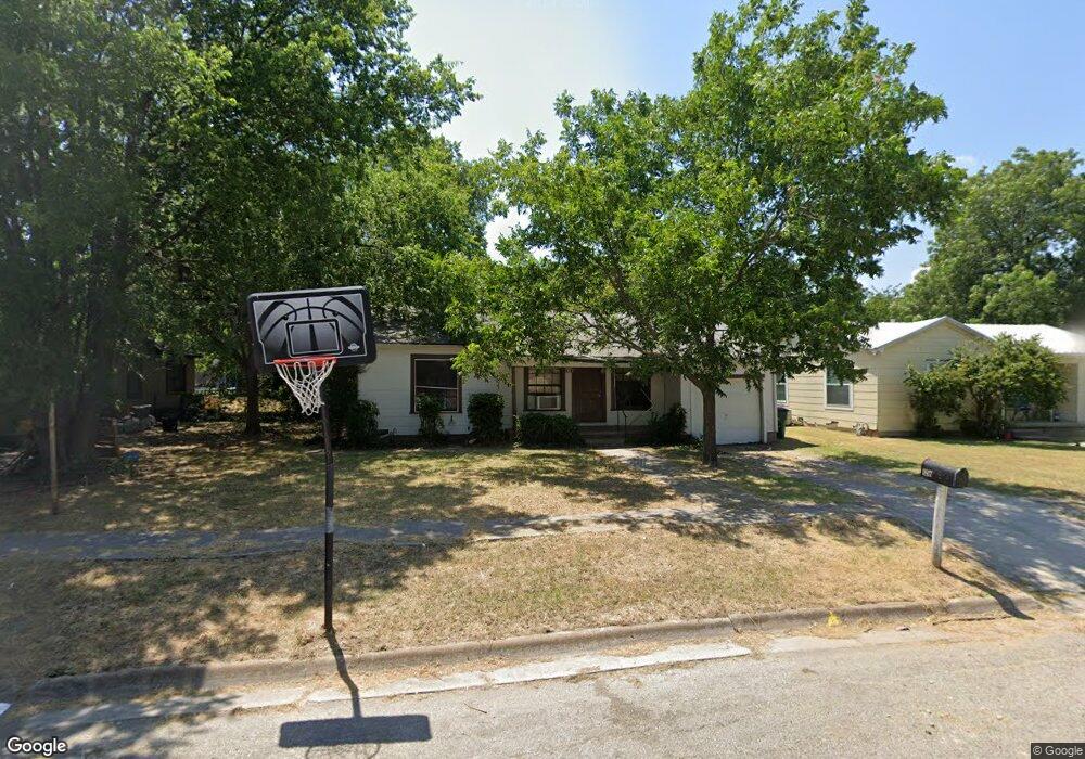
1817 Mill St Gainesville, TX 76240
Estimated Value: $109,000 - $147,000
2
Beds
1
Bath
830
Sq Ft
$153/Sq Ft
Est. Value
About This Home
This home is located at 1817 Mill St, Gainesville, TX 76240 and is currently estimated at $127,249, approximately $153 per square foot. 1817 Mill St is a home located in Cooke County with nearby schools including Edison Elementary School, W.E. Chalmers Elementary School, and Gainesville Intermediate School.
Ownership History
Date
Name
Owned For
Owner Type
Purchase Details
Closed on
Aug 8, 2008
Sold by
Reeves Robert and Reeves Gloria
Bought by
Karl Klement Properties Inc
Current Estimated Value
Home Financials for this Owner
Home Financials are based on the most recent Mortgage that was taken out on this home.
Original Mortgage
$31,100
Outstanding Balance
$19,906
Interest Rate
6%
Mortgage Type
Adjustable Rate Mortgage/ARM
Estimated Equity
$107,343
Purchase Details
Closed on
Jan 25, 2008
Sold by
Sparkman Wanda
Bought by
Reeves Robert and Reeves Gloria
Create a Home Valuation Report for This Property
The Home Valuation Report is an in-depth analysis detailing your home's value as well as a comparison with similar homes in the area
Purchase History
| Date | Buyer | Sale Price | Title Company |
|---|---|---|---|
| Karl Klement Properties Inc | -- | -- | |
| Reeves Robert | -- | -- |
Source: Public Records
Mortgage History
| Date | Status | Borrower | Loan Amount |
|---|---|---|---|
| Open | Karl Klement Properties Inc | $31,100 |
Source: Public Records
Tax History
| Year | Tax Paid | Tax Assessment Tax Assessment Total Assessment is a certain percentage of the fair market value that is determined by local assessors to be the total taxable value of land and additions on the property. | Land | Improvement |
|---|---|---|---|---|
| 2025 | $1,805 | $95,238 | $30,828 | $64,410 |
| 2024 | $1,805 | $95,240 | $30,828 | $64,412 |
| 2023 | $1,783 | $90,873 | $30,828 | $60,045 |
| 2022 | $1,807 | $83,017 | $25,704 | $57,313 |
| 2021 | $1,627 | $63,183 | $21,840 | $41,343 |
| 2020 | $1,503 | $56,580 | $21,840 | $34,740 |
| 2018 | $936 | $34,301 | $10,920 | $23,381 |
| 2017 | $902 | $33,167 | $10,920 | $22,247 |
| 2015 | $871 | $32,716 | $10,920 | $21,796 |
| 2014 | $871 | $32,716 | $10,920 | $21,796 |
Source: Public Records
Map
Nearby Homes
- 1901 Buck St
- 610 Walter Rd Unit Gainesville
- 1903 N Weaver St
- 1203 Mill St
- 807 Fletcher St
- 1213 Mill St
- 805 Fletcher St
- 1214 Witherspoon St
- 2662 N Weaver St
- 0 N Weaver St
- 714 Potter St
- 1015 N Dixon St
- 1107 Field St
- TBD Columbine Dr
- 620 Throckmorton St
- 713 N Commerce St
- 1001 E Star St
- 535 Hancock St
- 606 Mill St
- 527 N Chestnut St
Your Personal Tour Guide
Ask me questions while you tour the home.