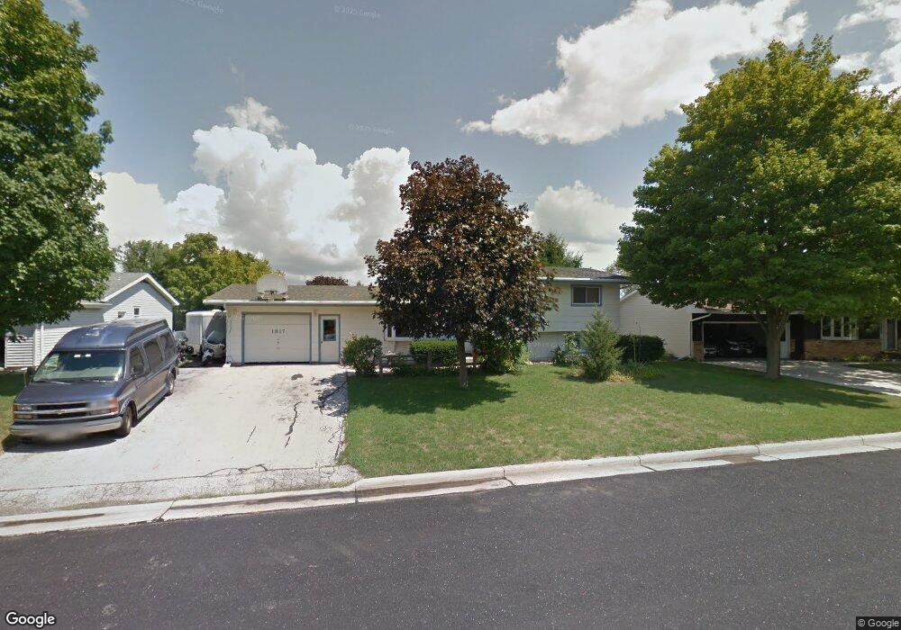
1817 Milldrum St Union Grove, WI 53182
Estimated Value: $321,000 - $387,000
3
Beds
2
Baths
1,680
Sq Ft
$211/Sq Ft
Est. Value
About This Home
This home is located at 1817 Milldrum St, Union Grove, WI 53182 and is currently estimated at $355,256, approximately $211 per square foot. 1817 Milldrum St is a home located in Racine County with nearby schools including Union Grove Elementary School, Union Grove High School, and Union Grove Christian School.
Ownership History
Date
Name
Owned For
Owner Type
Purchase Details
Closed on
Dec 2, 2020
Sold by
Witte Robert E and Witte Terri E
Bought by
Krueske Patrick and Krueske Lana
Current Estimated Value
Home Financials for this Owner
Home Financials are based on the most recent Mortgage that was taken out on this home.
Original Mortgage
$242,500
Outstanding Balance
$216,282
Interest Rate
2.8%
Mortgage Type
VA
Estimated Equity
$138,974
Create a Home Valuation Report for This Property
The Home Valuation Report is an in-depth analysis detailing your home's value as well as a comparison with similar homes in the area
Home Values in the Area
Average Home Value in this Area
Purchase History
| Date | Buyer | Sale Price | Title Company |
|---|---|---|---|
| Krueske Patrick | $242,500 | Milwaukee Title Inc |
Source: Public Records
Mortgage History
| Date | Status | Borrower | Loan Amount |
|---|---|---|---|
| Open | Krueske Patrick | $242,500 |
Source: Public Records
Tax History Compared to Growth
Tax History
| Year | Tax Paid | Tax Assessment Tax Assessment Total Assessment is a certain percentage of the fair market value that is determined by local assessors to be the total taxable value of land and additions on the property. | Land | Improvement |
|---|---|---|---|---|
| 2024 | $3,747 | $235,900 | $47,100 | $188,800 |
| 2023 | $3,717 | $235,900 | $47,100 | $188,800 |
| 2022 | $2,080 | $235,900 | $47,100 | $188,800 |
| 2021 | $3,658 | $235,900 | $47,100 | $188,800 |
| 2020 | $3,381 | $174,200 | $35,700 | $138,500 |
| 2019 | $3,452 | $174,200 | $35,700 | $138,500 |
| 2018 | $3,322 | $174,400 | $35,700 | $138,700 |
| 2017 | $3,754 | $183,200 | $36,100 | $147,100 |
| 2016 | $3,752 | $183,200 | $36,100 | $147,100 |
| 2015 | $3,999 | $183,200 | $36,100 | $147,100 |
| 2014 | $3,933 | $183,200 | $36,100 | $147,100 |
| 2013 | $4,104 | $183,200 | $36,100 | $147,100 |
Source: Public Records
Map
Nearby Homes
- Lt0 Durand Ave
- 1311 Highview Ave
- 1362 Vine St
- 406 Oakhurst Ave
- 1344 Vine St
- 1221 W Kiddle Ln
- 1030 Main St
- 1041 Bluebird Ln
- 1027 Main St
- 1020 Main St
- 163 11th Ave
- 290 Pheasant Run
- 927 State St
- 305 York St
- 319 York St Unit Lt64
- 102 Walnut Ridge Dr Unit 20
- Lt7 10th Ave
- Lt5 10th Ave
- Lt3 10th Ave
- Lt1 10th Ave
- 1809 Milldrum St
- 1839 Milldrum St
- 1820 Elliot Dr
- 1812 Elliot Dr
- 1801 Milldrum St
- 1822 Milldrum St
- 1832 Milldrum St
- 1812 Milldrum St
- 1806 Elliot Dr
- 1800 Milldrum St
- 1821 New St
- 1831 New St
- 1811 New St
- 1793 Milldrum St
- 1817 Elliot Dr
- 1839 Elliot Dr
- 1809 Elliot Dr
- 650 Elliot Dr
- 1801 Elliot Dr
- 1787 Milldrum St