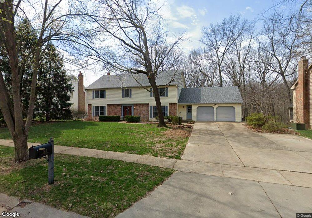
1817 Stenton Path Chesterfield, MO 63005
Estimated Value: $783,816 - $877,000
4
Beds
4
Baths
4,009
Sq Ft
$206/Sq Ft
Est. Value
About This Home
This home is located at 1817 Stenton Path, Chesterfield, MO 63005 and is currently estimated at $827,204, approximately $206 per square foot. 1817 Stenton Path is a home located in St. Louis County with nearby schools including Kehrs Mill Elementary, Crestview Middle School, and Marquette Sr. High School.
Ownership History
Date
Name
Owned For
Owner Type
Purchase Details
Closed on
Sep 1, 2016
Sold by
Gokel George W and Gokel Kathryn S
Bought by
Gokel G
Current Estimated Value
Purchase Details
Closed on
Aug 27, 2003
Sold by
Gokel G and Gokel K
Bought by
Gokel George W and Gokel Kathryn S
Home Financials for this Owner
Home Financials are based on the most recent Mortgage that was taken out on this home.
Original Mortgage
$188,000
Interest Rate
5.77%
Mortgage Type
Purchase Money Mortgage
Create a Home Valuation Report for This Property
The Home Valuation Report is an in-depth analysis detailing your home's value as well as a comparison with similar homes in the area
Home Values in the Area
Average Home Value in this Area
Purchase History
| Date | Buyer | Sale Price | Title Company |
|---|---|---|---|
| Gokel G | -- | None Available | |
| Gokel George W | -- | -- |
Source: Public Records
Mortgage History
| Date | Status | Borrower | Loan Amount |
|---|---|---|---|
| Previous Owner | Gokel George W | $188,000 |
Source: Public Records
Tax History
| Year | Tax Paid | Tax Assessment Tax Assessment Total Assessment is a certain percentage of the fair market value that is determined by local assessors to be the total taxable value of land and additions on the property. | Land | Improvement |
|---|---|---|---|---|
| 2025 | $8,192 | $151,340 | $53,980 | $97,360 |
| 2024 | $8,192 | $115,040 | $34,350 | $80,690 |
| 2023 | $7,979 | $115,040 | $34,350 | $80,690 |
| 2022 | $7,771 | $104,180 | $37,980 | $66,200 |
| 2021 | $7,727 | $104,180 | $37,980 | $66,200 |
| 2020 | $8,453 | $110,070 | $39,730 | $70,340 |
| 2019 | $8,406 | $110,070 | $39,730 | $70,340 |
| 2018 | $7,257 | $89,570 | $26,110 | $63,460 |
| 2017 | $7,094 | $89,570 | $26,110 | $63,460 |
| 2016 | $7,444 | $90,330 | $21,360 | $68,970 |
Source: Public Records
Map
Nearby Homes
- 16291 Upper Chesterfield Ridge Dr
- 1726 Blue Oak Dr
- 16176 Lea Oak Ct
- 16180 Lea Oak Ct
- 1503 Walpole Dr
- 1554 Charlemont Dr
- 16250 Lea Oak Ct Unit G1
- 1541 Milbridge Dr
- 16349 Justus Post Rd Unit 7
- 2133 Hunters Way Ct
- 1 Monarch Trace Ct Unit 301
- 1 Monarch Trace Ct Unit 307
- 16401 Wilson Farm Dr
- 16025 Hunters Way Dr
- 2142 Heather Glen Dr
- 1833 Baxter Ridge Dr
- 1521 Hedgeford Dr Unit 9
- 16427 Brandsford Point
- 1768 Orchard Hill Dr
- 468 Maple Rise Path
- 1823 Stenton Path
- 1811 Stenton Path
- 1829 Stenton Path
- 1848 Chamfers Farm Ct
- 1805 Stenton Path
- 1820 Stenton Path
- 1814 Stenton Path
- 1828 Stenton Path
- 1837 Stenton Path
- 1847 Chamfers Farm Ct
- 15889 Whitemarsh Cir
- 1856 Chamfers Farm Ct
- 1808 Stenton Path
- 1802 Stenton Path
- 1851 Stenton Path
- 1844 Stenton Path
- 1864 Chamfers Farm Ct
- 1855 Chamfers Farm Ct
- 1836 Stenton Path
- 15888 Whitemarsh Cir
Your Personal Tour Guide
Ask me questions while you tour the home.