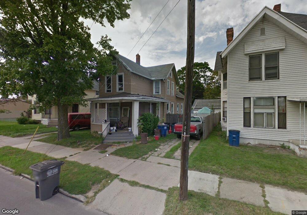
1818 Airport Hwy Toledo, OH 43609
Southside NeighborhoodEstimated Value: $56,000 - $91,000
4
Beds
1
Bath
1,646
Sq Ft
$41/Sq Ft
Est. Value
About This Home
This home is located at 1818 Airport Hwy, Toledo, OH 43609 and is currently estimated at $68,170, approximately $41 per square foot. 1818 Airport Hwy is a home located in Lucas County with nearby schools including Burroughs Elementary School, Bowsher High School, and Explorers Academy of Science and Technology.
Ownership History
Date
Name
Owned For
Owner Type
Purchase Details
Closed on
Jun 17, 2022
Sold by
Toledo Rentals Llc
Bought by
Global Education Campaign
Current Estimated Value
Purchase Details
Closed on
Apr 11, 2022
Sold by
Wright Donald B
Bought by
Toledo Rentals Llc
Home Financials for this Owner
Home Financials are based on the most recent Mortgage that was taken out on this home.
Interest Rate
4.72%
Purchase Details
Closed on
Mar 30, 2022
Sold by
Wright Donald B
Bought by
Toledo Rentals Llc
Home Financials for this Owner
Home Financials are based on the most recent Mortgage that was taken out on this home.
Interest Rate
4.72%
Purchase Details
Closed on
Oct 27, 2008
Sold by
Taylor Theodore Robert and Taylor Theodore R
Bought by
Wright Donald B
Home Financials for this Owner
Home Financials are based on the most recent Mortgage that was taken out on this home.
Original Mortgage
$4,500
Interest Rate
6.11%
Mortgage Type
Seller Take Back
Create a Home Valuation Report for This Property
The Home Valuation Report is an in-depth analysis detailing your home's value as well as a comparison with similar homes in the area
Home Values in the Area
Average Home Value in this Area
Purchase History
| Date | Buyer | Sale Price | Title Company |
|---|---|---|---|
| Global Education Campaign | -- | None Listed On Document | |
| Toledo Rentals Llc | $30,000 | -- | |
| Toledo Rentals Llc | $30,000 | None Listed On Document | |
| Wright Donald B | $8,000 | Attorney |
Source: Public Records
Mortgage History
| Date | Status | Borrower | Loan Amount |
|---|---|---|---|
| Previous Owner | Toledo Rentals Llc | -- | |
| Previous Owner | Wright Donald B | $4,500 |
Source: Public Records
Tax History Compared to Growth
Tax History
| Year | Tax Paid | Tax Assessment Tax Assessment Total Assessment is a certain percentage of the fair market value that is determined by local assessors to be the total taxable value of land and additions on the property. | Land | Improvement |
|---|---|---|---|---|
| 2024 | $439 | $11,235 | $2,520 | $8,715 |
| 2023 | $805 | $9,625 | $2,205 | $7,420 |
| 2022 | $787 | $9,625 | $2,205 | $7,420 |
| 2021 | $764 | $9,625 | $2,205 | $7,420 |
| 2020 | $822 | $8,855 | $2,030 | $6,825 |
| 2019 | $787 | $8,855 | $2,030 | $6,825 |
| 2018 | $776 | $8,855 | $2,030 | $6,825 |
| 2017 | $830 | $8,680 | $1,995 | $6,685 |
| 2016 | $825 | $24,800 | $5,700 | $19,100 |
| 2015 | $764 | $24,800 | $5,700 | $19,100 |
| 2014 | $546 | $8,690 | $2,000 | $6,690 |
| 2013 | $546 | $8,690 | $2,000 | $6,690 |
Source: Public Records
Map
Nearby Homes
- 142 S Detroit Ave
- 144 Whiting Ave
- 140 Whiting Ave
- 1754 Finch St
- 224 S Fearing Blvd
- 221 Somerset St
- 226 Somerset St
- 323 Champion St
- 440 Somerset St
- 1777 South Ave
- 512 Woodsdale Ave
- 321 Mayberry St
- 304 Mayberry St
- 531 Shasta Dr
- 2126 Airport Hwy
- 1587 Colton St
- 1579 Colton St
- 518 Myers St
- 649 Wright Ave
- 705 Wright Ave
- 1814 Airport Hwy
- 1822 Airport Hwy
- 1810 Airport Hwy
- 1828 Airport Hwy
- 204 Lake Shore Ave
- 1819 Dunham St
- 1827 Dunham St
- 1823 Dunham St
- 1825 Airport Hwy
- 1809 Dunham St
- 1815 Airport Hwy
- 1821 Airport Hwy
- 1811 Airport Hwy
- 1829 Dunham St
- 1780 Airport Hwy
- 1807 Airport Hwy
- 1829 Airport Hwy
- 1805 Airport Hwy
- 1831 Airport Hwy
- 1778 Airport Hwy