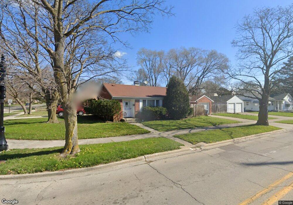
1818 Brookside Ave Waukegan, IL 60085
West Waukegan NeighborhoodEstimated Value: $192,162 - $223,000
2
Beds
1
Bath
1,011
Sq Ft
$206/Sq Ft
Est. Value
About This Home
This home is located at 1818 Brookside Ave, Waukegan, IL 60085 and is currently estimated at $208,041, approximately $205 per square foot. 1818 Brookside Ave is a home located in Lake County with nearby schools including Hyde Park Elementary School, Miguel Juarez Middle School, and Waukegan High School.
Ownership History
Date
Name
Owned For
Owner Type
Purchase Details
Closed on
Jul 25, 2017
Sold by
Wyckoff Carla N
Bought by
Abode Real Estate Company
Current Estimated Value
Purchase Details
Closed on
May 11, 2010
Sold by
Washburn M Diane Eatmon and Estate Of Dolores Eatmon
Bought by
Johnson Jeremiah Dale
Purchase Details
Closed on
Aug 18, 1995
Sold by
Kerr Robert A and Kerr Beverly D
Bought by
Eatmon Dolores
Home Financials for this Owner
Home Financials are based on the most recent Mortgage that was taken out on this home.
Original Mortgage
$75,000
Interest Rate
7.64%
Create a Home Valuation Report for This Property
The Home Valuation Report is an in-depth analysis detailing your home's value as well as a comparison with similar homes in the area
Home Values in the Area
Average Home Value in this Area
Purchase History
| Date | Buyer | Sale Price | Title Company |
|---|---|---|---|
| Abode Real Estate Company | -- | Attorney | |
| Johnson Jeremiah Dale | -- | None Available | |
| Eatmon Dolores | $84,500 | -- |
Source: Public Records
Mortgage History
| Date | Status | Borrower | Loan Amount |
|---|---|---|---|
| Previous Owner | Eatmon Dolores | $75,000 |
Source: Public Records
Tax History Compared to Growth
Tax History
| Year | Tax Paid | Tax Assessment Tax Assessment Total Assessment is a certain percentage of the fair market value that is determined by local assessors to be the total taxable value of land and additions on the property. | Land | Improvement |
|---|---|---|---|---|
| 2024 | $3,844 | $45,535 | $8,458 | $37,077 |
| 2023 | $3,542 | $40,768 | $7,573 | $33,195 |
| 2022 | $3,542 | $36,236 | $6,903 | $29,333 |
| 2021 | $3,304 | $31,691 | $6,503 | $25,188 |
| 2020 | $3,347 | $29,524 | $6,058 | $23,466 |
| 2019 | $3,368 | $27,054 | $5,551 | $21,503 |
| 2018 | $3,338 | $25,820 | $6,547 | $19,273 |
| 2017 | $3,249 | $22,843 | $5,792 | $17,051 |
| 2016 | $3,067 | $19,850 | $5,033 | $14,817 |
| 2015 | $3,001 | $17,766 | $4,505 | $13,261 |
| 2014 | $1,243 | $17,502 | $4,887 | $12,615 |
| 2012 | $2,101 | $18,961 | $5,294 | $13,667 |
Source: Public Records
Map
Nearby Homes
- 2115 Lydia St
- 615 Tiffany Dr
- 1213 Grand Ave
- 1416 Hamilton Ct
- 49 S Lewis Ave
- 0 Brookside Ave
- 1521 Catalpa Ave
- 824 N Butrick St
- 23 N Jackson St
- 968 Judge Ave
- 1005 N Lewis Ave
- 1109 Massena Ave
- 1023 N Elmwood Ave
- 24 Washington Terrace
- 511 Chestnut St
- 1038 Indiana Ave
- 1000 Pine St
- 428 N Poplar St
- 917 N Linden Ave
- 522 N Poplar St
- 331 N Lewis Ave
- 335 N Lewis Ave
- 1821 Brookside Ave
- 1804 Brookside Ave
- 330 N Elmwood Ave
- 339 N Lewis Ave
- 319 N Lewis Ave
- 334 N Elmwood Ave
- 1805 Brookside Ave
- 338 N Elmwood Ave
- 318 N Elmwood Ave
- 1900 Brookside Ave
- 330 N Lewis Ave
- 315 N Lewis Ave
- 334 N Lewis Ave
- 1901 Brookside Ave
- 314 N Elmwood Ave
- 338 N Lewis Ave
- 318 N Lewis Ave
- 403 N Lewis Ave