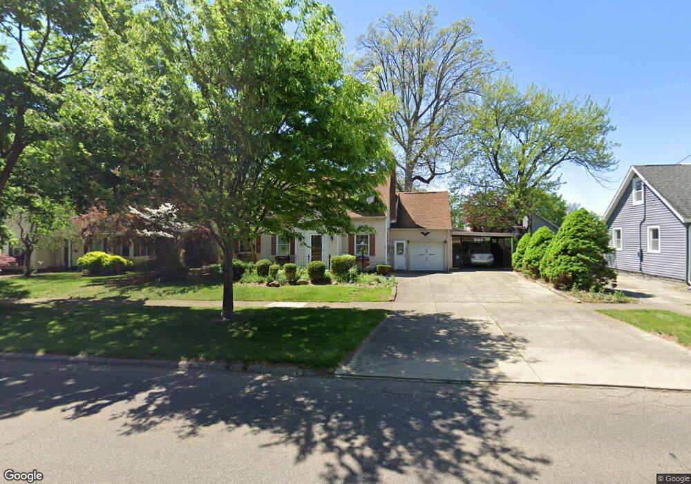
1818 Brown St Akron, OH 44301
Firestone Park NeighborhoodEstimated Value: $187,255 - $211,000
3
Beds
2
Baths
1,677
Sq Ft
$119/Sq Ft
Est. Value
About This Home
This home is located at 1818 Brown St, Akron, OH 44301 and is currently estimated at $199,314, approximately $118 per square foot. 1818 Brown St is a home located in Summit County with nearby schools including Kenmore Garfield Community Learning Center, Main Preparatory Academy, and Eagle Elementary.
Ownership History
Date
Name
Owned For
Owner Type
Purchase Details
Closed on
Jul 20, 2000
Sold by
Capron Richard B and Capron Karen A
Bought by
Mellinger Charles A and Mellinger Neenah L
Current Estimated Value
Home Financials for this Owner
Home Financials are based on the most recent Mortgage that was taken out on this home.
Original Mortgage
$40,000
Interest Rate
8.27%
Purchase Details
Closed on
Aug 21, 1996
Sold by
Richard C Capron Trst
Bought by
Capron Richard B and Capron Karen A
Home Financials for this Owner
Home Financials are based on the most recent Mortgage that was taken out on this home.
Original Mortgage
$64,000
Interest Rate
8.47%
Mortgage Type
New Conventional
Create a Home Valuation Report for This Property
The Home Valuation Report is an in-depth analysis detailing your home's value as well as a comparison with similar homes in the area
Home Values in the Area
Average Home Value in this Area
Purchase History
| Date | Buyer | Sale Price | Title Company |
|---|---|---|---|
| Mellinger Charles A | $114,500 | Tri County Title | |
| Capron Richard B | $105,000 | -- |
Source: Public Records
Mortgage History
| Date | Status | Borrower | Loan Amount |
|---|---|---|---|
| Previous Owner | Mellinger Charles A | $40,000 | |
| Previous Owner | Capron Richard B | $64,000 |
Source: Public Records
Tax History
| Year | Tax Paid | Tax Assessment Tax Assessment Total Assessment is a certain percentage of the fair market value that is determined by local assessors to be the total taxable value of land and additions on the property. | Land | Improvement |
|---|---|---|---|---|
| 2024 | $2,428 | $52,469 | $11,802 | $40,667 |
| 2023 | $2,428 | $52,469 | $11,802 | $40,667 |
| 2022 | $2,125 | $38,133 | $8,554 | $29,579 |
| 2021 | $2,127 | $38,133 | $8,554 | $29,579 |
| 2020 | $2,097 | $38,130 | $8,550 | $29,580 |
| 2019 | $1,675 | $29,460 | $7,780 | $21,680 |
| 2018 | $1,654 | $29,460 | $7,780 | $21,680 |
| 2017 | $1,678 | $29,460 | $7,780 | $21,680 |
| 2016 | $1,680 | $29,460 | $7,780 | $21,680 |
| 2015 | $1,678 | $29,460 | $7,780 | $21,680 |
| 2014 | $1,666 | $29,460 | $7,780 | $21,680 |
| 2013 | $1,637 | $29,490 | $7,780 | $21,710 |
Source: Public Records
Map
Nearby Homes
- 1810 Carter Ave
- 1878 Carter Ave Unit 1880
- 502 E Woodsdale Ave
- 367 Wayne Ave
- 1726 Coventry St
- 1708 Highview Ave
- 1835 Thornapple Ave
- 231 E Dresden Ave
- 1612 Oakwood Ave
- 1646 Highview Ave
- 248 E Catawba Ave
- 457 S Firestone Blvd
- 244 E Catawba Ave
- 1595 Redwood Ave
- 1645 Hammel St
- 416 Rockys Run Rd
- 1620 Highview Ave
- 695 Cooper Ave
- 378 Cypress Ave
- 2162 Canterbury Cir
- 1818 Brown St
- 1824 Brown St
- 1804 Brown St
- 1828 Brown St
- 1811 Carter Ave
- 1807 Carter Ave
- 1832 Brown St
- 434 E Dresden Ave
- 1813 Carter Ave
- 1836 Brown St
- 1829 Carter Ave
- 449 E Dresden Ave
- 441 E Dresden Ave
- 1840 Brown St
- 1792 Brown St
- 437 E Dresden Ave
- 1797 Brown St
- 1837 Carter Ave
- 1846 Brown St
- 1793 Brown St
Your Personal Tour Guide
Ask me questions while you tour the home.