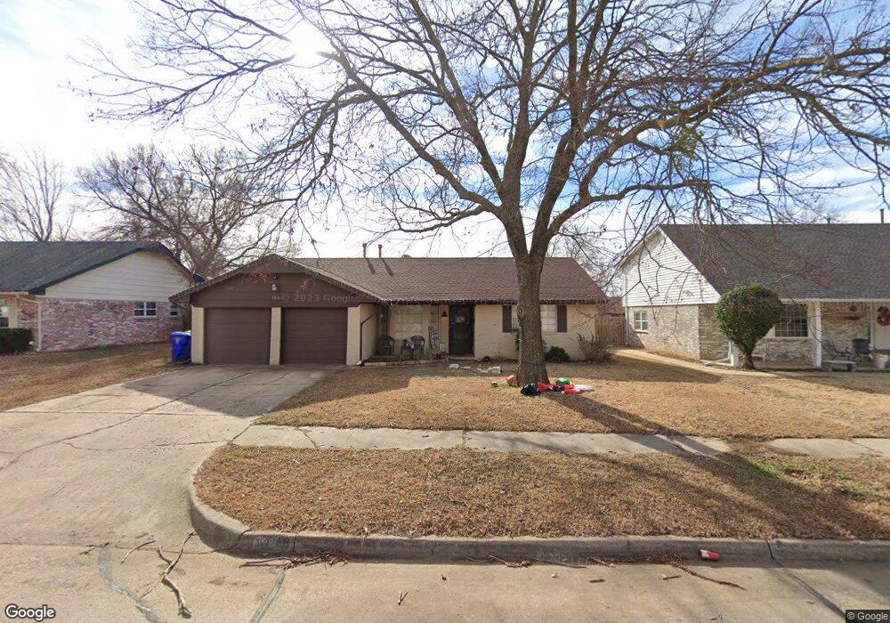
1818 Elmhurst Dr Norman, OK 73071
Southeast Norman NeighborhoodEstimated Value: $160,000 - $209,000
3
Beds
2
Baths
1,552
Sq Ft
$120/Sq Ft
Est. Value
About This Home
This home is located at 1818 Elmhurst Dr, Norman, OK 73071 and is currently estimated at $186,887, approximately $120 per square foot. 1818 Elmhurst Dr is a home located in Cleveland County with nearby schools including Kennedy Elementary School, Irving Middle School, and Norman High School.
Ownership History
Date
Name
Owned For
Owner Type
Purchase Details
Closed on
Jul 13, 2021
Sold by
Stamp Michael A and Stamp Michele D
Bought by
Herrera Monika E
Current Estimated Value
Home Financials for this Owner
Home Financials are based on the most recent Mortgage that was taken out on this home.
Original Mortgage
$117,826
Outstanding Balance
$106,909
Interest Rate
2.9%
Mortgage Type
FHA
Estimated Equity
$79,978
Purchase Details
Closed on
Jan 30, 2012
Sold by
Stamp Michael A and Stamp Michele D
Bought by
Stamp Michael A and Stamp Michele D
Home Financials for this Owner
Home Financials are based on the most recent Mortgage that was taken out on this home.
Original Mortgage
$60,500
Interest Rate
3.95%
Mortgage Type
New Conventional
Purchase Details
Closed on
Apr 29, 2008
Sold by
Boyer Glenda Mae and Brinkley Glenda Mae
Bought by
Brinkley Glenda Mae and Stamp Michael A
Create a Home Valuation Report for This Property
The Home Valuation Report is an in-depth analysis detailing your home's value as well as a comparison with similar homes in the area
Home Values in the Area
Average Home Value in this Area
Purchase History
| Date | Buyer | Sale Price | Title Company |
|---|---|---|---|
| Herrera Monika E | $120,000 | American Eagle Title Group | |
| Stamp Michael A | -- | None Available | |
| Brinkley Glenda Mae | -- | None Available |
Source: Public Records
Mortgage History
| Date | Status | Borrower | Loan Amount |
|---|---|---|---|
| Open | Herrera Monika E | $117,826 | |
| Previous Owner | Stamp Michael A | $60,500 |
Source: Public Records
Tax History Compared to Growth
Tax History
| Year | Tax Paid | Tax Assessment Tax Assessment Total Assessment is a certain percentage of the fair market value that is determined by local assessors to be the total taxable value of land and additions on the property. | Land | Improvement |
|---|---|---|---|---|
| 2024 | $1,806 | $15,082 | $3,094 | $11,988 |
| 2023 | $1,725 | $14,364 | $3,041 | $11,323 |
| 2022 | $1,575 | $13,680 | $2,400 | $11,280 |
| 2021 | $1,427 | $11,750 | $2,400 | $9,350 |
| 2020 | $1,396 | $11,750 | $2,400 | $9,350 |
| 2019 | $1,419 | $11,750 | $2,400 | $9,350 |
| 2018 | $1,377 | $11,750 | $2,400 | $9,350 |
| 2017 | $1,392 | $11,750 | $0 | $0 |
| 2016 | $1,374 | $11,405 | $2,329 | $9,076 |
| 2015 | $1,269 | $10,862 | $1,512 | $9,350 |
| 2014 | $1,281 | $10,862 | $1,512 | $9,350 |
Source: Public Records
Map
Nearby Homes
- 1301 Whippoorwill Dr
- 1812 Ridgewood Dr
- 1833 Parkridge Dr
- 1603 Oakcrest Ave
- 1633 Creekside Ln
- 1848 Parkridge Dr
- 1600 Rolling Stone Dr
- 1723 E Lindsey St Unit 2
- 1817 E Lindsey St Unit 3
- 1813 E Lindsey St Unit 4
- 1421 Teakwood Dr
- 1346 Concord Ct
- 1621 Woodcreek Ct
- 2361 Heatherfield Ln
- 1404 1406 Concord Dr
- 1701 Briarcreek
- 1900 Twin Tree Dr
- 916 Beaumont Square
- 1813 Candlewood Dr
- 1 E Lindsey St
- 1812 Elmhurst Dr
- 1824 Elmhurst Dr
- 1806 Elmhurst Dr
- 1815 Burnt Oak St
- 1809 Burnt Oak St
- 1830 Elmhurst Dr
- 1821 Elmhurst Dr
- 1821 Burnt Oak St
- 1815 Elmhurst Dr
- 1809 Elmhurst Dr
- 1827 Elmhurst Dr
- 1829 Burnt Oak St
- 1805 Burnt Oak St
- 1902 Elmhurst Dr
- 1800 Elmhurst Dr
- 1803 Elmhurst Dr
- 1901 Elmhurst Dr
- 1835 Burnt Oak St
- 1822 Burnt Oak St
- 1816 Burnt Oak St