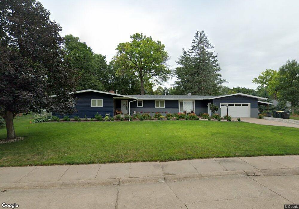
1818 Home St Hastings, NE 68901
Estimated Value: $328,000 - $376,000
3
Beds
3
Baths
2,120
Sq Ft
$163/Sq Ft
Est. Value
About This Home
This home is located at 1818 Home St, Hastings, NE 68901 and is currently estimated at $346,184, approximately $163 per square foot. 1818 Home St is a home located in Adams County with nearby schools including Hastings Senior High School, St. Michael's Preschool & Elementary School, and Zion Lutheran School.
Ownership History
Date
Name
Owned For
Owner Type
Purchase Details
Closed on
Jun 27, 2014
Sold by
Hahn Leroy
Bought by
Johnson Obadiah L and Johnson Ashely D
Current Estimated Value
Home Financials for this Owner
Home Financials are based on the most recent Mortgage that was taken out on this home.
Original Mortgage
$152,000
Outstanding Balance
$116,082
Interest Rate
4.23%
Mortgage Type
New Conventional
Estimated Equity
$230,102
Purchase Details
Closed on
Jan 24, 2012
Sold by
Hahn G Leroy and Gilgin Hahn Patricia Elizabeth
Bought by
Hahn G Leroy and G Leroy Hahn Revocable Trust
Create a Home Valuation Report for This Property
The Home Valuation Report is an in-depth analysis detailing your home's value as well as a comparison with similar homes in the area
Home Values in the Area
Average Home Value in this Area
Purchase History
| Date | Buyer | Sale Price | Title Company |
|---|---|---|---|
| Johnson Obadiah L | $190,000 | Elizabeth Prairie Title | |
| Hahn G Leroy | -- | None Available |
Source: Public Records
Mortgage History
| Date | Status | Borrower | Loan Amount |
|---|---|---|---|
| Open | Johnson Obadiah L | $152,000 |
Source: Public Records
Tax History Compared to Growth
Tax History
| Year | Tax Paid | Tax Assessment Tax Assessment Total Assessment is a certain percentage of the fair market value that is determined by local assessors to be the total taxable value of land and additions on the property. | Land | Improvement |
|---|---|---|---|---|
| 2024 | $4,501 | $281,991 | $54,999 | $226,992 |
| 2023 | $5,534 | $268,174 | $54,999 | $213,175 |
| 2022 | $5,872 | $260,697 | $54,999 | $205,698 |
| 2021 | $5,263 | $240,000 | $42,213 | $197,787 |
| 2020 | $5,656 | $262,285 | $42,213 | $220,072 |
| 2019 | $5,248 | $245,983 | $42,213 | $203,770 |
| 2018 | $4,980 | $232,205 | $28,435 | $203,770 |
| 2017 | $4,890 | $228,210 | $0 | $0 |
| 2016 | $4,614 | $215,140 | $28,435 | $186,705 |
| 2011 | -- | $195,310 | $26,090 | $169,220 |
Source: Public Records
Map
Nearby Homes
- 1201 Pershing Rd
- 1911 W 11th St
- 1225 Heritage Dr
- 1513 Crane Ave
- 1505 Crane Ave
- 1223 Westwood Terrace
- 1814 Boyce St
- 904 N Washington Ave
- 1330 Heritage Dr
- 1619 Boyce St
- 1108 N Baltimore Ave
- 1334 W 12th St
- 1001 N Webster Ave
- 736 N Barnes Ave
- 711 Crane Ave
- 1402 Arapahoe Ave
- 1801 W 7th St
- 2330 W 11th St
- 1314 N Laird Ave
- 1615 W 7th St