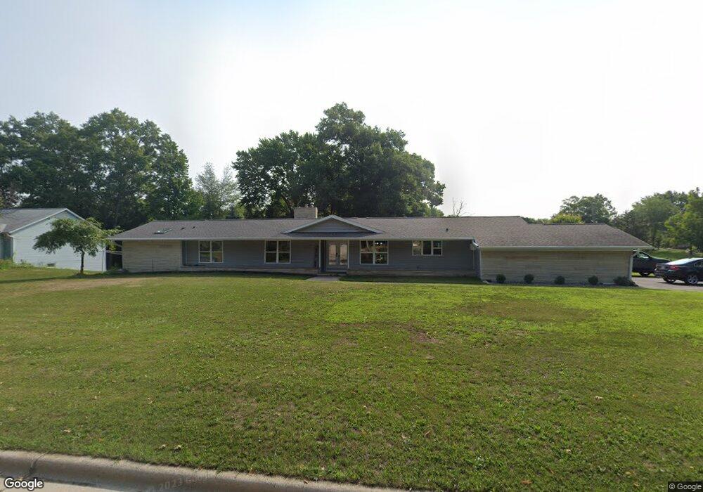
1819 Canary Ln Green Bay, WI 54304
Westside NeighborhoodEstimated Value: $381,000 - $457,000
4
Beds
2
Baths
2,446
Sq Ft
$166/Sq Ft
Est. Value
About This Home
This home is located at 1819 Canary Ln, Green Bay, WI 54304 and is currently estimated at $405,313, approximately $165 per square foot. 1819 Canary Ln is a home located in Brown County with nearby schools including King Elementary School, Lombardi Middle School, and Southwest High School.
Ownership History
Date
Name
Owned For
Owner Type
Purchase Details
Closed on
Sep 30, 2016
Sold by
Renard Andrew C
Bought by
Renard Andrew C and Renard Jamie L
Current Estimated Value
Home Financials for this Owner
Home Financials are based on the most recent Mortgage that was taken out on this home.
Original Mortgage
$95,000
Outstanding Balance
$44,475
Interest Rate
3.43%
Mortgage Type
New Conventional
Estimated Equity
$360,838
Purchase Details
Closed on
Oct 29, 2010
Sold by
Federal Home Loan Mortgage Corporation
Bought by
Renard Andrew C
Purchase Details
Closed on
Apr 7, 2010
Sold by
Hellmann Robert J
Bought by
Federal Home Loan Mortgage Corp
Create a Home Valuation Report for This Property
The Home Valuation Report is an in-depth analysis detailing your home's value as well as a comparison with similar homes in the area
Home Values in the Area
Average Home Value in this Area
Purchase History
| Date | Buyer | Sale Price | Title Company |
|---|---|---|---|
| Renard Andrew C | -- | Liberty Title | |
| Renard Andrew C | $106,000 | Servicelink Hopewell Campus | |
| Federal Home Loan Mortgage Corp | -- | None Available |
Source: Public Records
Mortgage History
| Date | Status | Borrower | Loan Amount |
|---|---|---|---|
| Open | Renard Andrew C | $95,000 |
Source: Public Records
Tax History Compared to Growth
Tax History
| Year | Tax Paid | Tax Assessment Tax Assessment Total Assessment is a certain percentage of the fair market value that is determined by local assessors to be the total taxable value of land and additions on the property. | Land | Improvement |
|---|---|---|---|---|
| 2024 | $5,767 | $304,200 | $62,400 | $241,800 |
| 2023 | $5,532 | $304,200 | $62,400 | $241,800 |
| 2022 | $5,392 | $304,200 | $62,400 | $241,800 |
| 2021 | $3,717 | $162,300 | $51,500 | $110,800 |
| 2020 | $3,757 | $162,300 | $51,500 | $110,800 |
| 2019 | $3,640 | $162,300 | $51,500 | $110,800 |
| 2018 | $3,555 | $162,300 | $51,500 | $110,800 |
| 2017 | $3,509 | $162,300 | $51,500 | $110,800 |
| 2016 | $3,454 | $162,300 | $51,500 | $110,800 |
| 2015 | $3,551 | $162,300 | $51,500 | $110,800 |
| 2014 | $3,488 | $162,300 | $51,500 | $110,800 |
| 2013 | $3,488 | $154,900 | $51,500 | $103,400 |
Source: Public Records
Map
Nearby Homes
- 2640 He Nis Ra Ln
- 1433 Baumgart Rd Unit 1435
- 2550 He Nis Ra Ln
- 2060 Wintergreen Ct
- 2044 Ann Ln
- 2441 Matchwood Ln
- 2439 W Point Rd
- 2466 Parkwood Dr
- 2768 Independence Dr
- 2060 Trissino Way
- 3023 Crusade Ln
- 1680 Cormier Rd
- 1973 Knotty Pine Dr
- 1570 Mesa Dr
- 2993 Fleetwood Dr
- 1514 Ashley Ct
- 3097 S Sandstone Ct
- 3096 S Sandstone Ct
- 1921 Beech Tree Dr
- 1471 Parkway Dr
- 1809 Canary Ln
- 1814 Valorane Blvd
- 2696 Oakwood Dr
- 2703 Oakwood Dr
- 1816 Canary Ln
- 1804 Valorane Blvd
- 2711 Oakwood Dr
- 1723 Canary Ln
- 1910 Mulberry Ln
- 1808 Canary Ln
- 1720 Valorane Blvd
- 2730 Oakwood Dr
- 1916 Mulberry Ln Unit 1918
- 2719 Oakwood Dr
- 1901 Mulberry Ln
- 1715 Canary Ln
- 1815 Valorane Blvd
- 2729 Whippoorwill Dr
- 2680 Oakwood Dr
- 1922 Mulberry Ln