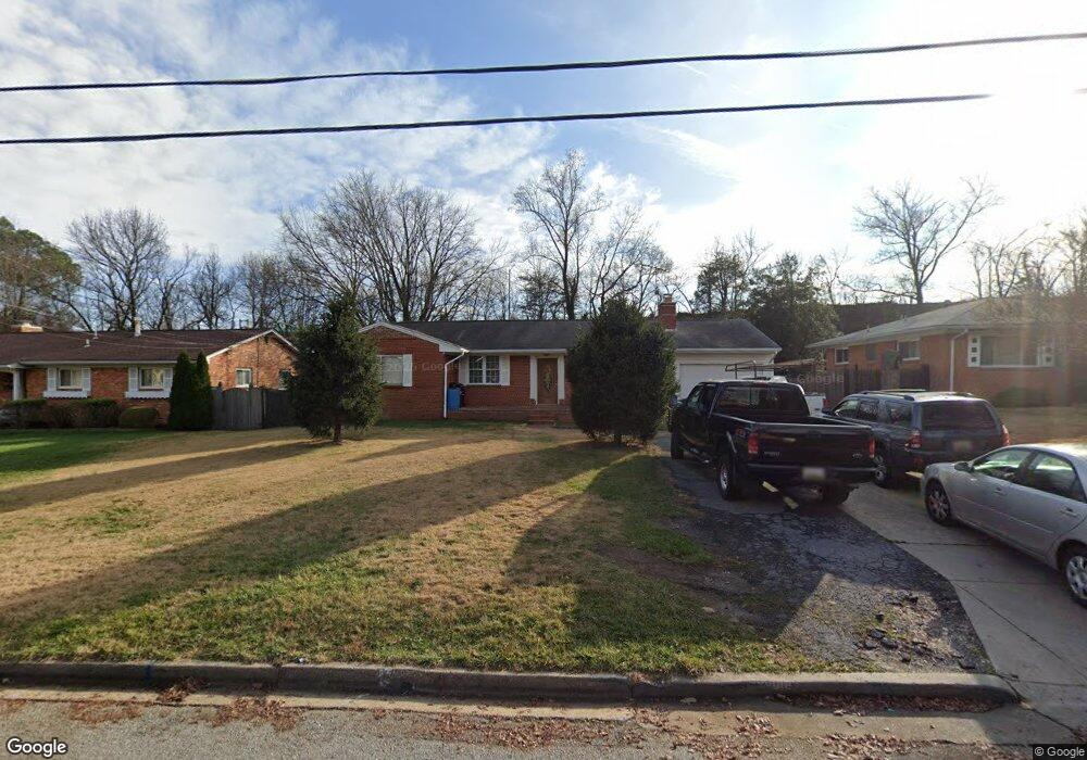
1819 Elton Rd Adelphi, MD 20783
Estimated Value: $487,742 - $512,000
Studio
3
Baths
1,494
Sq Ft
$336/Sq Ft
Est. Value
About This Home
This home is located at 1819 Elton Rd, Adelphi, MD 20783 and is currently estimated at $502,436, approximately $336 per square foot. 1819 Elton Rd is a home located in Prince George's County with nearby schools including Cherokee Lane Elementary School, Buck Lodge Middle School, and High Point High School.
Ownership History
Date
Name
Owned For
Owner Type
Purchase Details
Closed on
Jan 27, 2006
Sold by
Henson Bettie M
Bought by
Umanzor Raul
Current Estimated Value
Home Financials for this Owner
Home Financials are based on the most recent Mortgage that was taken out on this home.
Original Mortgage
$63,750
Outstanding Balance
$35,647
Interest Rate
6.28%
Mortgage Type
Credit Line Revolving
Estimated Equity
$466,789
Purchase Details
Closed on
Dec 30, 2005
Sold by
Henson Bettie M
Bought by
Umanzor Raul
Home Financials for this Owner
Home Financials are based on the most recent Mortgage that was taken out on this home.
Original Mortgage
$63,750
Outstanding Balance
$35,647
Interest Rate
6.28%
Mortgage Type
Credit Line Revolving
Estimated Equity
$466,789
Purchase Details
Closed on
Sep 5, 1978
Sold by
Richard X Redmond
Bought by
Henson Bettie M
Create a Home Valuation Report for This Property
The Home Valuation Report is an in-depth analysis detailing your home's value as well as a comparison with similar homes in the area
Home Values in the Area
Average Home Value in this Area
Purchase History
We collect this data history from publicly available records. To have your information removed, we recommend requesting removal directly through your county’s website.
| Date | Buyer | Sale Price | Title Company |
|---|---|---|---|
| Umanzor Raul | $425,000 | -- | |
| Umanzor Raul | $425,000 | -- | |
| Henson Bettie M | $87,000 | -- |
Source: Public Records
Mortgage History
We collect this data history from publicly available records. To have your information removed, we recommend requesting removal directly through your county’s website.
| Date | Status | Borrower | Loan Amount |
|---|---|---|---|
| Open | Umanzor Raul | $63,750 | |
| Open | Umanzor Raul | $340,000 | |
| Closed | Umanzor Raul | $63,750 | |
| Closed | Umanzor Raul | $340,000 |
Source: Public Records
Tax History
| Year | Tax Paid | Tax Assessment Tax Assessment Total Assessment is a certain percentage of the fair market value that is determined by local assessors to be the total taxable value of land and additions on the property. | Land | Improvement |
|---|---|---|---|---|
| 2025 | $6,575 | $434,300 | -- | -- |
| 2024 | $6,575 | $415,600 | $126,500 | $289,100 |
| 2023 | $6,338 | $399,733 | $0 | $0 |
| 2022 | $6,102 | $383,867 | $0 | $0 |
| 2021 | $5,866 | $368,000 | $125,700 | $242,300 |
| 2020 | $5,558 | $347,233 | $0 | $0 |
| 2019 | $5,249 | $326,467 | $0 | $0 |
| 2018 | $4,941 | $305,700 | $100,700 | $205,000 |
| 2017 | $4,617 | $283,933 | $0 | $0 |
| 2016 | -- | $262,167 | $0 | $0 |
| 2015 | $4,309 | $240,400 | $0 | $0 |
| 2014 | $4,309 | $240,400 | $0 | $0 |
Source: Public Records
Map
Nearby Homes
- 2302 Muskogee St
- 10111 Green Forest Dr
- 10218 Green Forest Dr
- 10224 Green Forest Dr
- 2508 Muskogee St
- 9203 Custer Terrace
- 10115 Chickadee Ln
- 2621 Lackawanna St
- 2703 Lackawanna Place
- 1615 Parham Place
- 0 Parkman Unit MDMC2227634
- 2712 Hughes Rd
- 1912 Kimberly Rd
- 10318 Parkman Rd
- 2502 Hughes Rd
- 9278 Adelphi Rd Unit 103
- 1824 Metzerott Rd Unit 204
- 1824 Metzerott Rd Unit 203
- 9250 Edwards Way Unit 103A
- 9250 Edwards Way Unit 101A
Your Personal Tour Guide
Ask me questions while you tour the home.