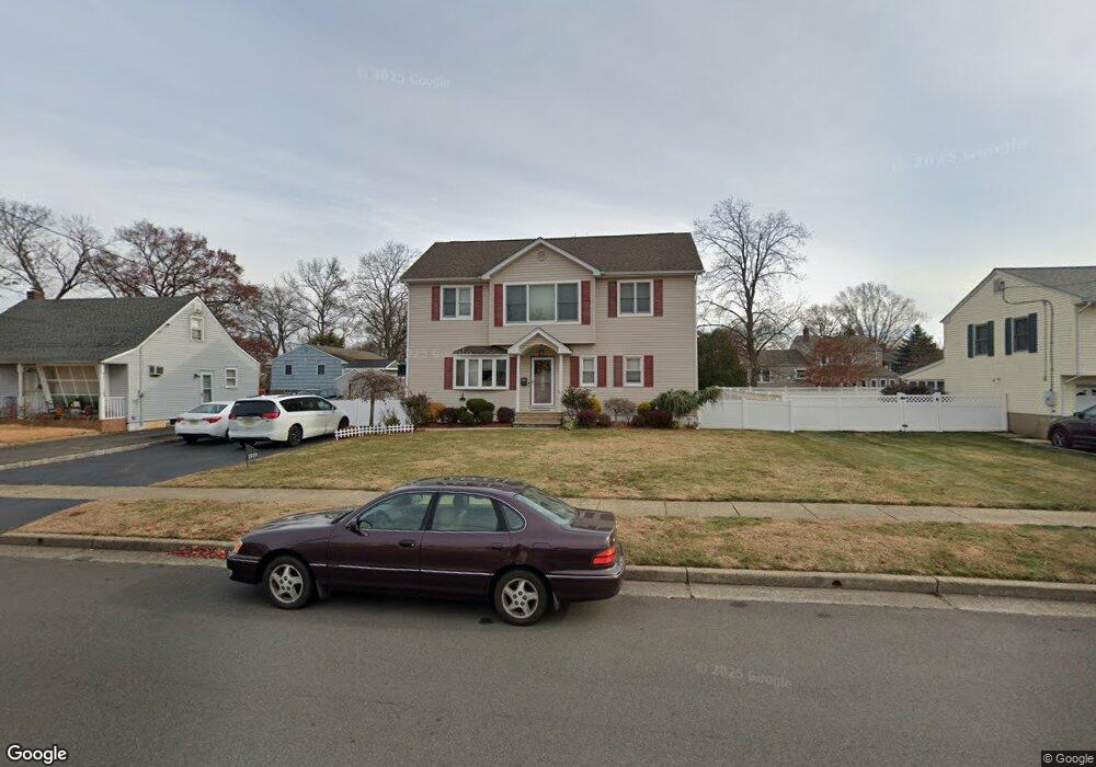
1819 Grant Ave South Plainfield, NJ 07080
Estimated Value: $597,000 - $693,000
--
Bed
--
Bath
2,240
Sq Ft
$282/Sq Ft
Est. Value
About This Home
This home is located at 1819 Grant Ave, South Plainfield, NJ 07080 and is currently estimated at $631,959, approximately $282 per square foot. 1819 Grant Ave is a home located in Middlesex County with nearby schools including South Plainfield High School, The Queen City Academy Charter School, and Koinonia Academy.
Ownership History
Date
Name
Owned For
Owner Type
Purchase Details
Closed on
Sep 18, 2020
Sold by
Paez Richard J and Paez Christina
Bought by
Varghese Abraham and Varghese Ancy
Current Estimated Value
Home Financials for this Owner
Home Financials are based on the most recent Mortgage that was taken out on this home.
Original Mortgage
$436,500
Outstanding Balance
$387,365
Interest Rate
2.9%
Mortgage Type
New Conventional
Estimated Equity
$244,594
Purchase Details
Closed on
Feb 27, 2001
Sold by
Hurst George
Bought by
Paez Richard and Paez Christina
Home Financials for this Owner
Home Financials are based on the most recent Mortgage that was taken out on this home.
Original Mortgage
$165,000
Interest Rate
7.15%
Purchase Details
Closed on
Jun 25, 1999
Sold by
Ambrusico Joseph
Bought by
Hurst George and Hurst Karen
Home Financials for this Owner
Home Financials are based on the most recent Mortgage that was taken out on this home.
Original Mortgage
$116,000
Interest Rate
7.09%
Create a Home Valuation Report for This Property
The Home Valuation Report is an in-depth analysis detailing your home's value as well as a comparison with similar homes in the area
Home Values in the Area
Average Home Value in this Area
Purchase History
| Date | Buyer | Sale Price | Title Company |
|---|---|---|---|
| Varghese Abraham | $485,000 | None Available | |
| Varghese Abraham | $485,000 | None Listed On Document | |
| Paez Richard | $175,000 | -- | |
| Hurst George | $145,000 | -- |
Source: Public Records
Mortgage History
| Date | Status | Borrower | Loan Amount |
|---|---|---|---|
| Open | Varghese Abraham | $436,500 | |
| Closed | Varghese Abraham | $436,500 | |
| Previous Owner | Paez Richard | $165,000 | |
| Previous Owner | Hurst George | $116,000 |
Source: Public Records
Tax History Compared to Growth
Tax History
| Year | Tax Paid | Tax Assessment Tax Assessment Total Assessment is a certain percentage of the fair market value that is determined by local assessors to be the total taxable value of land and additions on the property. | Land | Improvement |
|---|---|---|---|---|
| 2025 | $10,944 | $156,750 | $32,600 | $124,150 |
| 2024 | $10,468 | $156,750 | $32,600 | $124,150 |
| 2023 | $10,468 | $156,750 | $32,600 | $124,150 |
| 2022 | $10,338 | $156,750 | $32,600 | $124,150 |
| 2021 | $9,920 | $156,750 | $32,600 | $124,150 |
| 2020 | $9,947 | $156,750 | $32,600 | $124,150 |
| 2019 | $9,545 | $156,750 | $32,600 | $124,150 |
| 2018 | $9,298 | $156,750 | $32,600 | $124,150 |
| 2017 | $9,179 | $156,750 | $32,600 | $124,150 |
| 2016 | $9,087 | $156,750 | $32,600 | $124,150 |
| 2015 | $8,930 | $156,750 | $32,600 | $124,150 |
| 2014 | $10,170 | $183,800 | $32,600 | $151,200 |
Source: Public Records
Map
Nearby Homes
- 551 Melrose Ave
- 1210 Maltby Ave
- 917 Tompkins Ave
- 105 Firth St
- 139 Palmer Ave
- 1221 Grant Ave Unit 23
- 909 Sherman Ave
- 916 Sherman Ave
- 1210 Field Ave
- 1143 Worth Dr
- 1453 Tooz Place
- 814 Sherman Ave Unit 18
- 1726 Kenyon Ave
- 1712 Kenyon Ave
- 905 Stelle Ave Unit 7
- 1119 S 9th St
- 1400 Kenyon Ave
- 4 Rauer Ct
- 480 Sampton Ave
- 241 Van Fleet Ave
- 1815 Grant Ave
- 1831 Grant Ave
- 1812 Pershing Place
- 1811 Grant Ave
- 1818 Pershing Place
- 1808 Pershing Place
- 1816 Grant Ave
- 1822 Grant Ave
- 1835 Grant Ave
- 409 Tompkins Ave
- 1807 Grant Ave
- 1824 Pershing Place Unit Rear
- 1824 Pershing Place
- 1814 Grant Ave
- 401 Tompkins Ave
- 1830 Grant Ave
- 1808 Grant Ave
- 1826 Grant Ave
- 1807 Pershing Place
- 1811 Pershing Place