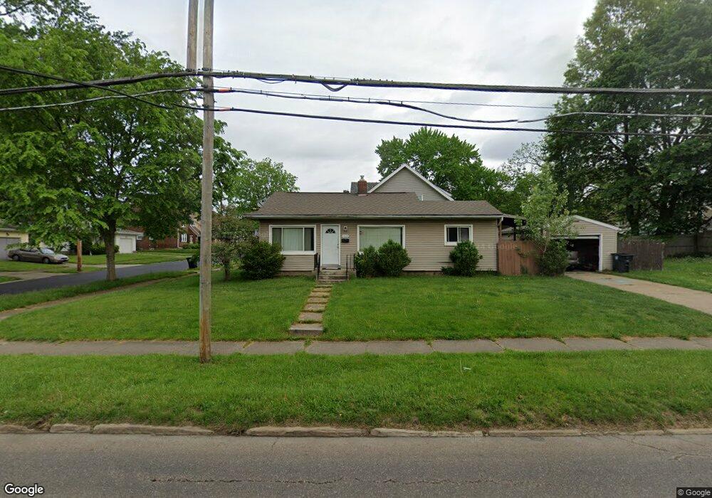
1819 Newton St Akron, OH 44305
Goodyear Heights NeighborhoodEstimated Value: $108,390 - $133,000
2
Beds
1
Bath
816
Sq Ft
$146/Sq Ft
Est. Value
About This Home
This home is located at 1819 Newton St, Akron, OH 44305 and is currently estimated at $119,348, approximately $146 per square foot. 1819 Newton St is a home located in Summit County with nearby schools including Seiberling Community Learning Center, Middlebury Academy, and Akron Preparatory school.
Ownership History
Date
Name
Owned For
Owner Type
Purchase Details
Closed on
Oct 28, 2009
Sold by
Mullin Terry S and Mullin Jerome F
Bought by
Syroid Michael
Current Estimated Value
Home Financials for this Owner
Home Financials are based on the most recent Mortgage that was taken out on this home.
Original Mortgage
$68,732
Outstanding Balance
$45,040
Interest Rate
5.07%
Mortgage Type
FHA
Estimated Equity
$74,308
Purchase Details
Closed on
Oct 23, 2008
Sold by
Bank Of New York
Bought by
Mullins Terry S
Purchase Details
Closed on
Sep 4, 2008
Sold by
Michael Virginia
Bought by
Bank Of New York
Purchase Details
Closed on
Apr 1, 2001
Sold by
Stanley Daniel E
Bought by
Michel Virginia
Home Financials for this Owner
Home Financials are based on the most recent Mortgage that was taken out on this home.
Original Mortgage
$59,500
Interest Rate
9.37%
Create a Home Valuation Report for This Property
The Home Valuation Report is an in-depth analysis detailing your home's value as well as a comparison with similar homes in the area
Home Values in the Area
Average Home Value in this Area
Purchase History
| Date | Buyer | Sale Price | Title Company |
|---|---|---|---|
| Syroid Michael | $70,000 | Chicago Title Insurance Co | |
| Mullins Terry S | $23,000 | Lawyers Title Ins | |
| Bank Of New York | $50,000 | Lawyers Title Ins | |
| Michel Virginia | $70,000 | Midland Commerce Group |
Source: Public Records
Mortgage History
| Date | Status | Borrower | Loan Amount |
|---|---|---|---|
| Open | Syroid Michael | $68,732 | |
| Previous Owner | Michel Virginia | $59,500 | |
| Closed | Michel Virginia | $3,500 |
Source: Public Records
Tax History Compared to Growth
Tax History
| Year | Tax Paid | Tax Assessment Tax Assessment Total Assessment is a certain percentage of the fair market value that is determined by local assessors to be the total taxable value of land and additions on the property. | Land | Improvement |
|---|---|---|---|---|
| 2025 | $1,616 | $26,726 | $8,015 | $18,711 |
| 2024 | $1,616 | $26,726 | $8,015 | $18,711 |
| 2023 | $1,616 | $26,726 | $8,015 | $18,711 |
| 2022 | $1,513 | $19,443 | $5,684 | $13,759 |
| 2021 | $1,514 | $19,443 | $5,684 | $13,759 |
| 2020 | $1,495 | $19,440 | $5,680 | $13,760 |
| 2019 | $1,649 | $19,850 | $6,050 | $13,800 |
| 2018 | $1,629 | $19,850 | $6,050 | $13,800 |
| 2017 | $1,652 | $19,850 | $6,050 | $13,800 |
| 2016 | $1,654 | $19,850 | $6,050 | $13,800 |
| 2015 | $1,652 | $19,850 | $6,050 | $13,800 |
| 2014 | $1,641 | $19,850 | $6,050 | $13,800 |
| 2013 | $1,736 | $21,670 | $6,050 | $15,620 |
Source: Public Records
Map
Nearby Homes
- 1796 Newton St
- 466 the Brooklands
- 486 Frazier Ave
- 465 Saint Leger Ave
- 580 Elko Ave
- 248 Malacca St
- 1792 Malasia Rd
- 249 Malacca St
- 360 Cluster Ave
- 359 Booth Ave
- 1604 Ottawa Ave
- 1892 Malasia Rd
- 333 Cluster Ave
- 287 E Park Blvd
- 1865 Goodyear Blvd
- 1598 Pilgrim St
- 2076 Congo St
- 404 Newell Ave
- 605 Melrose St
- 1947 Preston Ave Unit 1949
- 1855 Tonawanda Ave
- 1851 Tonawanda Ave
- 1873 Tonawanda Ave
- 386 the Brooklands
- 396 the Brooklands
- 1845 Tonawanda Ave
- 400 the Brooklands
- 1879 Tonawanda Ave
- 1858 Tonawanda Ave
- 406 the Brooklands
- 1852 Tonawanda Ave
- 1841 Tonawanda Ave
- 1862 Tonawanda Ave
- 1883 Tonawanda Ave
- 1846 Tonawanda Ave
- 410 the Brooklands
- 1880 Tonawanda Ave
- 1837 Tonawanda Ave
- 370 the Brooklands
- 1842 Tonawanda Ave