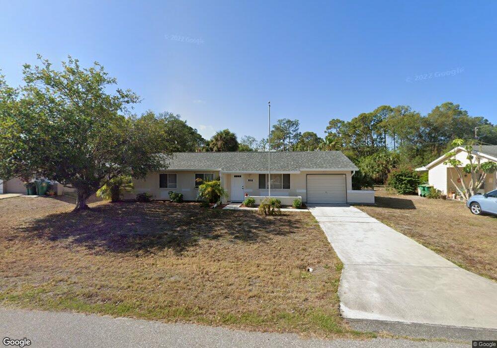
18191 Steele Ave Port Charlotte, FL 33948
Estimated Value: $190,511 - $262,000
--
Bed
--
Bath
1,204
Sq Ft
$181/Sq Ft
Est. Value
About This Home
This home is located at 18191 Steele Ave, Port Charlotte, FL 33948 and is currently estimated at $218,128, approximately $181 per square foot. 18191 Steele Ave is a home located in Charlotte County with nearby schools including Liberty Elementary School, Murdock Middle School, and Port Charlotte High School.
Ownership History
Date
Name
Owned For
Owner Type
Purchase Details
Closed on
Jan 7, 2022
Sold by
Mary Tote
Bought by
Caschera Teresa A
Current Estimated Value
Purchase Details
Closed on
Mar 2, 2020
Sold by
Caschera Teresa A and Estate Of Mary Tote
Bought by
Caschera Teresa A
Purchase Details
Closed on
Mar 18, 2011
Sold by
Wells Fargo Bank Na
Bought by
Tote Mary
Purchase Details
Closed on
Dec 14, 2010
Sold by
Miller Richard Carlton and Perrotta Miller Donna Marie
Bought by
Wells Fargo Bank N A
Purchase Details
Closed on
Feb 7, 2006
Sold by
Miller Richard C
Bought by
Miller Richard C and Miller Donna M
Create a Home Valuation Report for This Property
The Home Valuation Report is an in-depth analysis detailing your home's value as well as a comparison with similar homes in the area
Home Values in the Area
Average Home Value in this Area
Purchase History
| Date | Buyer | Sale Price | Title Company |
|---|---|---|---|
| Caschera Teresa A | -- | -- | |
| Caschera Teresa A | -- | Attorney | |
| Tote Mary | $42,100 | None Available | |
| Wells Fargo Bank N A | -- | Attorney | |
| Miller Richard C | -- | None Available |
Source: Public Records
Tax History Compared to Growth
Tax History
| Year | Tax Paid | Tax Assessment Tax Assessment Total Assessment is a certain percentage of the fair market value that is determined by local assessors to be the total taxable value of land and additions on the property. | Land | Improvement |
|---|---|---|---|---|
| 2023 | $3,057 | $147,622 | $15,300 | $132,322 |
| 2022 | $2,390 | $120,522 | $13,175 | $107,347 |
| 2021 | $2,149 | $89,172 | $5,270 | $83,902 |
| 2020 | $1,985 | $91,938 | $4,760 | $87,178 |
| 2019 | $1,821 | $84,140 | $4,335 | $79,805 |
| 2018 | $1,556 | $69,975 | $4,675 | $65,300 |
| 2017 | $1,486 | $65,508 | $3,672 | $61,836 |
| 2016 | $1,417 | $49,542 | $0 | $0 |
| 2015 | $1,339 | $45,038 | $0 | $0 |
| 2014 | $1,221 | $40,944 | $0 | $0 |
Source: Public Records
Map
Nearby Homes
- 18158 Wakashan Ave
- 18181 Wakashan Ave
- 3038 Sargeant St
- 18157 Wakashan Ave
- 2466 Fourwind St
- 18106 Wintergarden Ave
- 18141 Wintergarden Ave
- 3063 Sargeant St
- 18133 Wakashan Ave
- 18125 Wakashan Ave
- 18059 Regan Ave
- 18191 Wakashan Ave
- 18095 Shirley Ave
- 3117 Sudbury St
- 17458 York Ave Unit 6
- 2586 Auburn Blvd
- 18334 Avon Ave
- 2524 Collingswood Blvd
- 2445 Cannolot Blvd
- 2424 Auburn Blvd
- 18183 Steele Ave
- 18199 Steele Ave
- 18173 Steele Ave
- 18190 Steele Ave
- 18182 Steele Ave
- 18198 Steele Ave
- 18215 Steele Ave
- 18172 Steele Ave
- 18214 Wintergarden Ave
- 18191 Regan Ave
- 18183 Regan Ave
- 18199 Regan Ave
- 18223 Steele Ave
- 18191 Wintergarden Ave
- 18214 Steele Ave
- 18207 Regan Ave
- 2527 Baird St
- 18173 Wintergarden Ave
- 18173 Regan Ave
- 18156 Steele Ave