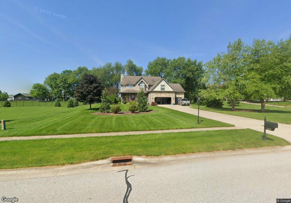
182 Arthur Ln Valparaiso, IN 46383
Porter County NeighborhoodEstimated Value: $608,522 - $738,000
3
Beds
3
Baths
2,600
Sq Ft
$265/Sq Ft
Est. Value
About This Home
This home is located at 182 Arthur Ln, Valparaiso, IN 46383 and is currently estimated at $690,131, approximately $265 per square foot. 182 Arthur Ln is a home located in Porter County with nearby schools including Morgan Township Elementary School, Morgan Township Middle/High School, and Victory Christian Academy.
Ownership History
Date
Name
Owned For
Owner Type
Purchase Details
Closed on
Jan 19, 2007
Sold by
Bucher Construction Ltd
Bought by
Chayhitz Barry R and Chayhitz Jayne M
Current Estimated Value
Home Financials for this Owner
Home Financials are based on the most recent Mortgage that was taken out on this home.
Original Mortgage
$262,600
Outstanding Balance
$156,492
Interest Rate
6.16%
Mortgage Type
Purchase Money Mortgage
Estimated Equity
$533,639
Create a Home Valuation Report for This Property
The Home Valuation Report is an in-depth analysis detailing your home's value as well as a comparison with similar homes in the area
Home Values in the Area
Average Home Value in this Area
Purchase History
| Date | Buyer | Sale Price | Title Company |
|---|---|---|---|
| Chayhitz Barry R | -- | Chicago Title Insurance Co | |
| Bucher Construction Ltd | -- | Chicago Title Insurance Co |
Source: Public Records
Mortgage History
| Date | Status | Borrower | Loan Amount |
|---|---|---|---|
| Open | Chayhitz Barry R | $262,600 |
Source: Public Records
Tax History Compared to Growth
Tax History
| Year | Tax Paid | Tax Assessment Tax Assessment Total Assessment is a certain percentage of the fair market value that is determined by local assessors to be the total taxable value of land and additions on the property. | Land | Improvement |
|---|---|---|---|---|
| 2024 | $3,286 | $501,700 | $91,000 | $410,700 |
| 2023 | $3,146 | $471,800 | $82,700 | $389,100 |
| 2022 | $3,520 | $482,300 | $82,700 | $399,600 |
| 2021 | $3,238 | $416,300 | $82,700 | $333,600 |
| 2020 | $2,944 | $384,800 | $75,200 | $309,600 |
| 2019 | $2,853 | $365,900 | $75,200 | $290,700 |
| 2018 | $2,754 | $358,700 | $75,200 | $283,500 |
| 2017 | $2,768 | $364,800 | $75,200 | $289,600 |
| 2016 | $2,687 | $365,300 | $78,100 | $287,200 |
| 2014 | $2,902 | $347,000 | $75,500 | $271,500 |
| 2013 | -- | $331,900 | $76,400 | $255,500 |
Source: Public Records
Map
Nearby Homes
- 197 Appaloosa Ln
- 239 Bayberry Ct
- 232 E 250 S
- 279 S State Road 49
- 323 E 124 S
- 3353 Field Hawk Dr
- 3251 Mockingbird Ln
- 1206 Meadow Glen Dr
- 3359 Blue Jay Dr
- 48 E Division Rd
- 0 Smoke Rd
- 501 Eagle Ct
- 372 Radcliff Dr
- 355 E 300 S
- 421 Amy Rose Ln
- 2054 Lawndale Dr
- 0 Parcel A 325 E
- 0 Parcel B 325 E
- 1954 Lawndale Dr
- 3152 Heavilin Rd
- 180 Arthur Ln
- 179 Appaloosa Ln
- 178 Arthur Ln
- 181 Appaloosa Ln
- 180 Buckskin Ln
- 177 Appaloosa Ln
- 183 Appaloosa Ln
- 175 Appaloosa Ln
- 185 Appaloosa Ln
- 182 Buckskin Ln
- 141 Belgian Ct
- 141 S Belgian Ct
- 187 Appaloosa Ln
- 143 S Belgian Ct
- 125 S 150 E
- 184 Buckskin Ln
- 185 Arthur Ln
- 186 Appaloosa Ln
- 182 Appaloosa Ln
- 184 Appaloosa Ln