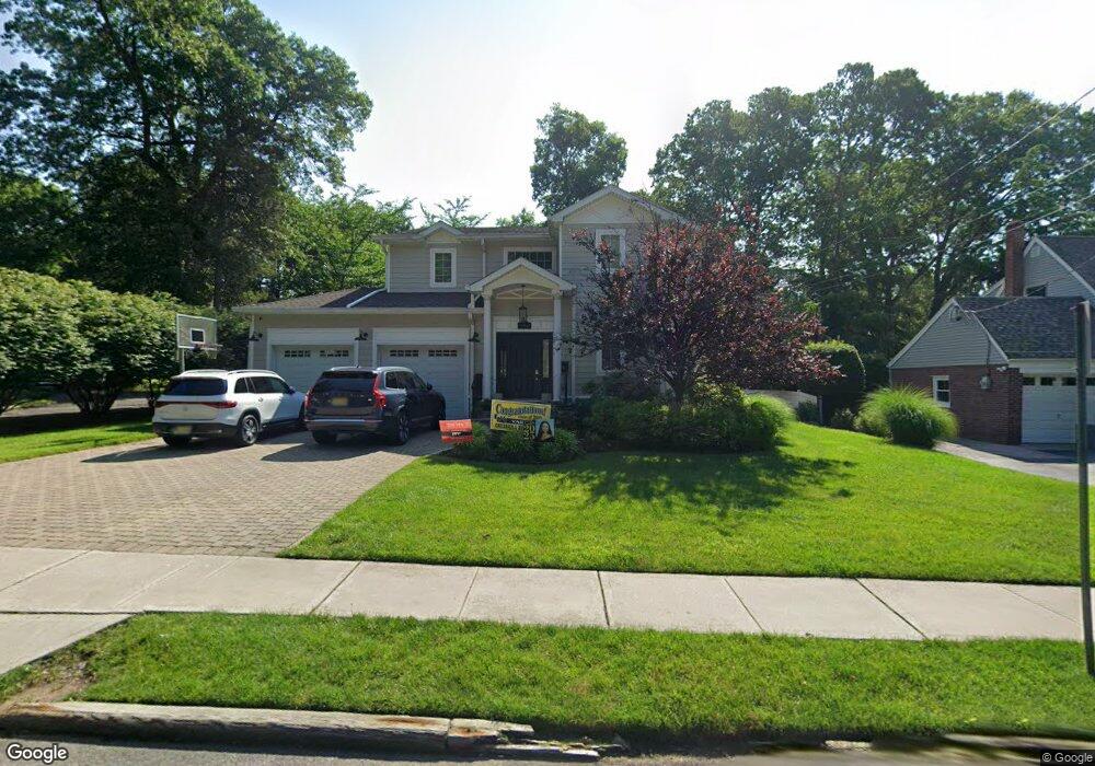
182 Brookside Ave Cresskill, NJ 07626
Estimated Value: $1,510,000 - $1,846,000
5
Beds
5
Baths
2,712
Sq Ft
$617/Sq Ft
Est. Value
About This Home
This home is located at 182 Brookside Ave, Cresskill, NJ 07626 and is currently estimated at $1,674,592, approximately $617 per square foot. 182 Brookside Ave is a home located in Bergen County with nearby schools including Cresskill High School and Spring School.
Ownership History
Date
Name
Owned For
Owner Type
Purchase Details
Closed on
Jan 27, 2020
Sold by
Kim Peter Hwan and Kim Julie Moon
Bought by
Elisha Amit H and Fridman Roni
Current Estimated Value
Home Financials for this Owner
Home Financials are based on the most recent Mortgage that was taken out on this home.
Original Mortgage
$791,200
Outstanding Balance
$694,543
Interest Rate
3.6%
Mortgage Type
New Conventional
Estimated Equity
$980,049
Purchase Details
Closed on
Jul 19, 2011
Sold by
Mia Homes Inc
Bought by
Kim Peter Hwan and Sun Kim Julie Moon
Home Financials for this Owner
Home Financials are based on the most recent Mortgage that was taken out on this home.
Original Mortgage
$732,000
Interest Rate
4.62%
Mortgage Type
Purchase Money Mortgage
Purchase Details
Closed on
Oct 8, 2010
Sold by
Hilperts Gerard A
Bought by
Mia Homes Inc
Create a Home Valuation Report for This Property
The Home Valuation Report is an in-depth analysis detailing your home's value as well as a comparison with similar homes in the area
Home Values in the Area
Average Home Value in this Area
Purchase History
| Date | Buyer | Sale Price | Title Company |
|---|---|---|---|
| Elisha Amit H | $989,000 | Carnegie Title Llc | |
| Kim Peter Hwan | $915,000 | -- | |
| Mia Homes Inc | $355,000 | -- |
Source: Public Records
Mortgage History
| Date | Status | Borrower | Loan Amount |
|---|---|---|---|
| Open | Elisha Amit H | $791,200 | |
| Previous Owner | Kim Peter Hwan | $732,000 |
Source: Public Records
Tax History
| Year | Tax Paid | Tax Assessment Tax Assessment Total Assessment is a certain percentage of the fair market value that is determined by local assessors to be the total taxable value of land and additions on the property. | Land | Improvement |
|---|---|---|---|---|
| 2025 | $23,472 | $1,089,800 | $411,000 | $678,800 |
| 2024 | $22,667 | $1,020,500 | $368,100 | $652,400 |
| 2023 | $22,197 | $976,600 | $343,100 | $633,500 |
| 2022 | $22,197 | $922,200 | $315,100 | $607,100 |
| 2021 | $21,756 | $890,900 | $302,600 | $588,300 |
| 2020 | $21,132 | $868,900 | $294,100 | $574,800 |
| 2019 | $18,739 | $778,500 | $290,600 | $487,900 |
| 2018 | $12,969 | $769,200 | $287,600 | $481,600 |
| 2017 | $18,319 | $673,000 | $226,800 | $446,200 |
| 2016 | $17,774 | $673,000 | $226,800 | $446,200 |
| 2015 | $17,222 | $673,000 | $226,800 | $446,200 |
| 2014 | $16,704 | $673,000 | $226,800 | $446,200 |
Source: Public Records
Map
Nearby Homes
- 174 Brookside Ave
- 126 Bergen Terrace
- 120 Bergen Terrace
- 196 Brookside Ave
- 227 Grant Ave
- 177 Brookside Ave
- 215 Grant Ave
- 191 Brookside Ave
- 253 Grant Ave
- 19 Gilmore Ave
- 33 Gilmore Ave
- 210 Brookside Ave
- 7 Harvard St
- 201 Grant Ave
- 228 Grant Ave
- 212 Grant Ave
- 201 Brookside Ave
- 10 Merrifield Way
- 236 Grant Ave
- 204 Grant Ave
Your Personal Tour Guide
Ask me questions while you tour the home.