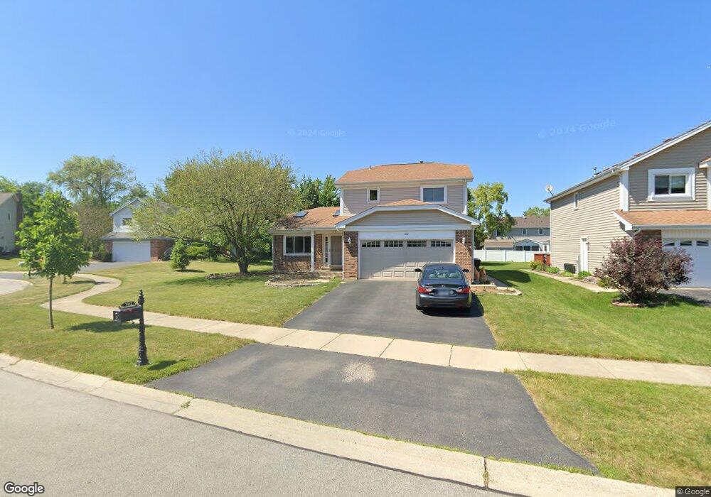
182 Denberry Ct Lake Zurich, IL 60047
Estimated Value: $417,421 - $536,000
--
Bed
3
Baths
1,765
Sq Ft
$264/Sq Ft
Est. Value
About This Home
This home is located at 182 Denberry Ct, Lake Zurich, IL 60047 and is currently estimated at $466,605, approximately $264 per square foot. 182 Denberry Ct is a home located in Lake County with nearby schools including Isaac Fox Elementary School, Lake Zurich Middle School - South Campus, and Lake Zurich High School.
Ownership History
Date
Name
Owned For
Owner Type
Purchase Details
Closed on
Jul 27, 2012
Sold by
Carlston Donald P and Koenig Diane M
Bought by
Carlston Donald P
Current Estimated Value
Purchase Details
Closed on
Aug 30, 2001
Sold by
Carlston Donald P and Carlston Diane M
Bought by
Carlston Donald P and Carlston Diane M
Home Financials for this Owner
Home Financials are based on the most recent Mortgage that was taken out on this home.
Original Mortgage
$152,850
Interest Rate
7.06%
Create a Home Valuation Report for This Property
The Home Valuation Report is an in-depth analysis detailing your home's value as well as a comparison with similar homes in the area
Home Values in the Area
Average Home Value in this Area
Purchase History
| Date | Buyer | Sale Price | Title Company |
|---|---|---|---|
| Carlston Donald P | -- | None Available | |
| Carlston Donald P | -- | Greater Illinois Title Compa |
Source: Public Records
Mortgage History
| Date | Status | Borrower | Loan Amount |
|---|---|---|---|
| Closed | Carlston Donald P | $152,850 |
Source: Public Records
Tax History Compared to Growth
Tax History
| Year | Tax Paid | Tax Assessment Tax Assessment Total Assessment is a certain percentage of the fair market value that is determined by local assessors to be the total taxable value of land and additions on the property. | Land | Improvement |
|---|---|---|---|---|
| 2024 | $8,369 | $115,658 | $26,910 | $88,748 |
| 2023 | $7,780 | $115,551 | $26,187 | $89,364 |
| 2022 | $7,780 | $105,873 | $24,112 | $81,761 |
| 2021 | $7,506 | $103,160 | $23,494 | $79,666 |
| 2020 | $7,369 | $103,160 | $23,494 | $79,666 |
| 2019 | $7,248 | $102,260 | $23,289 | $78,971 |
| 2018 | $6,403 | $91,670 | $21,196 | $70,474 |
| 2017 | $6,335 | $90,566 | $20,941 | $69,625 |
| 2016 | $6,202 | $87,698 | $20,278 | $67,420 |
| 2015 | $6,103 | $83,530 | $19,314 | $64,216 |
| 2014 | $5,860 | $79,674 | $19,448 | $60,226 |
| 2012 | $5,927 | $79,842 | $19,489 | $60,353 |
Source: Public Records
Map
Nearby Homes
- 21763 Deerpath Rd
- 1254 Tracie Dr
- 898 S Rand Rd
- 1202 Tracie Dr
- 429 Grand Ave
- 555 Waterford Dr
- 781 Edelweiss Dr
- 777 Edelweiss Dr
- 21355 N Bobwhite Ln
- 450 Trailside Dr
- 21186 W Preserve Dr
- 20992 W Preserve Dr
- 880 June Terrace Unit 270
- 21742 N Ashley St
- 21725 N Ashley St
- 77 Mionske Dr
- 533 Surryse Rd
- 815 Pheasant Ridge Dr
- 795 Harvest Dr
- 158 Canterbury Way